- Population
- 393
- 393
- Elevation
- 1,037 m
- above sea level
- Local time
- UTC+02:00
- Europe/Bucharest · UTC+02:00
- Airports
- TGM Târgu Mureş Transilvania International Airport98 km
- SCV Suceava Ștefan cel Mare International Airport109 km
About Dornișoara
Dornișoara is a village. Location: Comuna Poiana Stampei, Suceava. Population: 393. Elevation: 1,037 m. The best months to visit are June–August. The nearest airport is Târgu Mureş Transilvania International Airport (98 km). Nearby sights include Pietrosul Călimanilor and Negoiul Unguresc.
Climate of Dornișoara
Best months for sightseeingBest months for sightseeing: June–August.
This month · November
A cold month
Day 4° · Night -4° · Rain 40 mm
- Hottest month
- July (day 20°)
- Coldest month
- February (night -9°)
- Wettest month
- June (121 mm)
- Driest month
- January (35 mm)
Bars: average monthly low and high temperature. Below: precipitation. Monthly averages for 1970–2000 at about 18 km resolution, adjusted for elevation. Highlighted months are mild and relatively dry. Source: WorldClim 2.1 (CC BY 4.0).
Show values as a table
| Month | Jan | Feb | Mar | Apr | May | Jun | Jul | Aug | Sep | Oct | Nov | Dec |
|---|---|---|---|---|---|---|---|---|---|---|---|---|
| Average high (°C) | -1° | -1° | 3° | 9° | 14° | 17° | 20° | 19° | 15° | 10° | 4° | -1° |
| Average low (°C) | -9° | -9° | -6° | -1° | 5° | 8° | 10° | 9° | 5° | 1° | -4° | -8° |
| Precipitation (mm) | 35 | 35 | 38 | 61 | 88 | 121 | 113 | 90 | 58 | 45 | 40 | 41 |
How to get to Dornișoara
The nearest airport is Târgu Mureş Transilvania International Airport (TGM), 98 km to the southwest as the crow flies. For international flights: Suceava Ștefan cel Mare International Airport (SCV) (109 km). The nearest large city is Târgu Mureş, 85 km to the southwest.
Airports
- Târgu Mureş Transilvania International Airport (TGM) Recea 98 kmsouthwest
- Suceava Ștefan cel Mare International Airport (SCV) Suceava 109 kmnortheast
- Avram Iancu Cluj International Airport (CLJ) Cluj-Napoca 117 kmsouthwest
Nearby large cities
- Târgu Mureş Population: 212.8K 85 kmsouthwest
- Piatra Neamţ Population: 102.7K 101 kmeast
- Cluj-Napoca Population: 286.6K 123 kmsouthwest
- Baia Mare Population: 108.8K 124 kmnorthwest
- Bacau Population: 136.1K 157 kmsoutheast
Straight-line distances; road distances are longer. Airport data: OurAirports.
Day trips from Dornișoara
Within 100 km: 9 historic and cultural sites, 64 natural sites.
0–25 km5 places
- Pietrosul Călimanilor Mountain 13 kmSE
- Negoiul Unguresc Mountain 14 kmSE
- Căliman Izvor Mountain 18 kmSE
- Rețițiș Mountain 18 kmSE
25–60 km35 places
- Valea Putnei Natural site 36 kmNE
- Muntele Pietrosul Mountain 40 kmNE
- Pietrosul Mountain 54 kmNW
- Vârful Omului Mountain 33 kmN
60–100 km33 places
- Valea Poenii Natural site 73 kmW
- Valea Ormanului Natural site 98 kmW
- Valea Nirajului Natural site 76 kmS
- Valea Chiherului Natural site 62 kmS
Straight-line distances.
Nearby attractions & nature
Everything nearby-
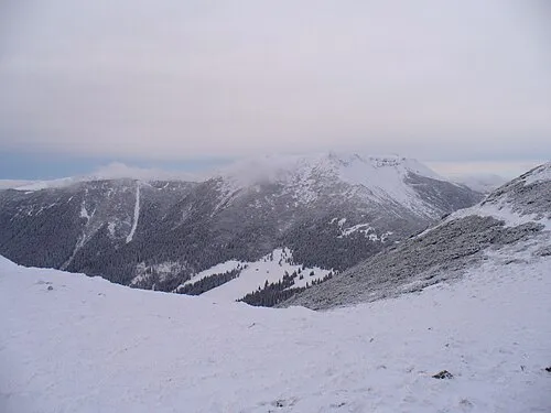 Pietrosul Călimanilor Mountain, Comuna Lunca Bradului13 km SE
-
Negoiul Unguresc Mountain, Mureș County14 km SE
-
Călimanul Cerbului Mountain, Comuna Şaru Dornei17 km SE
-
Căliman Izvor Mountain, Comuna Şaru Dornei18 km SE
-
Rețițiș Mountain, Suceava18 km SE
Sources & licences
Data last updated: