Markušovce
Located in Okres Spišská Nová Ves, Košice Region Coordinates: 48°54′43″ N 20°37′51″ E
- Population
- 4,658
- 4.7K
- Elevation
- 427 m
- above sea level
- Local time
- UTC+01:00
- Europe/Bratislava · UTC+01:00
- Airports
- TAT Poprad-Tatry Airport34 km
- KSC Košice International Airport53 km
About Markušovce
Markušovce is a village. Location: Okres Spišská Nová Ves, Košice Region. Population: 4,658. Elevation: 427 m.
Markušovce (Slovak pronunciation: [ˈmarkuʂɔwtse]; Hungarian: Márkusfalva) is a village and municipality in the Spišská Nová Ves District in the Košice Region of central-eastern Slovakia.
Source: Wikipedia · CC BY-SA 4.0
Population of Markušovce over time
| 2017 | 4,469 | |
|---|---|---|
| 2021 | 4,624 | |
| 2024 | 4,843 | |
| 2025 | 4,910 |
Censuses and official estimates; source: Wikidata.
Climate of Markušovce
Best months for sightseeingBest months for sightseeing: June–August.
This month · November
A cold month
Day 6° · Night -1° · Rain 45 mm
- Hottest month
- July (day 23°)
- Coldest month
- January (night -6°)
- Wettest month
- June (101 mm)
- Driest month
- February (28 mm)
Bars: average monthly low and high temperature. Below: precipitation. Monthly averages for 1970–2000 at about 18 km resolution, adjusted for elevation. Highlighted months are mild and relatively dry. Source: WorldClim 2.1 (CC BY 4.0).
Show values as a table
| Month | Jan | Feb | Mar | Apr | May | Jun | Jul | Aug | Sep | Oct | Nov | Dec |
|---|---|---|---|---|---|---|---|---|---|---|---|---|
| Average high (°C) | 1° | 3° | 8° | 13° | 19° | 22° | 23° | 23° | 19° | 13° | 6° | 2° |
| Average low (°C) | -6° | -5° | -1° | 3° | 8° | 11° | 12° | 12° | 8° | 4° | -1° | -4° |
| Precipitation (mm) | 36 | 28 | 32 | 53 | 81 | 101 | 88 | 76 | 56 | 45 | 45 | 37 |
How to get to Markušovce
The nearest airport is Poprad-Tatry Airport (TAT), 34 km to the northwest as the crow flies. The nearest large city is Košice, 51 km to the southeast.
Airports
- Poprad-Tatry Airport (TAT) Poprad 34 kmnorthwest
- Košice International Airport (KSC) Košice 53 kmsoutheast
- Sliač Airport (SLD) Sliač 114 kmwest
Nearby large cities
- Košice Population: 225K 51 kmsoutheast
- Miskolc Population: 154.5K 91 kmsouth
- Nyíregyháza Population: 117.7K 133 kmsoutheast
- Debrecen Population: 202.4K 170 kmsoutheast
- Satu Mare Population: 112.5K 207 kmsoutheast
Straight-line distances; road distances are longer. Airport data: OurAirports.
Day trips from Markušovce
Within 100 km: 23 historic and cultural sites, 233 natural sites, 15 lakes, rivers and coasts.
0–25 km4 places
- Spišská Kapitula Attraction 13 kmNE
- Spiš Castle Historic site 14 kmNE
- Slovenský Raj Mountain 18 kmW
- Prielom Hornádu Natural site 12 kmW
25–60 km75 places
- Skalnaté pleso Lake 42 kmNW
- Popradské Pleso Lake 48 kmNW
- Ostrá Mountain 53 kmNW
- Vysoká Mountain 49 kmNW
60–100 km192 places
- Beskids Mountain 63 kmNW
- Poľana Mountain 90 kmW
- Čertovica Mountain 66 kmW
- Bystrá Mountain 65 kmNW
Straight-line distances.
Nearby attractions & nature
Everything nearby-
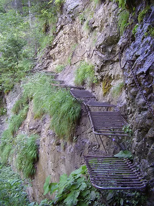 Prielom Hornádu Natural site, Czechia12 km W
-
Spiš Castle Historic site, Okres Spišská Nová Ves14 km NE
-
Spišská Kapitula Attraction, Levoča District13 km NE
-
Slovenský Raj Mountain, Košice Region18 km W
Sources & licences
Data last updated: · 2 independent sources