Okres Spišská Nová Ves
Located in Košice Region, Slovakia Coordinates: 48°57′00″ N 20°34′00″ E
- Population
- 99,500
- 99.5K
- Elevation
- 463 m
- above sea level
- Local time
- UTC+01:00
- Europe/Bratislava · UTC+01:00
- Places inside
- 37
- listed under Okres Spišská Nová Ves
- Airports
- TAT Poprad-Tatry Airport27 km
- KSC Košice International Airport59 km
About Okres Spišská Nová Ves
Okres Spišská Nová Ves is a district. Location: Košice Region, Slovakia. Population: 99,500.
Spišská Nová Ves District (Slovak: okres Spišská Nová Ves) is a district in the Košice Region of eastern Slovakia. The district in its present borders was established in 1996. Administrative, economic and cultural center is its seat Spišská Nová Ves. The district borders Gelnica District and Rožňava District in the south and Poprad District, Prešov District and Levoča District in the north.
Source: Wikipedia · CC BY-SA 4.0
At a glance
- Area
- 588 km²
Source: Wikidata
Photos of Okres Spišská Nová Ves
-
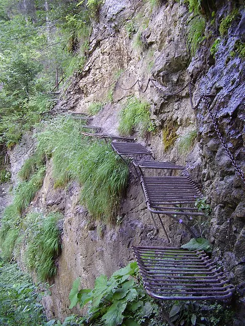
Prielom Hornádu Honza Groh · CC BY-SA 3.0

Places bordering Okres Spišská Nová Ves
- Rožňava District
- Gelnica District
- Prešov District
- Levoča District
- Poprad District
Population of Okres Spišská Nová Ves over time
| 2017 | 99,500 | |
|---|---|---|
| 2021 | 98,706 | |
| 2024 | 98,670 | |
| 2025 | 98,622 |
Censuses and official estimates; source: Wikidata.
Climate of Okres Spišská Nová Ves
Best months for sightseeingBest months for sightseeing: June–August.
This month · November
A cold month
Day 6° · Night -1° · Rain 45 mm
- Hottest month
- July (day 23°)
- Coldest month
- January (night -7°)
- Wettest month
- June (101 mm)
- Driest month
- February (28 mm)
Bars: average monthly low and high temperature. Below: precipitation. Monthly averages for 1970–2000 at about 18 km resolution, adjusted for elevation. Highlighted months are mild and relatively dry. Source: WorldClim 2.1 (CC BY 4.0).
Show values as a table
| Month | Jan | Feb | Mar | Apr | May | Jun | Jul | Aug | Sep | Oct | Nov | Dec |
|---|---|---|---|---|---|---|---|---|---|---|---|---|
| Average high (°C) | 1° | 2° | 7° | 13° | 18° | 21° | 23° | 23° | 18° | 13° | 6° | 2° |
| Average low (°C) | -7° | -6° | -2° | 3° | 7° | 10° | 12° | 11° | 8° | 4° | -1° | -5° |
| Precipitation (mm) | 36 | 28 | 32 | 53 | 81 | 101 | 88 | 76 | 56 | 45 | 45 | 37 |
How to get to Okres Spišská Nová Ves
The nearest airport is Poprad-Tatry Airport (TAT), 27 km to the northwest as the crow flies. The nearest large city is Košice, 57 km to the southeast.
Airports
- Poprad-Tatry Airport (TAT) Poprad 27 kmnorthwest
- Košice International Airport (KSC) Košice 59 kmsoutheast
- Sliač Airport (SLD) Sliač 111 kmwest
Nearby large cities
- Košice Population: 225K 57 kmsoutheast
- Miskolc Population: 154.5K 95 kmsouth
- Nyíregyháza Population: 117.7K 140 kmsoutheast
- Debrecen Population: 202.4K 176 kmsoutheast
- Satu Mare Population: 112.5K 213 kmsoutheast
Straight-line distances; road distances are longer. Airport data: OurAirports.
Day trips from Okres Spišská Nová Ves
Within 100 km: 23 historic and cultural sites, 239 natural sites, 14 lakes, rivers and coasts.
0–25 km7 places
- Ľubica River 23 kmNW
- Spišská Kapitula Attraction 14 kmNE
- Spiš Castle Historic site 16 kmE
- Slovenský Raj Mountain 14 kmW
25–60 km103 places
- Skalnaté pleso Lake 36 kmNW
- Popradské Pleso Lake 42 kmNW
- Ostrá Mountain 46 kmNW
- Vysoká Mountain 42 kmNW
60–100 km166 places
- Poľana Mountain 87 kmSW
- Čertovica Mountain 61 kmW
- Baníkov Mountain 68 kmNW
- Cigelka River 63 kmNE
Straight-line distances.
Places in Okres Spišská Nová Ves
37 places- 1 Spišská Nová Ves 37.3K
- 2 Smižany 9K
- 3 Krompachy 8.6K
- 4 Rudňany 4.8K
- 5 Markušovce 4.7K
- 6 Bystrany 3.7K
- 7 Spišské Vlachy 3.3K
- 8 Žehra 2.7K
- 9 Hrabušice 2.6K
- 10 Letanovce 2.4K
- 11 Spišské Tomášovce 2.3K
- 12 Harichovce 1.9K
- 13 Slovinky 1.9K
- 14 Spišský Hrušov 1.3K
- 15 Jamník 1.2K
- 16 Teplička 1.2K
- 17 Olcnava 1.1K
- 18 Odorín 1K
- 19 Iliašovce 1K
- 20 Poráč 1K
- 21 Chrasť nad Hornádom 917
- 22 Arnutovce 867
- 23 Betlanovce 776
- 24 Vítkovce 673
- 25 Kolinovce 590
- 26 Danišovce 575
- 27 Hnilčík 559
- 28 Mlynky 542
- 29 Matejovce nad Hornádom 507
- 30 Vojkovce 424
- 31 Hnilec 421
- 32 Lieskovany 410
- 33 Kaľava 401
- 34 Slatvina 334
- 35 Hincovce 266
- 36 Oľšavka 194
Bar: population relative to the most populous place in this list.
Heritage & sights1
- Spiš Castle · Historic site
Nearby attractions & nature
Everything nearby-
Prielom Hornádu Natural site, Czechia6.5 km W
-
Slovenský Raj Mountain, Košice Region14 km W
-
Wooden Articular Church in Kežmarok Attraction, Kežmarok23 km NW
-
Levočské Vrchy Mountain, Prešov Region22 km N
-
Spišská Kapitula Attraction, Levoča District14 km NE
-
Ľubica River, Prešov Region23 km NW
Sources & licences
Data last updated: · 2 independent sources