Horný Vadičov
Located in Kysucké Nové Mesto District, Žilina Region Coordinates: 49°16′30″ N 18°53′37″ E
- Population
- 1,729
- 1.7K
- Elevation
- 487 m
- above sea level
- Local time
- UTC+01:00
- Europe/Bratislava · UTC+01:00
- Airports
- SLD Sliač Airport73 km
- OSR Leoš Janáček Airport Ostrava74 km
About Horný Vadičov
Horný Vadičov is a village. Location: Kysucké Nové Mesto District, Žilina Region. Population: 1,729. Elevation: 487 m.
Horný Vadičov (Hungarian: Felsővadas) is a village and municipality in the Kysucké Nové Mesto District in the Žilina Region of northern Slovakia.
Source: Wikipedia · CC BY-SA 4.0
Population of Horný Vadičov over time
| 2017 | 1,619 | |
|---|---|---|
| 2021 | 1,679 | |
| 2024 | 1,723 | |
| 2025 | 1,729 |
Censuses and official estimates; source: Wikidata.
Climate of Horný Vadičov
Best months for sightseeingBest months for sightseeing: June–August.
This month · November
A cold month
Day 6° · Night -1° · Rain 75 mm
- Hottest month
- July (day 23°)
- Coldest month
- January (night -7°)
- Wettest month
- June (118 mm)
- Driest month
- February (58 mm)
Bars: average monthly low and high temperature. Below: precipitation. Monthly averages for 1970–2000 at about 18 km resolution, adjusted for elevation. Highlighted months are mild and relatively dry. Source: WorldClim 2.1 (CC BY 4.0).
Show values as a table
| Month | Jan | Feb | Mar | Apr | May | Jun | Jul | Aug | Sep | Oct | Nov | Dec |
|---|---|---|---|---|---|---|---|---|---|---|---|---|
| Average high (°C) | 1° | 3° | 7° | 12° | 18° | 21° | 23° | 23° | 18° | 13° | 6° | 2° |
| Average low (°C) | -7° | -6° | -2° | 2° | 6° | 9° | 11° | 10° | 7° | 3° | -1° | -5° |
| Precipitation (mm) | 64 | 58 | 61 | 66 | 96 | 118 | 113 | 104 | 82 | 66 | 75 | 76 |
How to get to Horný Vadičov
The nearest airport is Sliač Airport (SLD), 73 km to the south as the crow flies. For international flights: Leoš Janáček Airport Ostrava (OSR) (74 km). The nearest large city is Brno, 167 km to the west.
Airports
- Sliač Airport (SLD) Sliač 73 kmsouth
- Leoš Janáček Airport Ostrava (OSR) Mošnov 74 kmnorthwest
- Poprad-Tatry Airport (TAT) Poprad 101 kmeast
Nearby large cities
- Brno Population: 404.3K 167 kmwest
- Bratislava Population: 423.7K 182 kmsouthwest
- Košice Population: 225K 184 kmeast
- Miskolc Population: 154.5K 190 kmsoutheast
- Győr Population: 129.3K 200 kmsouthwest
Straight-line distances; road distances are longer. Airport data: OurAirports.
Day trips from Horný Vadičov
Within 100 km: 29 historic and cultural sites, 398 natural sites, 14 lakes, rivers and coasts.
0–25 km16 places
- Veľký Kriváň Mountain 14 kmSE
- Chleb Mountain 15 kmSE
- Bugaj Mountain 16 kmNE
- Vrátna Valley Natural site 12 kmSE
25–60 km159 places
- Korňa River 26 kmNW
- Tlstá Mountain 38 kmS
- Strážov Mountain 47 kmSW
- Rakytov Mountain 41 kmSE
60–100 km266 places
- Skalnaté pleso Lake 98 kmE
- Popradské Pleso Lake 87 kmE
- Ostrá Mountain 83 kmE
- Vysoká Mountain 88 kmE
Straight-line distances.
Nearby attractions & nature
Everything nearby-
 Veľký Rozsutec Mountain, Žilina District16 km E
-
 Veľký Kriváň Mountain, Martin District14 km SE
-
 Kysuca River, Žilina Region13 km W
-
Vrátna Valley Natural site, Žilina Region12 km SE
-
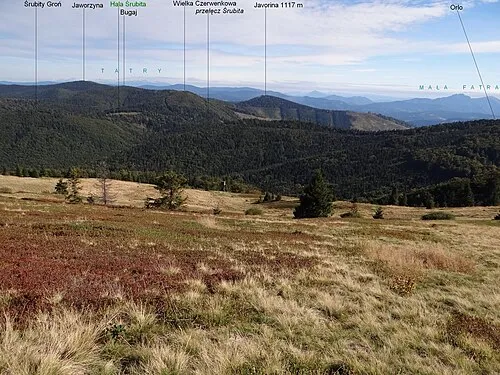 Bugaj Mountain, Silesian Voivodeship16 km NE
-
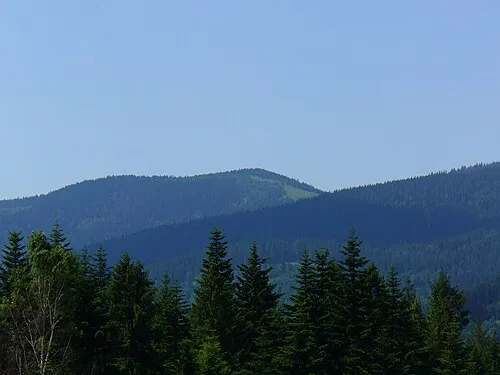 Rycerzowa Wielka Mountain, Gmina Ujsoły21 km NE
Other cities and towns in Kysucké Nové Mesto District
-
 Radoľa Village, Kysucké Nové Mesto District7.7 km W
-
 Snežnica Village, Kysucké Nové Mesto District7.8 km W
-
 Povina Village, Kysucké Nové Mesto District7.3 km NW
-
 Lodno Village, Kysucké Nové Mesto District6.9 km N
-
 Kysucký Lieskovec Village, Kysucké Nové Mesto District9.1 km NW
-
 Nesluša Village, Kysucké Nové Mesto District12 km NW
Sources & licences
Data last updated: · 2 independent sources