Legen
Located in Urban Municipality of Slovenj Gradec, Slovenia Coordinates: 46°30′23″ N 15°08′39″ E
- Population
- 1,026
- 1K
- Elevation
- 828 m
- above sea level
- Local time
- UTC+01:00
- Europe/Ljubljana · UTC+01:00
- Airports
- MBX Maribor Edvard Rusjan Airport42 km
- GRZ Graz Airport58 km
About Legen
Legen is a village. Location: Urban Municipality of Slovenj Gradec, Slovenia. Population: 1,026. Elevation: 828 m.
Legen (pronounced [ˈleːɡən]) is a settlement in the City Municipality of Slovenj Gradec in northern Slovenia. It lies in the valley of Barbara Creek (Slovene: Barbarski potok) and the surrounding Pohorje Hills east of Slovenj Gradec. The area is part of the traditional region of Styria. The entire municipality is now included in the Carinthia Statistical Region. In January 2026, the population was 1,133.
Source: Wikipedia · CC BY-SA 4.0
At a glance
- Area
- 18.4 km²
Source: Wikidata
Climate of Legen
Best months for sightseeingBest months for sightseeing: June–September.
This month · November
A wet month
Day 6° · Night -2° · Rain 105 mm
- Hottest month
- July (day 23°)
- Coldest month
- January (night -7°)
- Wettest month
- July (151 mm)
- Driest month
- January (45 mm)
Bars: average monthly low and high temperature. Below: precipitation. Monthly averages for 1970–2000 at about 18 km resolution, adjusted for elevation. Highlighted months are mild and relatively dry. Source: WorldClim 2.1 (CC BY 4.0).
Show values as a table
| Month | Jan | Feb | Mar | Apr | May | Jun | Jul | Aug | Sep | Oct | Nov | Dec |
|---|---|---|---|---|---|---|---|---|---|---|---|---|
| Average high (°C) | 1° | 3° | 8° | 12° | 17° | 21° | 23° | 22° | 18° | 13° | 6° | 1° |
| Average low (°C) | -7° | -6° | -2° | 2° | 6° | 9° | 11° | 11° | 7° | 3° | -2° | -5° |
| Precipitation (mm) | 45 | 53 | 74 | 91 | 106 | 149 | 151 | 135 | 116 | 111 | 105 | 72 |
Other places to visit in this season: June July August September
How to get to Legen
The nearest airport is Maribor Edvard Rusjan Airport (MBX), 42 km to the east as the crow flies. For international flights: Graz Airport (GRZ) (58 km). The nearest large city is Klagenfurt, 66 km to the west.
Airports
- Maribor Edvard Rusjan Airport (MBX) Maribor 42 kmeast
- Graz Airport (GRZ) Feldkirchen bei Graz 58 kmnortheast
- Ljubljana Jože Pučnik Airport (LJU) Zgornji Brnik 61 kmsouthwest
Nearby large cities
- Klagenfurt Population: 100.3K 66 kmwest
- Graz Population: 303.3K 66 kmnorth
- Ljubljana Population: 272.2K 71 kmsouthwest
- Zagreb Population: 663.6K 100 kmsoutheast
- Rijeka Population: 108K 142 kmsouthwest
Straight-line distances; road distances are longer. Airport data: OurAirports.
Day trips from Legen
Within 100 km: 215 historic and cultural sites, 836 natural sites, 396 lakes, rivers and coasts.
0–25 km29 places
- Ribnica Lake Lake 9 kmE
- Pohorje Mountain 25 kmE
- Rogla Mountain 16 kmSE
- Črni Vrh Mountain 7 kmE
25–60 km383 places
- Mrzla Gora Mountain 46 kmW
- Grintavec Mountain 50 kmW
- Rača River 57 kmSW
- Lake Ptuj Lake 60 kmE
60–100 km1,035 places
- Lake Bled Lake 82 kmW
- Šmarna gora Mountain 67 kmSW
- Rjavina Mountain 98 kmW
- Porezen Mountain 97 kmW
Straight-line distances.
Nearby attractions & nature
Everything nearby-
Hühnerkogel Mountain, Eibiswald18 km NW
-
Črni Vrh Mountain, Municipality of Mislinja7.3 km E
-
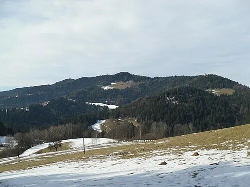 Pongrac Mountain, Eibiswald19 km NE
-
Feistritz River, Austria11 km N
-
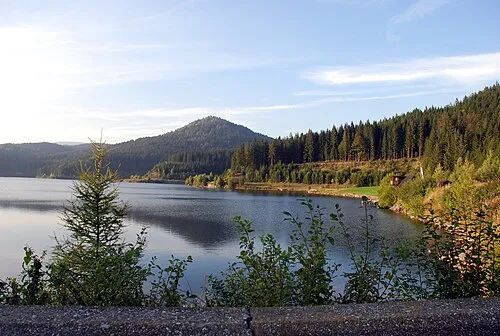 Gradischkogel Mountain, Lavamünd23 km N
-
Jankitzkogel Mountain, Lavamünd19 km NW
Other cities and towns in Urban Municipality of Slovenj Gradec
-
 Pameče Village, Urban Municipality of Slovenj Gradec5.9 km NW
-
 Troblje Village, Urban Municipality of Slovenj Gradec5 km NW
-
 Sveti Primož na Pohorju Village, Urban Municipality of Slovenj Gradec5.2 km N
-
Mislinjska Dobrava Village, Urban Municipality of Slovenj Gradec4.8 km S
-
 Stari Trg Village, Urban Municipality of Slovenj Gradec6 km W
-
Podgorje Village, Urban Municipality of Slovenj Gradec6 km SW
Sources & licences
Data last updated: · 2 independent sources