- Population
- 1,538
- 1.5K
- Elevation
- 932 m
- above sea level
- Local time
- UTC+01:00
- Europe/Madrid · UTC+01:00
- Airports
- LEI Almería Airport49 km
- GRX F.G.L. Airport Granada-Jaén Airport82 km
About Laujar de Andarax
Laujar de Andarax is a village. Location: Fondón, Almeria. Population: 1,538. Elevation: 932 m. The best months to visit are May–June, September–October. The nearest airport is Almería Airport (49 km). Nearby sights include Barranco del Horcajo and Cerro del Almirez.
Climate of Laujar de Andarax
Best months for sightseeingBest months for sightseeing: May–June, September–October.
This month · November
Outside the best season
Day 15° · Night 5° · Rain 55 mm
Better nearby cities in November
- Almería · 42 km southeast20°
- Málaga · 140 km west20°
- Cartagena · 182 km east21°
- Hottest month
- July (day 32°)
- Coldest month
- January (night 1°)
- Wettest month
- December (60 mm)
- Driest month
- July (5 mm)
Bars: average monthly low and high temperature. Below: precipitation. Monthly averages for 1970–2000 at about 18 km resolution, adjusted for elevation. Highlighted months are mild and relatively dry. Source: WorldClim 2.1 (CC BY 4.0).
Show values as a table
| Month | Jan | Feb | Mar | Apr | May | Jun | Jul | Aug | Sep | Oct | Nov | Dec |
|---|---|---|---|---|---|---|---|---|---|---|---|---|
| Average high (°C) | 11° | 13° | 16° | 18° | 22° | 27° | 32° | 32° | 27° | 21° | 15° | 12° |
| Average low (°C) | 1° | 2° | 4° | 6° | 9° | 13° | 16° | 16° | 13° | 9° | 5° | 3° |
| Precipitation (mm) | 58 | 48 | 49 | 49 | 39 | 21 | 5 | 5 | 21 | 46 | 55 | 60 |
Other places to visit in this season: May June September October
How to get to Laujar de Andarax
The nearest airport is Almería Airport (LEI), 49 km to the east as the crow flies. For international flights: Málaga-Costa del Sol Airport (AGP) (148 km). The nearest large city is Almería, 42 km to the southeast.
Airports
- Almería Airport (LEI) Almería 49 kmeast
- F.G.L. Airport Granada-Jaén Airport (GRX) Granada 82 kmwest
- Málaga-Costa del Sol Airport (AGP) Málaga 148 kmwest
Nearby large cities
- Almería Population: 196.9K 42 kmsoutheast
- Granada Population: 233.5K 67 kmwest
- Jaén Population: 113.5K 117 kmnorthwest
- Málaga Population: 592.3K 140 kmwest
- Cartagena Population: 213.9K 182 kmeast
Straight-line distances; road distances are longer. Airport data: OurAirports.
Day trips from Laujar de Andarax
Within 100 km: 229 historic and cultural sites, 142 natural sites, 242 lakes, rivers and coasts.
0–25 km26 places
- Peñón de Polarda Mountain 12 kmNE
- Piorno Mountain 23 kmSE
- Sierra Nevada Mountain 14 kmNE
- Cerro del Molinero Mountain 11 kmS
25–60 km203 places
- Playa de San Nicolás Beach 30 kmS
- Playa Castell Del Ferro - Sotillo Beach 52 kmSW
- Playa de Nueva Almería Beach 45 kmSE
- Playa la Garrofa Beach 38 kmSE
60–100 km384 places
- Playa de Carboneras Beach 89 kmE
- Playa Granada Beach 67 kmSW
- Playa de los muertos Beach 88 kmE
- La Cala el Cañuelo Beach Beach 85 kmW
Straight-line distances.
Nearby attractions & nature
Everything nearby-
Barranco del Horcajo River, Láujar de Andarax4.2 km N
-
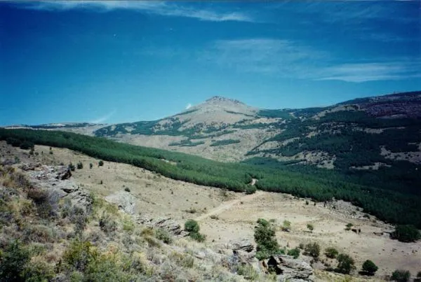 Cerro del Almirez Mountain, Fiñana11 km N
-
Cerro del Aire Mountain, Beires8.5 km NE
-
Las Hermanicas Mountain, Dalías13 km SE
-
Cerro del Molinero Mountain, Berja11 km S
-
Morrón de Mariné Mountain, Dalías12 km SE
Sources & licences
Data last updated: