Parque Municipal de Aguadulce
Located in Roquetas de Mar, Almeria Coordinates: 36°48′51″ N 2°34′11″ W
- Elevation
- 36 m
- above sea level
- Local time
- UTC+01:00
- Europe/Madrid · UTC+01:00
- Airports
- LEI Almería Airport18 km
- GRX F.G.L. Airport Granada-Jaén Airport115 km
About Parque Municipal de Aguadulce
Parque Municipal de Aguadulce is a natural site. Location: Roquetas de Mar, Almeria. The best months to visit are March–May, October–November. The nearest airport is Almería Airport (18 km). Nearby sights include Playa Aguadulce and Playa El Campillo del Moro.
Photos of Parque Municipal de Aguadulce
-
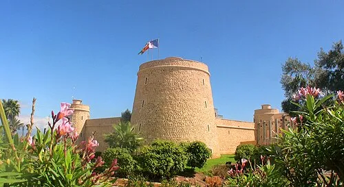
Castillo de Santa Ana Informagico · CC BY-SA 3.0 es

Climate of Parque Municipal de Aguadulce
Best months for sightseeingBest months for sightseeing: March–May, October–November.
This month · November
A good month to visit
Day 20° · Night 10° · Rain 36 mm
- Hottest month
- August (day 32°)
- Coldest month
- January (night 6°)
- Wettest month
- November (36 mm)
- Driest month
- July (1 mm)
Bars: average monthly low and high temperature. Below: precipitation. Monthly averages for 1970–2000 at about 18 km resolution, adjusted for elevation. Highlighted months are mild and relatively dry. Source: WorldClim 2.1 (CC BY 4.0).
Show values as a table
| Month | Jan | Feb | Mar | Apr | May | Jun | Jul | Aug | Sep | Oct | Nov | Dec |
|---|---|---|---|---|---|---|---|---|---|---|---|---|
| Average high (°C) | 16° | 17° | 19° | 21° | 24° | 28° | 32° | 32° | 29° | 24° | 20° | 17° |
| Average low (°C) | 6° | 7° | 9° | 10° | 13° | 17° | 20° | 20° | 18° | 14° | 10° | 8° |
| Precipitation (mm) | 35 | 26 | 25 | 28 | 19 | 11 | 1 | 2 | 14 | 34 | 36 | 34 |
Other places to visit in this season: March April May October November
How to get to Parque Municipal de Aguadulce
The nearest airport is Almería Airport (LEI), 18 km to the east as the crow flies. For international flights: Region of Murcia International Airport (RMU) (169 km). The nearest large city is Almería, 10 km to the east.
Airports
- Almería Airport (LEI) Almería 18 kmeast
- F.G.L. Airport Granada-Jaén Airport (GRX) Granada 115 kmwest
- Region of Murcia International Airport (RMU) Corvera 169 kmnortheast
Nearby large cities
- Almería Population: 196.9K 10 kmeast
- Granada Population: 233.5K 101 kmnorthwest
- Jaén Population: 113.5K 151 kmnorthwest
- Málaga Population: 592.3K 166 kmwest
- Cartagena Population: 213.9K 166 kmnortheast
Straight-line distances; road distances are longer. Airport data: OurAirports.
Day trips from Parque Municipal de Aguadulce
Within 100 km: 166 historic and cultural sites, 107 natural sites, 157 lakes, rivers and coasts.
0–25 km71 places
- Playa de Nueva Almería Beach 12 kmE
- Playa la Garrofa Beach 5 kmE
- Playa De Levante Beach 23 kmSW
- Playa Aguadulce Beach 1 kmE
25–60 km107 places
- Playa de San Nicolás Beach 40 kmW
- Playa Ancón Beach 35 kmE
- Cala Rajá Beach 36 kmE
- Cala Carbón Beach 38 kmE
60–100 km252 places
- Playa de Carboneras Beach 64 kmE
- Playa Granada Beach 89 kmW
- Playa Castell Del Ferro - Sotillo Beach 71 kmW
- Playa de los muertos Beach 62 kmE
Straight-line distances.
Nearest towns and villages
-
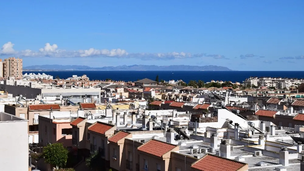 Aguadulce Town, Roquetas de Mar0.2 km W
-
El Pillico Village, Roquetas de Mar0.8 km SW
-
El Campillo del Moro Village, Roquetas de Mar1.7 km W
-
La Gangosa Town, Vícar4.7 km W
-
Roquetas de Mar Town, Roquetas de Mar6.9 km SW
-
La Ribera de la Algaida Village, Roquetas de Mar2.3 km SW
Nearby attractions & nature
Everything nearby-
Playa Aguadulce Beach, Roquetas de Mar0.4 km E
-
Playa El Campillo del Moro Beach, Almeria1.2 km SW
-
Playa la Garrofa Beach, Almeria4.9 km E
-
Yegüeros Mountain, Enix7.9 km N
-
Aquarium Roquetas Attraction, Roquetas de Mar4.7 km SW
-
Castillo de Santa Ana Historic site, Roquetas de Mar7.4 km SW
-
Parque Nicolás Salmerón Natural site, Almería9.5 km E
-
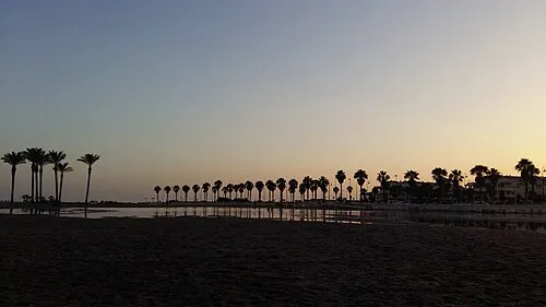 Playa Serena Beach, Roquetas de Mar11 km SW
Sources & licences
Data last updated: