- Elevation
- 4 m
- above sea level
- Local time
- UTC+01:00
- Europe/Madrid · UTC+01:00
- Airports
- GIB Gibraltar Airport17 km
- TTU Sania Ramel Airport77 km
About Puerto Sotogrande
Puerto Sotogrande is a village. Location: San Roque, Cadiz. Elevation: 4 m. The best months to visit are May–June, September–October. The nearest airport is Gibraltar Airport (17 km). Nearby sights include Playa Sotogrande and Capilla Santa Maria del Mar.
Climate of Puerto Sotogrande
Best months for sightseeingBest months for sightseeing: May–June, September–October.
This month · November
A wet month
Day 19° · Night 13° · Rain 107 mm
Better nearby cities in November
- Málaga · 90 km northeast20°
- Dos Hermanas · 124 km northwest20°
- Seville · 136 km northwest20°
- Hottest month
- August (day 29°)
- Coldest month
- January (night 9°)
- Wettest month
- December (138 mm)
- Driest month
- July (1 mm)
Bars: average monthly low and high temperature. Below: precipitation. Monthly averages for 1970–2000 at about 18 km resolution, adjusted for elevation. Highlighted months are mild and relatively dry. Source: WorldClim 2.1 (CC BY 4.0).
Show values as a table
| Month | Jan | Feb | Mar | Apr | May | Jun | Jul | Aug | Sep | Oct | Nov | Dec |
|---|---|---|---|---|---|---|---|---|---|---|---|---|
| Average high (°C) | 16° | 17° | 18° | 20° | 22° | 26° | 29° | 29° | 27° | 23° | 19° | 17° |
| Average low (°C) | 9° | 10° | 11° | 12° | 14° | 17° | 19° | 20° | 18° | 16° | 13° | 11° |
| Precipitation (mm) | 110 | 79 | 70 | 57 | 30 | 10 | 1 | 4 | 16 | 66 | 107 | 138 |
Other places to visit in this season: May June September October
How to get to Puerto Sotogrande
The nearest airport is Gibraltar Airport (GIB), 17 km to the southwest as the crow flies. The nearest large city is Algeciras, 24 km to the southwest.
Airports
- Gibraltar Airport (GIB) Gibraltar 17 kmsouthwest
- Sania Ramel Airport (TTU) Tétouan 77 kmsouth
- Málaga-Costa del Sol Airport (AGP) Málaga 81 kmnortheast
Nearby large cities
- Algeciras Population: 121.4K 24 kmsouthwest
- Marbella Population: 156.3K 43 kmnortheast
- Jerez de la Frontera Population: 212.9K 89 kmnorthwest
- Málaga Population: 592.3K 90 kmnortheast
- Cadiz Population: 117K 95 kmwest
Straight-line distances; road distances are longer. Airport data: OurAirports.
Day trips from Puerto Sotogrande
Within 100 km: 358 historic and cultural sites, 217 natural sites, 357 lakes, rivers and coasts.
0–25 km120 places
- Playa de Poniente Beach 16 kmS
- Playa de Levante Beach 12 kmSW
- La Alcaidesa Beach 7 kmSW
- Playa de La Hacienda Beach 16 kmSW
25–60 km340 places
- Playa de San Amaro Beach 44 kmS
- Playa de Benítez Beach 44 kmS
- Playa de Benzú Beach 42 kmS
- Playa de Atlanterra Beach 54 kmW
60–100 km472 places
- Playa de Zahora Beach 70 kmW
- Playa de la Victoria Beach 93 kmW
- Playa de Levante Beach 90 kmW
- Playa de la Caleta Beach 92 kmNE
Straight-line distances.
Nearby attractions & nature
Everything nearby-
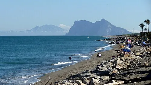 Playa Sotogrande Beach, San Roque0.6 km S
-
Capilla Santa Maria del Mar Attraction, San Roque0.5 km N
-
SotoPaintball Sotogrande Natural site, San Roque0.9 km W
-
Estuario de Río Guadiaro Natural site, San Roque1.4 km SW
-
Playa de Río Guadiaro Beach, San Roque1.2 km SW
-
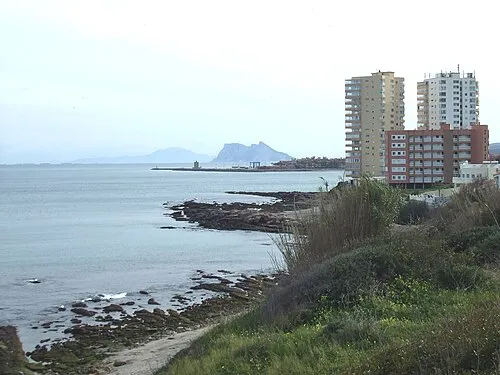 Playa Torre Guadiaro Beach, Cadiz1.2 km NE
Sources & licences
Data last updated: