Iglesia de San Mateo
Local name: Iglesia Mayor de San Mateo
Located in Tarifa, Cadiz Coordinates: 36°00′49″ N 5°36′07″ W
- Local time
- UTC+01:00
- Europe/Madrid · UTC+01:00
- Elevation
- 13 m
- above sea level
- Airports
- GIB Gibraltar Airport27 km
- TNG Tangier Ibn Battuta Airport43 km
About Iglesia de San Mateo
Iglesia de San Mateo is a tourist attraction. Location: Tarifa, Cadiz.
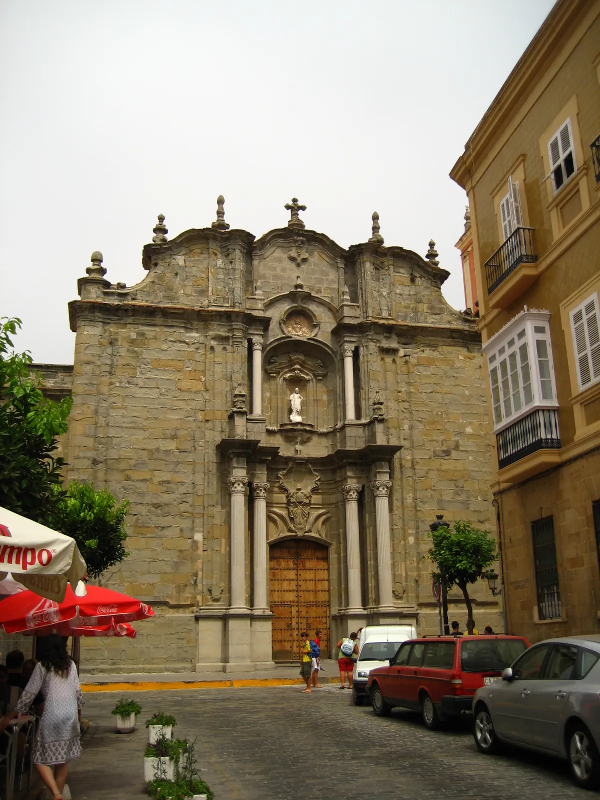
Iglesia de San Mateo (St. Matthew's Church) is the main church of Tarifa in the Province of Cadiz, Spain. It was supposed to have been built in 1506 on the remains of an old mosque, although worship at the church has only been mentioned in documents since 1534, another date given for its inauguration. Numerous alterations have been made to the church over the centuries.
Source: Wikipedia · CC BY-SA 4.0
At a glance
- Architectural style
- baroque architecture
Source: Wikidata
Photos of Iglesia de San Mateo
-

Jl FilpoC · CC BY-SA 4.0 -

Luis Rogelio HM · CC BY-SA 2.0 -

Javier Castro Romero · CC0 -

Jl FilpoC · CC BY-SA 4.0 -

Winklitz · CC BY 2.0


Climate of Iglesia de San Mateo
Best months for sightseeingBest months for sightseeing: May–June, October.
This month · November
A wet month
Day 20° · Night 13° · Rain 134 mm
Better nearby cities in November
- Málaga · 132 km northeast20°
- Dos Hermanas · 144 km north20°
- Seville · 156 km north20°
- Hottest month
- August (day 30°)
- Coldest month
- January (night 9°)
- Wettest month
- December (145 mm)
- Driest month
- July (0 mm)
Bars: average monthly low and high temperature. Below: precipitation. Monthly averages for 1970–2000 at about 18 km resolution, adjusted for elevation. Highlighted months are mild and relatively dry. Source: WorldClim 2.1 (CC BY 4.0).
Show values as a table
| Month | Jan | Feb | Mar | Apr | May | Jun | Jul | Aug | Sep | Oct | Nov | Dec |
|---|---|---|---|---|---|---|---|---|---|---|---|---|
| Average high (°C) | 16° | 17° | 19° | 20° | 23° | 26° | 30° | 30° | 28° | 23° | 20° | 17° |
| Average low (°C) | 9° | 10° | 11° | 12° | 15° | 18° | 20° | 21° | 19° | 16° | 13° | 11° |
| Precipitation (mm) | 136 | 129 | 121 | 68 | 35 | 11 | 0 | 3 | 19 | 75 | 134 | 145 |
How to get to Iglesia de San Mateo
The nearest airport is Gibraltar Airport (GIB), 27 km to the northeast as the crow flies. The nearest large city is Algeciras, 19 km to the northeast.
Airports
- Gibraltar Airport (GIB) Gibraltar 27 kmnortheast
- Tangier Ibn Battuta Airport (TNG) Tangier 43 kmsouthwest
- Sania Ramel Airport (TTU) Tétouan 53 kmsoutheast
Nearby large cities
- Algeciras Population: 121.4K 19 kmnortheast
- Tétouan Population: 415.8K 53 kmsoutheast
- Cadiz Population: 117K 84 kmnorthwest
- Marbella Population: 156.3K 85 kmnortheast
- Jerez de la Frontera Population: 212.9K 89 kmnorthwest
Straight-line distances; road distances are longer. Airport data: OurAirports.
Day trips from Iglesia de San Mateo
Within 100 km: 265 historic and cultural sites, 174 natural sites, 273 lakes, rivers and coasts.
0–25 km98 places
- Jbel Moussa Mountain 21 kmSE
- Playa de Benzú Beach 24 kmSE
- Playa de Atlanterra Beach 24 kmNW
- Playa del Cañuelo Beach 20 kmNW
25–60 km218 places
- Playa de Zahora Beach 45 kmNW
- Jebel Zem Zem Mountain 36 kmS
- Kasbah Mosque Attraction 31 kmSW
- Grand Mosque of Tangier Attraction 31 kmSW
60–100 km396 places
- Jebel Kelti Mountain 78 kmS
- Playa de la Victoria Beach 82 kmNW
- Playa de Levante Beach 82 kmNW
- Caleta Beach Beach 85 kmNW
Straight-line distances.
Nearby attractions & nature
Everything nearby-
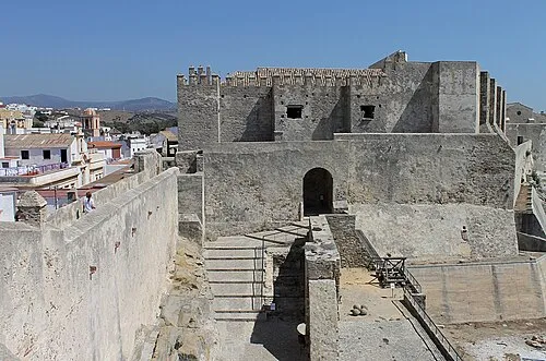 Castle of Tarifa Historic site, Tarifa0.2 km S
-
Iglesia San Francisco De Asis Attraction, Tarifa0.2 km W
-
Puerta de Jerez Landmark, Tarifa0.2 km W
-
Sancho IV Monument Landmark, Tarifa0.3 km SW
-
Residencia de Díaz Museum, Tarifa0.6 km NW
-
Plaza de Toros Attraction, Tarifa0.6 km W
-
Castillo de Santa Catalina Historic site, Tarifa0.6 km SW
-
Tarifa DGPS-Transmitter Landmark, Tarifa1.5 km SW
Nearest towns and villages
-
Tarifa Town, Tarifa0.5 km W
-
El Cuartón Village, Tarifa8.3 km NE
-
El Bujeo Village, Tarifa9.5 km NE
-
Algeciras Municipality, Cadiz17 km NE
Sources & licences
Data last updated: · 2 independent sources