- Elevation
- 380 m
- above sea level
- Local time
- UTC+01:00
- Europe/Madrid · UTC+01:00
- Airports
- ODB Córdoba Airport63 km
- GRX F.G.L. Airport Granada-Jaén Airport84 km
About Alharilla
Alharilla is a village. Location: Porcuna, Jaen. Elevation: 380 m. The best months to visit are March–May, October. The nearest airport is Córdoba Airport (63 km). Nearby sights include Cerrillo Blanco, Iberian necropolis and Arroyo del Salado.
Climate of Alharilla
Best months for sightseeingBest months for sightseeing: March–May, October.
This month · November
Outside the best season
Day 18° · Night 7° · Rain 64 mm
Better nearby cities in November
- Málaga · 133 km south20°
- Dos Hermanas · 171 km southwest20°
- Seville · 171 km west20°
- Hottest month
- July (day 36°)
- Coldest month
- January (night 3°)
- Wettest month
- December (73 mm)
- Driest month
- July (4 mm)
Bars: average monthly low and high temperature. Below: precipitation. Monthly averages for 1970–2000 at about 18 km resolution, adjusted for elevation. Highlighted months are mild and relatively dry. Source: WorldClim 2.1 (CC BY 4.0).
Show values as a table
| Month | Jan | Feb | Mar | Apr | May | Jun | Jul | Aug | Sep | Oct | Nov | Dec |
|---|---|---|---|---|---|---|---|---|---|---|---|---|
| Average high (°C) | 14° | 16° | 20° | 21° | 26° | 31° | 36° | 35° | 31° | 24° | 18° | 14° |
| Average low (°C) | 3° | 4° | 6° | 8° | 12° | 16° | 18° | 18° | 16° | 11° | 7° | 4° |
| Precipitation (mm) | 59 | 45 | 36 | 50 | 36 | 20 | 4 | 5 | 22 | 55 | 64 | 73 |
Other places to visit in this season: March April May October
How to get to Alharilla
The nearest airport is Córdoba Airport (ODB), 63 km to the west as the crow flies. For international flights: Málaga-Costa del Sol Airport (AGP) (139 km). The nearest large city is Jaén, 33 km to the southeast.
Airports
- Córdoba Airport (ODB) Córdoba 63 kmwest
- F.G.L. Airport Granada-Jaén Airport (GRX) Granada 84 kmsouth
- Málaga-Costa del Sol Airport (AGP) Málaga 139 kmsouth
Nearby large cities
- Jaén Population: 113.5K 33 kmsoutheast
- Córdoba Population: 325.7K 56 kmwest
- Granada Population: 233.5K 91 kmsoutheast
- Málaga Population: 592.3K 133 kmsouth
- Marbella Population: 156.3K 167 kmsouthwest
Straight-line distances; road distances are longer. Airport data: OurAirports.
Day trips from Alharilla
Within 100 km: 329 historic and cultural sites, 147 natural sites, 404 lakes, rivers and coasts.
0–25 km35 places
- Loma del Madero Mountain 15 kmNE
- Parque Manuel Carrasco Natural site 24 kmSE
- Río de las Yeguas River 19 kmNW
- Arroyo de Valhondo River 12 kmNE
25–60 km329 places
- Pantano del Rumblar Lake 44 kmNE
- Pantano del Jándula Lake 43 kmNE
- Pantano del Guadamellato Lake 52 kmW
- Pantano Grande Lake 52 kmE
60–100 km516 places
- Laguna de Retamar Lake 85 kmN
- Laguna de los Lomillos Lake 96 kmN
- La Laguna Lake 96 kmN
- Laguna de Juagarzal Lake 94 kmNE
Straight-line distances.
Nearby attractions & nature
Everything nearby-
Cerrillo Blanco, Iberian necropolis Historic site, Porcuna4 km W
-
Arroyo del Salado River, Porcuna7.2 km S
-
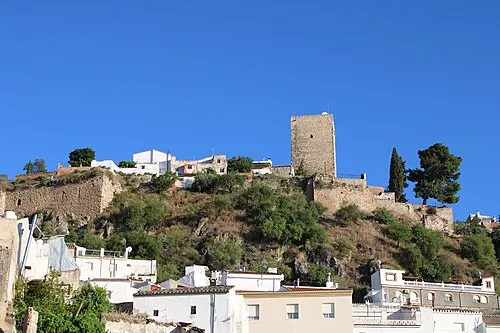 Castillo de la Villa de Martos Historic site, Martos24 km SE
-
Arroyo de Valhondo River, Arjona12 km NE
-
Loma del Madero Mountain, Lahiguera15 km NE
-
Plaza de Toros Attraction, Andújar17 km NE
Sources & licences
Data last updated: