- Elevation
- 672 m
- above sea level
- Local time
- UTC+01:00
- Europe/Madrid · UTC+01:00
- Airports
- AGP Málaga-Costa del Sol Airport43 km
- GRX F.G.L. Airport Granada-Jaén Airport61 km
About Arroyo de la Fuente de la Lana
Arroyo de la Fuente de la Lana is a river. Location: Antequera, Malaga. The best months to visit are May, October. The nearest airport is Málaga-Costa del Sol Airport (43 km). Nearby sights include Arroyo de la Yedra and Sierra de Camorolos.
Climate of Arroyo de la Fuente de la Lana
Best months for sightseeingBest months for sightseeing: May, October.
This month · November
Outside the best season
Day 17° · Night 6° · Rain 81 mm
Better nearby cities in November
- Málaga · 39 km south20°
- Dos Hermanas · 133 km west20°
- Seville · 139 km west20°
- Hottest month
- July (day 33°)
- Coldest month
- January (night 3°)
- Wettest month
- December (91 mm)
- Driest month
- July (3 mm)
Bars: average monthly low and high temperature. Below: precipitation. Monthly averages for 1970–2000 at about 18 km resolution, adjusted for elevation. Highlighted months are mild and relatively dry. Source: WorldClim 2.1 (CC BY 4.0).
Show values as a table
| Month | Jan | Feb | Mar | Apr | May | Jun | Jul | Aug | Sep | Oct | Nov | Dec |
|---|---|---|---|---|---|---|---|---|---|---|---|---|
| Average high (°C) | 13° | 14° | 17° | 19° | 23° | 28° | 33° | 33° | 29° | 22° | 17° | 14° |
| Average low (°C) | 3° | 3° | 5° | 7° | 10° | 13° | 16° | 16° | 14° | 10° | 6° | 4° |
| Precipitation (mm) | 85 | 66 | 60 | 58 | 41 | 18 | 3 | 4 | 22 | 60 | 81 | 91 |
How to get to Arroyo de la Fuente de la Lana
The nearest airport is Málaga-Costa del Sol Airport (AGP), 43 km to the south as the crow flies. The nearest large city is Málaga, 39 km to the south.
Airports
- Málaga-Costa del Sol Airport (AGP) Málaga 43 kmsouth
- F.G.L. Airport Granada-Jaén Airport (GRX) Granada 61 kmeast
- Córdoba Airport (ODB) Córdoba 93 kmnorth
Nearby large cities
- Málaga Population: 592.3K 39 kmsouth
- Marbella Population: 156.3K 72 kmsouthwest
- Granada Population: 233.5K 76 kmeast
- Córdoba Population: 325.7K 96 kmnorth
- Jaén Population: 113.5K 97 kmnortheast
Straight-line distances; road distances are longer. Airport data: OurAirports.
Day trips from Arroyo de la Fuente de la Lana
Within 100 km: 503 historic and cultural sites, 214 natural sites, 421 lakes, rivers and coasts.
0–25 km42 places
- Sierra del Torcal Mountain 14 kmSW
- Sierra del Pedroso Mountain 14 kmNE
- Sierra del Jobo Mountain 15 kmSE
- Sierra Gorda Mountain 22 kmE
25–60 km391 places
- Playa de la Caleta Beach 39 kmS
- Laguna Playa Beach 49 kmSE
- Platja Rincón de la Victoria Beach 42 kmS
- Playa de Las Gaviotas Beach 44 kmSE
60–100 km705 places
- Playa Granada Beach 88 kmSE
- La Cala el Cañuelo Beach Beach 69 kmSE
- Playa de Poniente Beach 90 kmSE
- Playa Molino Beach 85 kmSE
Straight-line distances.
Nearest towns and villages
-
 Archidona Municipality, Malaga6.6 km NE
-
 Cartaojal Village, Antequera7.4 km NW
-
Archidona Town, Archidona6.4 km NE
-
Antequera Town, Antequera11 km SW
-
 Villanueva del Trabuco Municipality, Malaga12 km E
-
Villanueva del Rosario Municipality, Malaga9 km SE
Nearby attractions & nature
Everything nearby-
Arroyo de la Yedra River, Antequera6.6 km S
-
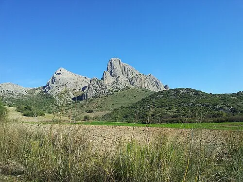 Sierra de Camorolos Mountain, Colmenar15 km SE
-
Río Parroso River, Antequera9.4 km SE
-
Sierra de Arcas Mountain, Villanueva de Algaidas10 km N
-
Arroyo de la Negra River, Antequera9.7 km NE
-
Río Cerezo River, Antequera10 km SE
-
Sierra de Chimenea Mountain, Antequera20 km SW
-
Sierra del Torcal Mountain, Antequera14 km SW
Sources & licences
Data last updated: