- Elevation
- 917 m
- above sea level
- Local time
- UTC+01:00
- Europe/Madrid · UTC+01:00
- Airports
- AGP Málaga-Costa del Sol Airport12 km
- GIB Gibraltar Airport84 km
About Cerro del Moro
Cerro del Moro is a mountain. Location: Benalmádena, Malaga. Elevation: 917 m. The best months to visit are June–September. The nearest airport is Málaga-Costa del Sol Airport (12 km). Nearby sights include Parque Rústico de Retamar and Parque los Limones.
Climate of Cerro del Moro
Best months for sightseeingBest months for sightseeing: June–September.
This month · November
Outside the best season
Day 14° · Night 6° · Rain 93 mm
Better nearby cities in November
- Málaga · 20 km northeast20°
- Dos Hermanas · 140 km northwest20°
- Seville · 150 km northwest20°
- Hottest month
- August (day 26°)
- Coldest month
- January (night 2°)
- Wettest month
- December (106 mm)
- Driest month
- July (1 mm)
Bars: average monthly low and high temperature. Below: precipitation. Monthly averages for 1970–2000 at about 18 km resolution, adjusted for elevation. Highlighted months are mild and relatively dry. Source: WorldClim 2.1 (CC BY 4.0).
Show values as a table
| Month | Jan | Feb | Mar | Apr | May | Jun | Jul | Aug | Sep | Oct | Nov | Dec |
|---|---|---|---|---|---|---|---|---|---|---|---|---|
| Average high (°C) | 10° | 11° | 13° | 15° | 18° | 22° | 25° | 26° | 23° | 18° | 14° | 11° |
| Average low (°C) | 2° | 3° | 4° | 5° | 8° | 11° | 14° | 15° | 13° | 9° | 6° | 3° |
| Precipitation (mm) | 95 | 69 | 61 | 47 | 29 | 12 | 1 | 4 | 17 | 60 | 93 | 106 |
Other places to visit in this season: June July August September
How to get to Cerro del Moro
The nearest airport is Málaga-Costa del Sol Airport (AGP), 12 km to the northeast as the crow flies. The nearest large city is Málaga, 20 km to the northeast.
Airports
- Málaga-Costa del Sol Airport (AGP) Málaga 12 kmnortheast
- Gibraltar Airport (GIB) Gibraltar 84 kmsouthwest
- F.G.L. Airport Granada-Jaén Airport (GRX) Granada 98 kmnortheast
Nearby large cities
- Málaga Population: 592.3K 20 kmnortheast
- Marbella Population: 156.3K 28 kmwest
- Algeciras Population: 121.4K 93 kmsouthwest
- Granada Population: 233.5K 109 kmnortheast
- Tétouan Population: 415.8K 133 kmsouthwest
Straight-line distances; road distances are longer. Airport data: OurAirports.
Day trips from Cerro del Moro
Within 100 km: 356 historic and cultural sites, 191 natural sites, 354 lakes, rivers and coasts.
0–25 km158 places
- Playa de la Caleta Beach 22 kmNE
- Playa Bonita Beach 4 kmSE
- Playa del Palo Beach 25 kmNE
- Playa Cabopino Beach 18 kmSW
25–60 km241 places
- Laguna Playa Beach 46 kmE
- Platja Rincón de la Victoria Beach 31 kmNE
- Playa de Las Gaviotas Beach 34 kmE
- Playa Puerto Banús Beach 34 kmW
60–100 km502 places
- Playa Granada Beach 93 kmE
- La Cala el Cañuelo Beach Beach 74 kmE
- Playa de Poniente Beach 95 kmE
- Playa de Poniente Beach 83 kmSW
Straight-line distances.
Nearest towns and villages
-
Benalmádena Town, Benalmádena2.3 km SE
-
Mijas Town, Mijas3.8 km W
-
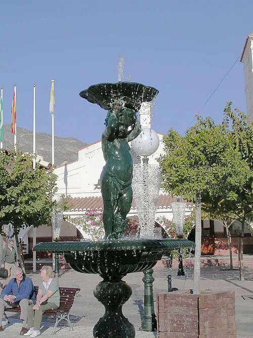 Arroyo de la Miel Town, Benalmádena5.5 km E
-
 Fuengirola Municipality, Malaga5.4 km S
-
Osunillas Village, Mijas2.1 km W
-
Fuengirola Town, Fuengirola7.6 km S
Nearby attractions & nature
Everything nearby-
Parque Rústico de Retamar Natural site, Benalmádena2.3 km SE
-
Parque los Limones Natural site, Benalmádena2.5 km SE
-
Jardines del Muro Natural site, Benalmádena2.5 km SE
-
Cerro Guerrero Mountain, Benalmádena3.6 km NE
-
Playa Malibu Palace Beach, Benalmádena4.3 km SE
-
Estupa de la Iluminación de Benalmádena Landmark, Benalmádena2.3 km SE
-
Museo De Arte Precolombino Felipe Orlando Museum, Benalmádena2.3 km SE
-
Playa Nudista Benalnatura Beach, Benalmádena4.7 km SE
Sources & licences
Data last updated: