- Elevation
- 590 m
- above sea level
- Local time
- UTC+01:00
- Europe/Madrid · UTC+01:00
- Airports
- GIB Gibraltar Airport36 km
- AGP Málaga-Costa del Sol Airport70 km
About Sierra Bermeja
Sierra Bermeja is a mountain. Location: Casares, Malaga. Elevation: 590 m. The best months to visit are June–September. The nearest airport is Gibraltar Airport (36 km). Nearby sights include El Parque de San Isidro Los Pedregales and Necropolis Prehistorica de Corominas.
Climate of Sierra Bermeja
Best months for sightseeingBest months for sightseeing: June–September.
This month · November
A wet month
Day 16° · Night 9° · Rain 109 mm
Better nearby cities in November
- Málaga · 78 km east20°
- Dos Hermanas · 109 km northwest20°
- Seville · 121 km northwest20°
- Hottest month
- August (day 27°)
- Coldest month
- January (night 5°)
- Wettest month
- December (131 mm)
- Driest month
- July (1 mm)
Bars: average monthly low and high temperature. Below: precipitation. Monthly averages for 1970–2000 at about 18 km resolution, adjusted for elevation. Highlighted months are mild and relatively dry. Source: WorldClim 2.1 (CC BY 4.0).
Show values as a table
| Month | Jan | Feb | Mar | Apr | May | Jun | Jul | Aug | Sep | Oct | Nov | Dec |
|---|---|---|---|---|---|---|---|---|---|---|---|---|
| Average high (°C) | 13° | 13° | 15° | 17° | 20° | 24° | 27° | 27° | 24° | 20° | 16° | 14° |
| Average low (°C) | 5° | 6° | 7° | 8° | 10° | 13° | 16° | 16° | 15° | 12° | 9° | 7° |
| Precipitation (mm) | 110 | 88 | 77 | 56 | 33 | 11 | 1 | 3 | 18 | 69 | 109 | 131 |
Other places to visit in this season: June July August September
How to get to Sierra Bermeja
The nearest airport is Gibraltar Airport (GIB), 36 km to the south as the crow flies. The nearest large city is Marbella, 32 km to the east.
Airports
- Gibraltar Airport (GIB) Gibraltar 36 kmsouth
- Málaga-Costa del Sol Airport (AGP) Málaga 70 kmeast
- Jerez Airport (XRY) Jerez de la Frontera 80 kmnorthwest
Nearby large cities
- Marbella Population: 156.3K 32 kmeast
- Algeciras Population: 121.4K 42 kmsouthwest
- Málaga Population: 592.3K 78 kmeast
- Jerez de la Frontera Population: 212.9K 84 kmwest
- Cadiz Population: 117K 95 kmwest
Straight-line distances; road distances are longer. Airport data: OurAirports.
Day trips from Sierra Bermeja
Within 100 km: 409 historic and cultural sites, 229 natural sites, 400 lakes, rivers and coasts.
0–25 km100 places
- Playa de Río Guadiaro Beach 21 kmS
- Cala Sardina Beach 18 kmS
- Playa de Linda Vista Beach 22 kmE
- Playa de Guadalmina Beach 21 kmE
25–60 km364 places
- Playa de Poniente Beach 36 kmS
- Playa de Levante Beach 32 kmS
- La Alcaidesa Beach 27 kmS
- Playa de La Hacienda Beach 36 kmS
60–100 km574 places
- Playa de Zahora Beach 79 kmW
- Playa de la Victoria Beach 94 kmW
- Playa de San Amaro Beach 64 kmS
- Playa de Levante Beach 89 kmW
Straight-line distances.
Nearest towns and villages
Nearby attractions & nature
Everything nearby-
El Parque de San Isidro Los Pedregales Natural site, Estepona3.4 km SE
-
Necropolis Prehistorica de Corominas Historic site, Estepona3.1 km SE
-
Fuente de Carlos III Landmark, Casares4.4 km SW
-
Iglesia de la Encarnación Attraction, Casares4.5 km SW
-
Cerro de la Coronuela Mountain, Benarrabá9 km NW
-
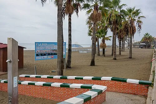 La Rada Beach Beach, Malaga9.2 km SE
-
Playa del Cristo Beach, Malaga8.3 km SE
-
Playa Bahia Beach, Estepona10 km SE
Sources & licences
Data last updated: