Canteras de Almayate Museo de la Piedra
Located in Vélez-Málaga, Malaga Coordinates: 36°43′24″ N 4°09′29″ W
- Local time
- UTC+01:00
- Europe/Madrid · UTC+01:00
- Elevation
- 15 m
- above sea level
- Airports
- AGP Málaga-Costa del Sol Airport31 km
- GRX F.G.L. Airport Granada-Jaén Airport62 km
About Canteras de Almayate Museo de la Piedra
Canteras de Almayate Museo de la Piedra is a museum. Location: Vélez-Málaga, Malaga. The best months to visit are March–May, October–November. The nearest airport is Málaga-Costa del Sol Airport (31 km). Nearby sights include Cerro del Alarcón (phoenician site) and Jardín (phoenician necropole).
Climate of Canteras de Almayate Museo de la Piedra
Best months for sightseeingBest months for sightseeing: March–May, October–November.
This month · November
A good month to visit
Day 21° · Night 11° · Rain 71 mm
- Hottest month
- August (day 33°)
- Coldest month
- January (night 7°)
- Wettest month
- December (81 mm)
- Driest month
- July (2 mm)
Bars: average monthly low and high temperature. Below: precipitation. Monthly averages for 1970–2000 at about 18 km resolution, adjusted for elevation. Highlighted months are mild and relatively dry. Source: WorldClim 2.1 (CC BY 4.0).
Show values as a table
| Month | Jan | Feb | Mar | Apr | May | Jun | Jul | Aug | Sep | Oct | Nov | Dec |
|---|---|---|---|---|---|---|---|---|---|---|---|---|
| Average high (°C) | 17° | 18° | 20° | 22° | 25° | 30° | 33° | 33° | 30° | 25° | 21° | 18° |
| Average low (°C) | 7° | 8° | 9° | 11° | 14° | 17° | 20° | 20° | 18° | 14° | 11° | 9° |
| Precipitation (mm) | 75 | 52 | 45 | 45 | 30 | 14 | 2 | 4 | 17 | 51 | 71 | 81 |
Other places to visit in this season: March April May October November
How to get to Canteras de Almayate Museo de la Piedra
The nearest airport is Málaga-Costa del Sol Airport (AGP), 31 km to the west as the crow flies. The nearest large city is Málaga, 23 km to the west.
Airports
- Málaga-Costa del Sol Airport (AGP) Málaga 31 kmwest
- F.G.L. Airport Granada-Jaén Airport (GRX) Granada 62 kmnortheast
- Gibraltar Airport (GIB) Gibraltar 124 kmsouthwest
Nearby large cities
- Málaga Population: 592.3K 23 kmwest
- Marbella Population: 156.3K 69 kmwest
- Granada Population: 233.5K 71 kmnortheast
- Jaén Population: 113.5K 121 kmnorth
- Algeciras Population: 121.4K 133 kmsouthwest
Straight-line distances; road distances are longer. Airport data: OurAirports.
Day trips from Canteras de Almayate Museo de la Piedra
Within 100 km: 354 historic and cultural sites, 165 natural sites, 327 lakes, rivers and coasts.
0–25 km122 places
- Playa de la Caleta Beach 22 kmW
- Laguna Playa Beach 5 kmE
- Platja Rincón de la Victoria Beach 11 kmW
- Playa de Las Gaviotas Beach 8 kmW
25–60 km270 places
- Playa Granada Beach 53 kmE
- La Cala el Cañuelo Beach Beach 33 kmE
- Playa de Poniente Beach 55 kmE
- Playa Bonita Beach 40 kmSW
60–100 km454 places
- Playa Castell Del Ferro - Sotillo Beach 71 kmE
- Playa Puerto Banús Beach 75 kmW
- Playa Real De Zaragoza Beach 63 kmSW
- Playa De La Joya Beach 61 kmE
Straight-line distances.
Nearby attractions & nature
Everything nearby-
Cerro del Alarcón (phoenician site) Historic site, Vélez-Málaga3.8 km NE
-
Jardín (phoenician necropole) Historic site, Vélez-Málaga4.1 km NE
-
Cerro del Peñón (phoenician site) Historic site, Vélez-Málaga4.1 km E
-
Yacimiento fenicio de Toscanos Historic site, Vélez-Málaga4.1 km E
-
Manganeto, roman pottery kilns Historic site, Vélez-Málaga4.1 km E
-
Toscanos, trench 1 Historic site, Vélez-Málaga4.2 km E
-
Toscanos, construction A (Bau A) Historic site, Vélez-Málaga4.2 km E
-
Toscanos, trench 2 Historic site, Vélez-Málaga4.2 km E
Nearest towns and villages
-
Valle Niza Village, Vélez-Málaga0.7 km NE
-
Torre del Mar Town, Vélez-Málaga6.2 km E
-
Almayate Alto Village, Vélez-Málaga1.9 km N
-
Almayate Bajo Village, Vélez-Málaga2.7 km E
More sights in Vélez-Málaga
-
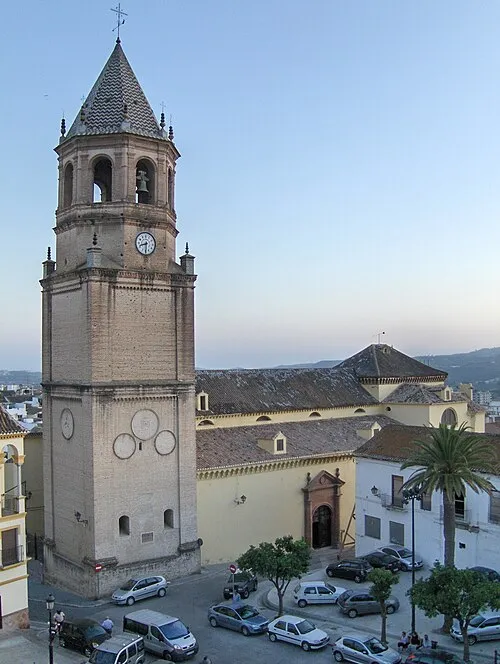 Iglesia de San Juan Bautista Attraction, Vélez-Málaga8.2 km NE
-
Cerro del Mar (phoenician site) Historic site, Vélez-Málaga4.7 km E
-
Parroquia de San Andrés Apóstol Attraction, Vélez-Málaga6.1 km E
-
Estatua Pescador Tralla Landmark, Vélez-Málaga6.2 km E
-
Monasterio de Carmelitas Descalzas de Jesús María y José Attraction, Vélez-Málaga8 km NE
-
Teatro del Carmen Attraction, Vélez-Málaga8.1 km NE
Sources & licences
Data last updated: