- Elevation
- 53 m
- above sea level
- Local time
- UTC+01:00
- Europe/Madrid · UTC+01:00
- Airports
- SVQ Seville Airport63 km
- XRY Jerez Airport87 km
About Arroyo de Bayas
Arroyo de Bayas is a river. Location: Niebla, Province of Huelva. The best months to visit are March–May, October–November. The nearest airport is Seville Airport (63 km). Nearby sights include Arroyo Giraldo and Arroyo de Clarina.
Climate of Arroyo de Bayas
Best months for sightseeingBest months for sightseeing: March–May, October–November.
This month · November
A good month to visit
Day 20° · Night 10° · Rain 79 mm
- Hottest month
- July (day 34°)
- Coldest month
- January (night 6°)
- Wettest month
- December (87 mm)
- Driest month
- July (3 mm)
Bars: average monthly low and high temperature. Below: precipitation. Monthly averages for 1970–2000 at about 18 km resolution, adjusted for elevation. Highlighted months are mild and relatively dry. Source: WorldClim 2.1 (CC BY 4.0).
Show values as a table
| Month | Jan | Feb | Mar | Apr | May | Jun | Jul | Aug | Sep | Oct | Nov | Dec |
|---|---|---|---|---|---|---|---|---|---|---|---|---|
| Average high (°C) | 16° | 17° | 20° | 22° | 25° | 29° | 34° | 33° | 30° | 25° | 20° | 16° |
| Average low (°C) | 6° | 7° | 8° | 10° | 13° | 16° | 19° | 19° | 17° | 14° | 10° | 7° |
| Precipitation (mm) | 75 | 52 | 38 | 52 | 32 | 15 | 3 | 5 | 19 | 61 | 79 | 87 |
Other places to visit in this season: March April May October November
How to get to Arroyo de Bayas
The nearest airport is Seville Airport (SVQ), 63 km to the east as the crow flies. The nearest large city is Huelva, 33 km to the southwest.
Airports
- Seville Airport (SVQ) Seville 63 kmeast
- Jerez Airport (XRY) Jerez de la Frontera 87 kmsoutheast
- Faro - Gago Coutinho International Airport (FAO) Faro 129 kmwest
Nearby large cities
- Huelva Population: 144.3K 33 kmsouthwest
- Seville Population: 686.7K 56 kmeast
- Dos Hermanas Population: 122.9K 62 kmeast
- Jerez de la Frontera Population: 212.9K 89 kmsoutheast
- Cadiz Population: 117K 101 kmsouth
Straight-line distances; road distances are longer. Airport data: OurAirports.
Day trips from Arroyo de Bayas
Within 100 km: 331 historic and cultural sites, 89 natural sites, 416 lakes, rivers and coasts.
0–25 km59 places
- Alcalde Mojarro Natural site 17 kmSE
- Parque Blas Infante Natural site 18 kmSE
- El Tomillar Park Natural site 18 kmSE
- Arroyo de los Prados River 24 kmW
25–60 km363 places
- Playa de Castilla Beach 41 kmS
- Playa de Castilla Beach 37 kmSW
- Playa de Punta Umbría Beach 42 kmSW
- Playa de la Bota Beach 44 kmSW
60–100 km414 places
- Playa de Levante Beach 100 kmS
- Punta del Moral Beach 70 kmW
- Punta del Caiman Beach 69 kmW
- Playa de las Tres Piedras Beach 78 kmS
Straight-line distances.
Nearest towns and villages
-
 Villarrasa Municipality, Province of Huelva2.4 km W
-
Villarrasa Village, Villarrasa1.4 km S
-
Palma del Condado, La Municipality, Province of Huelva4.1 km E
-
La Palma del Condado Town, Palma del Condado, La4.8 km E
-
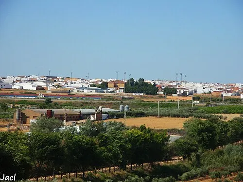 Bollullos par del Condado Town, Bollullos Par del Condado8.6 km SE
-
Niebla Village, Niebla8 km SW
Nearby attractions & nature
Everything nearby-
Arroyo Giraldo River, Niebla2.1 km NW
-
Arroyo de Clarina River, Niebla2.7 km N
-
Arroyo del Arzobispo River, Niebla5.5 km W
-
Arroyo Helechoso River, Niebla5.8 km W
-
Arroyo Fuentidueña River, Paterna del Campo6.2 km NE
-
Arroyo de Huerta Quemada River, Niebla6.4 km N
-
Arroyo Conejero River, Paterna del Campo7.2 km NE
-
Arroyo de la Granja River, Niebla7.4 km N
Sources & licences
Data last updated: