- Elevation
- 100 m
- above sea level
- Local time
- UTC+01:00
- Europe/Madrid · UTC+01:00
- Airports
- ODB Córdoba Airport41 km
- SVQ Seville Airport74 km
About Arroyo Salado de Gilena
Arroyo Salado de Gilena is a river. Location: Écija, Seville. The best months to visit are March–May, October–November. The nearest airport is Córdoba Airport (41 km). Nearby sights include Real Monasterio de Santa Inés del Valle and Palacio de Santaella.
Photos of Arroyo Salado de Gilena
-
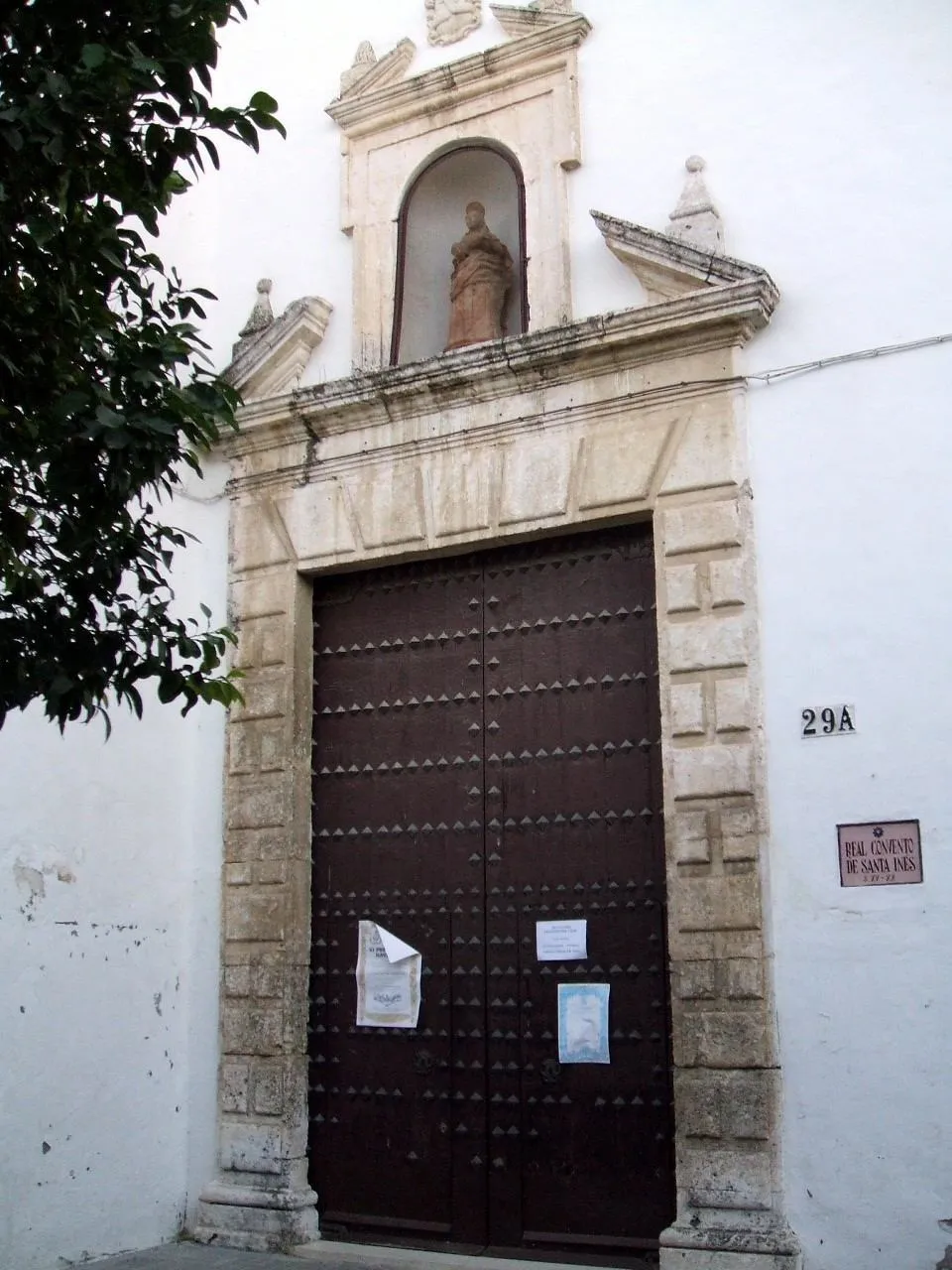
Real Monasterio de Santa Inés del Valle Zarateman · Public domain

Climate of Arroyo Salado de Gilena
Best months for sightseeingBest months for sightseeing: March–May, October–November.
This month · November
A good month to visit
Day 20° · Night 8° · Rain 81 mm
- Hottest month
- July (day 35°)
- Coldest month
- January (night 5°)
- Wettest month
- December (95 mm)
- Driest month
- July (3 mm)
Bars: average monthly low and high temperature. Below: precipitation. Monthly averages for 1970–2000 at about 18 km resolution, adjusted for elevation. Highlighted months are mild and relatively dry. Source: WorldClim 2.1 (CC BY 4.0).
Show values as a table
| Month | Jan | Feb | Mar | Apr | May | Jun | Jul | Aug | Sep | Oct | Nov | Dec |
|---|---|---|---|---|---|---|---|---|---|---|---|---|
| Average high (°C) | 15° | 17° | 20° | 22° | 26° | 31° | 35° | 35° | 32° | 25° | 20° | 16° |
| Average low (°C) | 5° | 6° | 7° | 9° | 12° | 16° | 18° | 19° | 17° | 12° | 8° | 6° |
| Precipitation (mm) | 78 | 53 | 42 | 54 | 35 | 16 | 3 | 4 | 23 | 62 | 81 | 95 |
Other places to visit in this season: March April May October November
How to get to Arroyo Salado de Gilena
The nearest airport is Córdoba Airport (ODB), 41 km to the northeast as the crow flies. For international flights: Seville Airport (SVQ) (74 km). The nearest large city is Córdoba, 49 km to the northeast.
Airports
- Córdoba Airport (ODB) Córdoba 41 kmnortheast
- Seville Airport (SVQ) Seville 74 kmwest
- Málaga-Costa del Sol Airport (AGP) Málaga 106 kmsoutheast
Nearby large cities
- Córdoba Population: 325.7K 49 kmnortheast
- Dos Hermanas Population: 122.9K 80 kmwest
- Seville Population: 686.7K 82 kmwest
- Málaga Population: 592.3K 105 kmsoutheast
- Marbella Population: 156.3K 112 kmsouth
Straight-line distances; road distances are longer. Airport data: OurAirports.
Day trips from Arroyo Salado de Gilena
Within 100 km: 394 historic and cultural sites, 200 natural sites, 432 lakes, rivers and coasts.
0–25 km45 places
- Loma del Pozo de Osuna Mountain 12 kmSW
- Loma de Fuentidueña Mountain 15 kmSE
- Arroyo de la Vizcaína River 24 kmSE
- Cañada de la Traviesa River 23 kmS
25–60 km334 places
- Laguna Salada Lake 53 kmSE
- Pantano de la Brena Lake 35 kmN
- Loma del Vellón Mountain 49 kmN
- Cerro del Trigo Mountain 45 kmN
60–100 km647 places
- La Isleta Island 94 kmW
- Isla de la Cartuja Island 84 kmW
- Laguna de Bartolomé Lake 91 kmSW
- Embalse de San Pedro Lake 90 kmN
Straight-line distances.
Nearest towns and villages
-
Écija Town, Écija3.2 km NW
-
Villanueva del Rey Village, Écija8.2 km W
-
 Fuente Palmera Municipality, Cordoba21 km N
-
Luisiana, La Municipality, Seville14 km W
-
 Santaella Municipality, Cordoba20 km E
-
 Marinaleda Municipality, Seville20 km SE
Nearby attractions & nature
Everything nearby-
Real Monasterio de Santa Inés del Valle Attraction, Écija3.6 km N
-
Palacio de Santaella Historic site, Écija2.7 km NW
-
Palacio de Almenara Alta Historic site, Écija2.8 km N
-
Iglesia de San Gil Attraction, Écija2.8 km N
-
Plaza de Toros Attraction, Écija2.8 km NW
-
Palacio de Benamejí Historic site, Écija2.8 km NW
-
Museo Histórico Municipal de Écija Museum, Écija2.8 km NW
-
Portada del siglo XVII Historic site, Écija2.8 km N
Sources & licences
Data last updated: