- Elevation
- 132 m
- above sea level
- Local time
- UTC+01:00
- Europe/Madrid · UTC+01:00
- Airports
- SVQ Seville Airport25 km
- XRY Jerez Airport91 km
About Las Pajanosas
Las Pajanosas is a village. Location: Guillena, Seville. Elevation: 132 m. The best months to visit are March–May, October–November. The nearest airport is Seville Airport (25 km). Nearby sights include Mundo Park and Zoo de Sevilla.
Climate of Las Pajanosas
Best months for sightseeingBest months for sightseeing: March–May, October–November.
This month · November
A good month to visit
Day 19° · Night 9° · Rain 81 mm
- Hottest month
- July (day 35°)
- Coldest month
- January (night 5°)
- Wettest month
- December (93 mm)
- Driest month
- July (3 mm)
Bars: average monthly low and high temperature. Below: precipitation. Monthly averages for 1970–2000 at about 18 km resolution, adjusted for elevation. Highlighted months are mild and relatively dry. Source: WorldClim 2.1 (CC BY 4.0).
Show values as a table
| Month | Jan | Feb | Mar | Apr | May | Jun | Jul | Aug | Sep | Oct | Nov | Dec |
|---|---|---|---|---|---|---|---|---|---|---|---|---|
| Average high (°C) | 15° | 17° | 20° | 21° | 25° | 30° | 35° | 34° | 31° | 25° | 19° | 16° |
| Average low (°C) | 5° | 6° | 8° | 10° | 13° | 16° | 19° | 19° | 17° | 13° | 9° | 6° |
| Precipitation (mm) | 77 | 55 | 39 | 56 | 35 | 16 | 3 | 5 | 21 | 62 | 81 | 93 |
Other places to visit in this season: March April May October November
How to get to Las Pajanosas
The nearest airport is Seville Airport (SVQ), 25 km to the southeast as the crow flies. The nearest large city is Seville, 23 km to the southeast.
Airports
- Seville Airport (SVQ) Seville 25 kmsoutheast
- Jerez Airport (XRY) Jerez de la Frontera 91 kmsouth
- Córdoba Airport (ODB) Córdoba 114 kmeast
Nearby large cities
- Seville Population: 686.7K 23 kmsoutheast
- Dos Hermanas Population: 122.9K 35 kmsoutheast
- Huelva Population: 144.3K 81 kmsouthwest
- Jerez de la Frontera Population: 212.9K 98 kmsouth
- Cadiz Population: 117K 117 kmsouth
Straight-line distances; road distances are longer. Airport data: OurAirports.
Day trips from Las Pajanosas
Within 100 km: 328 historic and cultural sites, 114 natural sites, 469 lakes, rivers and coasts.
0–25 km154 places
- Isla de la Cartuja Island 20 kmSE
- Pantano de la Minilla Lake 13 kmNW
- Embalse del Gergal Lake 4 kmE
- Cerro del Cerco Mountain 17 kmSW
25–60 km238 places
- Isla Mínima Island 50 kmS
- Isla Mayor Island 53 kmS
- La Isleta Island 38 kmS
- Pantano del Pintado Lake 50 kmN
60–100 km519 places
- Playa de Castilla Beach 75 kmSW
- Playa de Castilla Beach 82 kmSW
- Playa de Punta Umbría Beach 89 kmSW
- Playa de la Bota Beach 92 kmSW
Straight-line distances.
Nearby attractions & nature
Everything nearby-
Mundo Park Attraction, Guillena1.7 km E
-
Zoo de Sevilla Attraction, Guillena1.8 km E
-
Arroyo de las Torres River, Gerena3.3 km SW
-
Embalse del Gergal Lake, Guillena4.5 km E
-
Río de los Frailes River, Guillena8.6 km SE
-
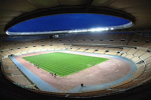 Estadio de La Cartuja Landmark, Santiponce19 km SE
Sources & licences
Data last updated: