Barranco de Valdabra
Located in Huesca Municipality, Huesca Coordinates: 42°02′00″ N 0°25′00″ W
- Elevation
- 386 m
- above sea level
- Local time
- UTC+01:00
- Europe/Madrid · UTC+01:00
- Airports
- ZAZ Zaragoza Airport66 km
- ILD Lleida-Alguaire Airport86 km
About Barranco de Valdabra
Barranco de Valdabra is a river. Location: Huesca Municipality, Huesca. The best months to visit are May, September–October. The nearest airport is Zaragoza Airport (66 km). Nearby sights include Río Isuela and Parque Miguel Servet.
Climate of Barranco de Valdabra
Best months for sightseeingBest months for sightseeing: May, September–October.
This month · November
Outside the best season
Day 14° · Night 6° · Rain 46 mm
- Hottest month
- July (day 32°)
- Coldest month
- January (night 2°)
- Wettest month
- May (60 mm)
- Driest month
- July (20 mm)
Bars: average monthly low and high temperature. Below: precipitation. Monthly averages for 1970–2000 at about 18 km resolution, adjusted for elevation. Highlighted months are mild and relatively dry. Source: WorldClim 2.1 (CC BY 4.0).
Show values as a table
| Month | Jan | Feb | Mar | Apr | May | Jun | Jul | Aug | Sep | Oct | Nov | Dec |
|---|---|---|---|---|---|---|---|---|---|---|---|---|
| Average high (°C) | 10° | 13° | 16° | 19° | 23° | 28° | 32° | 32° | 27° | 21° | 14° | 10° |
| Average low (°C) | 2° | 4° | 5° | 8° | 11° | 15° | 18° | 18° | 15° | 11° | 6° | 3° |
| Precipitation (mm) | 36 | 33 | 34 | 49 | 60 | 46 | 20 | 38 | 50 | 57 | 46 | 41 |
How to get to Barranco de Valdabra
The nearest airport is Zaragoza Airport (ZAZ), 66 km to the southwest as the crow flies. The nearest large city is Zaragoza, 57 km to the southwest.
Airports
- Zaragoza Airport (ZAZ) Zaragoza 66 kmsouthwest
- Lleida-Alguaire Airport (ILD) Lleida 86 kmsoutheast
- Pamplona Airport (PNA) Pamplona 130 kmnorthwest
Nearby large cities
- Zaragoza Population: 687K 57 kmsouthwest
- Lleida Population: 140.8K 98 kmsoutheast
- Pamplona Population: 208.2K 133 kmnorthwest
- Reus Population: 103.5K 160 kmsoutheast
- Tarragona Population: 141.5K 172 kmsoutheast
Straight-line distances; road distances are longer. Airport data: OurAirports.
Day trips from Barranco de Valdabra
Within 100 km: 163 historic and cultural sites, 665 natural sites, 162 lakes, rivers and coasts.
0–25 km21 places
- Embalse de la Sotonera Lake 23 kmNW
- Cerro Fanfanrongan Mountain 24 kmNE
- Cerro la Cuasta Mountain 22 kmN
- Parque Miguel Servet Natural site 12 kmN
25–60 km213 places
- Pantano de la Peña Lake 46 kmNW
- Pantano de la Nava Lake 33 kmNW
- Estanca del Gancho Lake 60 kmW
- Pantano de Arguis Lake 30 kmN
60–100 km756 places
- Pantano de Yesa Lake 87 kmNW
- Lago de Urdiceto Lake 91 kmNE
- Pantà d'Utxesa Lake 98 kmSE
- Ibón de Tramacastilla Lake 77 kmN
Straight-line distances.
Nearest towns and villages
-
Sangarrén Village, Sangarrén2.1 km SW
-
Albero Bajo Municipality, Huesca2.9 km E
-
Buñales Village, Huesca Municipality1.7 km NE
-
Albero Bajo Village, Albero Bajo3.2 km E
-
Vicién Municipality, Huesca3.2 km NW
-
Tabernas de Isuela Village, Huesca Municipality2.5 km N
Nearby attractions & nature
Everything nearby-
Río Isuela River, Huesca Municipality2.2 km NE
-
Parque Miguel Servet Natural site, Huesca Municipality12 km N
-
Universidad, Huesca Park Natural site, Huesca Municipality12 km N
-
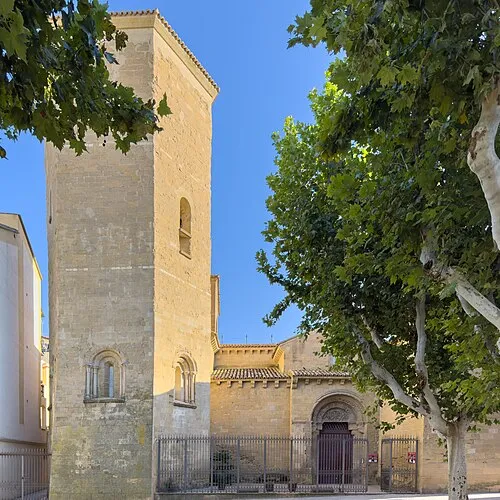 Abbey of San Pedro el Viejo Attraction, Huesca Municipality12 km N
-
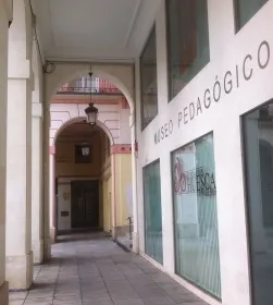 Museo Pedagógico de Aragón Museum, Huesca Municipality12 km N
-
 Teatro Olimpia Attraction, Huesca Municipality12 km N
-
Cerro la Cuasta Mountain, Loporzano22 km N
-
Cerro Fanfanrongan Mountain, Loporzano24 km NE
Sources & licences
Data last updated: