- Elevation
- 642 m
- above sea level
- Local time
- UTC+01:00
- Europe/Madrid · UTC+01:00
- Airports
- ZAZ Zaragoza Airport76 km
- PNA Pamplona Airport99 km
About Pantano de la Nava
Pantano de la Nava is a lake. Location: Loarre, Huesca. Elevation: 642 m. The best months to visit are May–June, September–October. The nearest airport is Zaragoza Airport (76 km). Nearby sights include Loarre Castle and Don Güeso.
Climate of Pantano de la Nava
Best months for sightseeingBest months for sightseeing: May–June, September–October.
This month · November
Outside the best season
Day 13° · Night 5° · Rain 56 mm
- Hottest month
- July (day 31°)
- Coldest month
- January (night 2°)
- Wettest month
- May (65 mm)
- Driest month
- July (26 mm)
Bars: average monthly low and high temperature. Below: precipitation. Monthly averages for 1970–2000 at about 18 km resolution, adjusted for elevation. Highlighted months are mild and relatively dry. Source: WorldClim 2.1 (CC BY 4.0).
Show values as a table
| Month | Jan | Feb | Mar | Apr | May | Jun | Jul | Aug | Sep | Oct | Nov | Dec |
|---|---|---|---|---|---|---|---|---|---|---|---|---|
| Average high (°C) | 9° | 12° | 15° | 17° | 21° | 26° | 31° | 30° | 26° | 19° | 13° | 10° |
| Average low (°C) | 2° | 3° | 4° | 6° | 10° | 13° | 16° | 16° | 13° | 9° | 5° | 2° |
| Precipitation (mm) | 46 | 43 | 39 | 55 | 65 | 52 | 26 | 40 | 49 | 62 | 56 | 52 |
Other places to visit in this season: May June September October
How to get to Pantano de la Nava
The nearest airport is Zaragoza Airport (ZAZ), 76 km to the southwest as the crow flies. The nearest large city is Zaragoza, 73 km to the south.
Airports
- Zaragoza Airport (ZAZ) Zaragoza 76 kmsouthwest
- Pamplona Airport (PNA) Pamplona 99 kmnorthwest
- Tarbes-Lourdes-Pyrénées Airport (LDE) Tarbes/Lourdes/Pyrénées 112 kmnortheast
Nearby large cities
- Zaragoza Population: 687K 73 kmsouth
- Pamplona Population: 208.2K 101 kmnorthwest
- Lleida Population: 140.8K 128 kmsoutheast
- Logroño Population: 151.2K 150 kmwest
- Donostia / San Sebastian Population: 185.4K 158 kmnorthwest
Straight-line distances; road distances are longer. Airport data: OurAirports.
Nearest towns and villages
-
Loarre Village, Loarre3.5 km N
-
Jabarrillo Village, Loarre1.7 km S
-
Ayerbe Village, Ayerbe Municipality4.2 km W
-
Loscorrales Village, Loscorrales3.4 km S
-
Santa Engracia Village, Loarre3.3 km N
-
Sarsamarcuello Village, Loarre3.9 km NW
Nearby attractions & nature
Everything nearby-
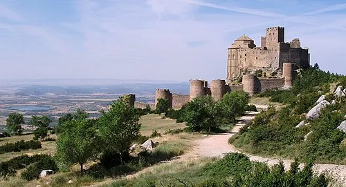 Loarre Castle Historic site, Loarre5.1 km NE
-
Don Güeso Mountain, Loarre6.8 km N
-
Sierra de Loarre Mountain, Loarre7.2 km NE
-
Pusilibro Mountain, Loarre7.3 km NE
-
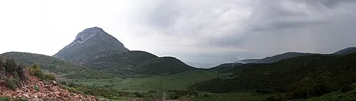 Gratal Mountain, Sotonera, La15 km E
-
Tozal de la Pardina Mountain, Arguis Municipality9.3 km NE
-
Pico de Caballera Mountain, Arguis Municipality9.6 km E
-
Naviella Mountain, Arguis Municipality9.6 km E
Sources & licences
Data last updated: