- Elevation
- 567 m
- above sea level
- Local time
- UTC+01:00
- Europe/Madrid · UTC+01:00
- Airports
- ZAZ Zaragoza Airport83 km
- ILD Lleida-Alguaire Airport84 km
About Bandaliés
Bandaliés is a village. Location: Loporzano, Huesca. Elevation: 567 m. The best months to visit are May–June, September–October. The nearest airport is Zaragoza Airport (83 km). Nearby sights include Castillo de Montearagón and Cerro la Cuasta.
Climate of Bandaliés
Best months for sightseeingBest months for sightseeing: May–June, September–October.
This month · November
Outside the best season
Day 13° · Night 5° · Rain 48 mm
- Hottest month
- July (day 32°)
- Coldest month
- January (night 1°)
- Wettest month
- May (63 mm)
- Driest month
- July (20 mm)
Bars: average monthly low and high temperature. Below: precipitation. Monthly averages for 1970–2000 at about 18 km resolution, adjusted for elevation. Highlighted months are mild and relatively dry. Source: WorldClim 2.1 (CC BY 4.0).
Show values as a table
| Month | Jan | Feb | Mar | Apr | May | Jun | Jul | Aug | Sep | Oct | Nov | Dec |
|---|---|---|---|---|---|---|---|---|---|---|---|---|
| Average high (°C) | 8° | 12° | 15° | 18° | 22° | 28° | 32° | 31° | 26° | 20° | 13° | 9° |
| Average low (°C) | 1° | 3° | 4° | 6° | 10° | 14° | 17° | 17° | 14° | 10° | 5° | 2° |
| Precipitation (mm) | 37 | 33 | 34 | 50 | 63 | 50 | 20 | 40 | 55 | 60 | 48 | 44 |
Other places to visit in this season: May June September October
How to get to Bandaliés
The nearest airport is Zaragoza Airport (ZAZ), 83 km to the southwest as the crow flies. The nearest large city is Zaragoza, 74 km to the southwest.
Airports
- Zaragoza Airport (ZAZ) Zaragoza 83 kmsouthwest
- Lleida-Alguaire Airport (ILD) Lleida 84 kmsoutheast
- Tarbes-Lourdes-Pyrénées Airport (LDE) Tarbes/Lourdes/Pyrénées 115 kmnorth
Nearby large cities
- Zaragoza Population: 687K 74 kmsouthwest
- Lleida Population: 140.8K 98 kmsoutheast
- Pamplona Population: 208.2K 132 kmnorthwest
- Reus Population: 103.5K 162 kmsoutheast
- Tarragona Population: 141.5K 173 kmsoutheast
Straight-line distances; road distances are longer. Airport data: OurAirports.
Day trips from Bandaliés
Within 100 km: 162 historic and cultural sites, 1,082 natural sites, 193 lakes, rivers and coasts.
0–25 km51 places
- Pantano de Arguis Lake 19 kmNW
- Sierra de Guara Mountain 18 kmNE
- Gabardiella Mountain 16 kmN
- Puntón de Guara Mountain 15 kmN
25–60 km206 places
- Embalse de la Sotonera Lake 32 kmW
- Pantano de la Peña Lake 42 kmNW
- Pantano de la Nava Lake 31 kmNW
- Pantano de Mediano Lake 45 kmE
60–100 km1,180 places
- Esglesia de Sant Esteve de Ginast Attraction 91 kmNE
- Fourmat Mountain 95 kmN
- Pantano de Yesa Lake 85 kmNW
- Lago de Urdiceto Lake 73 kmNE
Straight-line distances.
Nearby attractions & nature
Everything nearby-
Castillo de Montearagón Historic site, Quicena4 km W
-
Cerro la Cuasta Mountain, Loporzano6.5 km N
-
Cerro Fanfanrongan Mountain, Loporzano6.9 km N
-
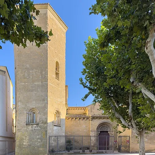 Abbey of San Pedro el Viejo Attraction, Huesca Municipality9.5 km W
-
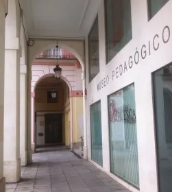 Museo Pedagógico de Aragón Museum, Huesca Municipality9.6 km W
-
 Teatro Olimpia Attraction, Huesca Municipality9.7 km W
Sources & licences
Data last updated: