Los Castillos
Located in Cervera de la Cañada Municipality, Saragossa Coordinates: 41°23′29″ N 1°43′08″ W
- Elevation
- 885 m
- above sea level
- Local time
- UTC+01:00
- Europe/Madrid · UTC+01:00
- Airports
- ZAZ Zaragoza Airport64 km
- RJL Logroño-Agoncillo Airport129 km
About Los Castillos
Los Castillos is a mountain. Location: Cervera de la Cañada Municipality, Saragossa. Elevation: 885 m. The best months to visit are May–June, September–October. The nearest airport is Zaragoza Airport (64 km). Nearby sights include Armantes and Cerro de la Cruz.
Climate of Los Castillos
Best months for sightseeingBest months for sightseeing: May–June, September–October.
This month · November
Outside the best season
Day 12° · Night 2° · Rain 32 mm
Better nearby cities in November
- Alicante · 355 km south20°
- Elche · 359 km south20°
- Orihuela · 374 km south20°
- Hottest month
- July (day 30°)
- Coldest month
- January (night -1°)
- Wettest month
- May (56 mm)
- Driest month
- August (22 mm)
Bars: average monthly low and high temperature. Below: precipitation. Monthly averages for 1970–2000 at about 18 km resolution, adjusted for elevation. Highlighted months are mild and relatively dry. Source: WorldClim 2.1 (CC BY 4.0).
Show values as a table
| Month | Jan | Feb | Mar | Apr | May | Jun | Jul | Aug | Sep | Oct | Nov | Dec |
|---|---|---|---|---|---|---|---|---|---|---|---|---|
| Average high (°C) | 8° | 11° | 14° | 16° | 20° | 25° | 30° | 29° | 25° | 18° | 12° | 9° |
| Average low (°C) | -1° | 0° | 1° | 3° | 7° | 10° | 13° | 13° | 10° | 6° | 2° | 0° |
| Precipitation (mm) | 26 | 25 | 24 | 39 | 56 | 43 | 23 | 22 | 30 | 38 | 32 | 36 |
Other places to visit in this season: May June September October
How to get to Los Castillos
The nearest airport is Zaragoza Airport (ZAZ), 64 km to the northeast as the crow flies. The nearest large city is Zaragoza, 76 km to the northeast.
Airports
- Zaragoza Airport (ZAZ) Zaragoza 64 kmnortheast
- Logroño-Agoncillo Airport (RJL) Logroño 129 kmnorthwest
- Pamplona Airport (PNA) Pamplona 153 kmnorth
Nearby large cities
- Zaragoza Population: 687K 76 kmnortheast
- Logroño Population: 151.2K 134 kmnorthwest
- Pamplona Population: 208.2K 158 kmnorth
- Alcalá de Henares Population: 193.8K 171 kmsouthwest
- Torrejón de Ardoz Population: 118.2K 180 kmsouthwest
Straight-line distances; road distances are longer. Airport data: OurAirports.
Day trips from Los Castillos
Within 100 km: 166 historic and cultural sites, 128 natural sites, 104 lakes, rivers and coasts.
0–25 km44 places
- Embalse de la Tranquera Lake 17 kmS
- Sierra de la Virgen Mountain 17 kmN
- Sierra de Vicort Mountain 19 kmE
- Sierra de Morata Mountain 19 kmE
25–60 km33 places
- Pantano de las Torcas Lake 54 kmE
- Pantano de Monteagudo Lake 39 kmW
- Laguna de Gallocanta Lake 51 kmS
- Solorio Range Mountain 34 kmSW
60–100 km321 places
- Pantano de la Nava Lake 74 kmN
- Pantano de Moneva Lake 78 kmE
- Laguna de Lor Lake 66 kmN
- Balsa de la Higuera Lake 88 kmE
Straight-line distances.
Nearest towns and villages
-
Cervera de la Cañada Village, Cervera de la Cañada Municipality4.8 km N
-
 Torralba de Ribota Village, Torralba de Ribota Municipality4.1 km NE
-
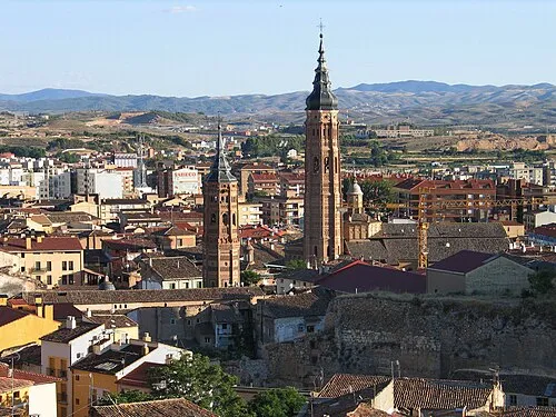 Calatayud Town, Calatayud Municipality7.6 km SE
-
Torralba de Ribota Municipality Municipality, Saragossa4.9 km NE
-
Calatayud Municipality Municipality, Saragossa8 km E
-
Aniñon Village, Aniñón Municipality6 km N
Nearby attractions & nature
Everything nearby-
Armantes Mountain, Cervera de la Cañada Municipality1.2 km W
-
Cerro de la Cruz Mountain, Calatayud Municipality0.9 km E
-
Cruz de Armantes Mountain, Cervera de la Cañada Municipality1.3 km W
-
Maño Maño Mountain, Cervera de la Cañada Municipality3.1 km SW
-
Río Jalón River, Spain7.6 km SE
-
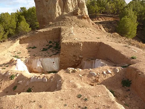 La Mora Encantada Historic site, Ateca Municipality8.3 km SW
-
Riberas del Jalón (Bubierca-Ateca) Natural site, Ateca Municipality12 km SW
-
Río Manubles River, Spain9 km SW
Sources & licences
Data last updated: