- Population
- 828
- 828
- Elevation
- 327 m
- above sea level
- Local time
- UTC+01:00
- Europe/Madrid · UTC+01:00
- Places inside
- 1
- listed under Villafranca de Ebro Municipality
- Airports
- ZAZ Zaragoza Airport38 km
- ILD Lleida-Alguaire Airport97 km
About Villafranca de Ebro Municipality
Villafranca de Ebro Municipality is a municipality. Location: Saragossa, Aragon. Population: 828. Elevation: 327 m. The best months to visit are April–May, September–October. The nearest airport is Zaragoza Airport (38 km). Nearby sights include Río Ginel and Monastery of Comendadoras Canonesas del Santo Sepulcro.
Climate of Villafranca de Ebro Municipality
Best months for sightseeingBest months for sightseeing: April–May, September–October.
This month · November
Outside the best season
Day 15° · Night 5° · Rain 32 mm
Better nearby cities in November
- Alicante · 359 km south20°
- Elche · 368 km south20°
- Orihuela · 389 km south20°
- Hottest month
- July (day 32°)
- Coldest month
- January (night 2°)
- Wettest month
- May (50 mm)
- Driest month
- July (16 mm)
Bars: average monthly low and high temperature. Below: precipitation. Monthly averages for 1970–2000 at about 18 km resolution, adjusted for elevation. Highlighted months are mild and relatively dry. Source: WorldClim 2.1 (CC BY 4.0).
Show values as a table
| Month | Jan | Feb | Mar | Apr | May | Jun | Jul | Aug | Sep | Oct | Nov | Dec |
|---|---|---|---|---|---|---|---|---|---|---|---|---|
| Average high (°C) | 10° | 13° | 17° | 19° | 23° | 28° | 32° | 31° | 27° | 21° | 15° | 11° |
| Average low (°C) | 2° | 3° | 5° | 7° | 11° | 15° | 17° | 17° | 14° | 10° | 5° | 3° |
| Precipitation (mm) | 24 | 21 | 24 | 39 | 50 | 36 | 16 | 25 | 37 | 39 | 32 | 28 |
Other places to visit in this season: April May September October
How to get to Villafranca de Ebro Municipality
The nearest airport is Zaragoza Airport (ZAZ), 38 km to the west as the crow flies. The nearest large city is Zaragoza, 24 km to the west.
Airports
- Zaragoza Airport (ZAZ) Zaragoza 38 kmwest
- Lleida-Alguaire Airport (ILD) Lleida 97 kmeast
- Reus Airport (REU) Reus 156 kmeast
Nearby large cities
- Zaragoza Population: 687K 24 kmwest
- Lleida Population: 140.8K 103 kmeast
- Reus Population: 103.5K 151 kmeast
- Pamplona Population: 208.2K 162 kmnorthwest
- Tarragona Population: 141.5K 163 kmeast
Straight-line distances; road distances are longer. Airport data: OurAirports.
Day trips from Villafranca de Ebro Municipality
Within 100 km: 145 historic and cultural sites, 122 natural sites, 119 lakes, rivers and coasts.
0–25 km44 places
- Sierra de Lanaja Mountain 21 kmNE
- Sierra de Alcubierre Mountain 18 kmN
- Tío Jorge Park Natural site 25 kmNW
- Bruil Park Natural site 23 kmW
25–60 km75 places
- Pantano de las Torcas Lake 51 kmSW
- Laguna Salada Lake 51 kmSE
- Pantano de Moneva Lake 49 kmSW
- Balsa de la Higuera Lake 42 kmS
60–100 km267 places
- Pantà d'Utxesa Lake 94 kmE
- Embalse de la Sotonera Lake 60 kmN
- Pantà de Secà Lake 95 kmE
- Pantano de Santolea Lake 94 kmS
Straight-line distances.
Places in Villafranca de Ebro Municipality
1 placeBar: population relative to the most populous place in this list.
Nearby attractions & nature
Everything nearby-
Río Ginel River, Fuentes de Ebro Municipality7 km S
-
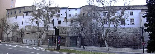 Monastery of Comendadoras Canonesas del Santo Sepulcro Attraction, Zaragoza Municipality24 km W
-
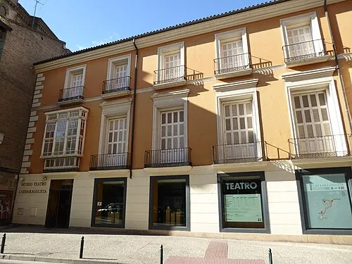 Museo del Teatro de Caesaraugusta Museum, Zaragoza Municipality24 km W
-
 Museo del Fuego y de los Bomberos Museum, Zaragoza Municipality25 km W
-
Castillo de Alfajarín Historic site, Alfajarín Municipality9.4 km NW
-
Cuarte Torrero Mediumwave Transmitter Landmark, Zaragoza Municipality24 km W
-
Ermita de Nuestra Señora del Pueyo Historic site, Villamayor de Gállego19 km NW
-
Pabellón Príncipe Felipe Landmark, Zaragoza Municipality23 km W
Sources & licences
Data last updated: