- Population
- 4,814
- 4.8K
- Elevation
- 271 m
- above sea level
- Local time
- UTC+01:00
- Europe/Madrid · UTC+01:00
- Places inside
- 2
- listed under Villanueva de Gállego Municipality
- Airports
- ZAZ Zaragoza Airport20 km
- ILD Lleida-Alguaire Airport115 km
About Villanueva de Gállego Municipality
Villanueva de Gállego Municipality is a municipality. Location: Saragossa, Aragon. Population: 4,814. Elevation: 271 m. The best months to visit are May, September–October. The nearest airport is Zaragoza Airport (20 km). Nearby sights include Monastery of Comendadoras Canonesas del Santo Sepulcro and Museo del Teatro de Caesaraugusta.
Climate of Villanueva de Gállego Municipality
Best months for sightseeingBest months for sightseeing: May, September–October.
This month · November
Outside the best season
Day 15° · Night 6° · Rain 33 mm
Better nearby cities in November
- Alicante · 383 km south20°
- Elche · 391 km south20°
- Alicante · 382 km south20°
- Hottest month
- July (day 32°)
- Coldest month
- January (night 2°)
- Wettest month
- May (50 mm)
- Driest month
- July (19 mm)
Bars: average monthly low and high temperature. Below: precipitation. Monthly averages for 1970–2000 at about 18 km resolution, adjusted for elevation. Highlighted months are mild and relatively dry. Source: WorldClim 2.1 (CC BY 4.0).
Show values as a table
| Month | Jan | Feb | Mar | Apr | May | Jun | Jul | Aug | Sep | Oct | Nov | Dec |
|---|---|---|---|---|---|---|---|---|---|---|---|---|
| Average high (°C) | 11° | 13° | 17° | 19° | 23° | 28° | 32° | 31° | 27° | 21° | 15° | 11° |
| Average low (°C) | 2° | 3° | 5° | 7° | 11° | 15° | 17° | 17° | 14° | 10° | 6° | 3° |
| Precipitation (mm) | 25 | 23 | 24 | 40 | 50 | 37 | 19 | 24 | 31 | 35 | 33 | 29 |
How to get to Villanueva de Gállego Municipality
The nearest airport is Zaragoza Airport (ZAZ), 20 km to the southwest as the crow flies. The nearest large city is Zaragoza, 14 km to the south.
Airports
- Zaragoza Airport (ZAZ) Zaragoza 20 kmsouthwest
- Lleida-Alguaire Airport (ILD) Lleida 115 kmeast
- Pamplona Airport (PNA) Pamplona 128 kmnorthwest
Nearby large cities
- Zaragoza Population: 687K 14 kmsouth
- Lleida Population: 140.8K 124 kmeast
- Pamplona Population: 208.2K 133 kmnorthwest
- Logroño Population: 151.2K 153 kmnorthwest
- Reus Population: 103.5K 177 kmeast
Straight-line distances; road distances are longer. Airport data: OurAirports.
Day trips from Villanueva de Gállego Municipality
Within 100 km: 172 historic and cultural sites, 165 natural sites, 117 lakes, rivers and coasts.
0–25 km89 places
- Montes de Zuera Mountain 19 kmN
- Altos del Castellar Mountain 14 kmN
- Montes de Castejón Mountain 21 kmNW
- Tío Jorge Park Natural site 13 kmS
25–60 km64 places
- Embalse de la Sotonera Lake 40 kmN
- Pantano de las Torcas Lake 58 kmS
- Pantano de la Nava Lake 59 kmN
- Estanca del Gancho Lake 44 kmNW
60–100 km301 places
- Pantano de Yesa Lake 95 kmN
- Laguna Salada Lake 82 kmSE
- Laguna de Pitallas Lake 93 kmNW
- Pantano de la Peña Lake 68 kmN
Straight-line distances.
Places in Villanueva de Gállego Municipality
2 placesBar: population relative to the most populous place in this list.
Cities & villages1
- El Comercio · Village
Nearby attractions & nature
Everything nearby-
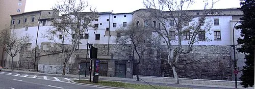 Monastery of Comendadoras Canonesas del Santo Sepulcro Attraction, Zaragoza Municipality14 km S
-
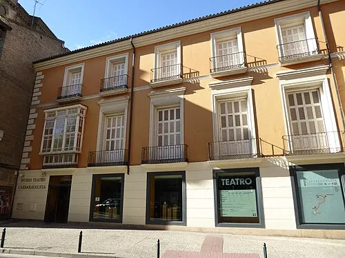 Museo del Teatro de Caesaraugusta Museum, Zaragoza Municipality14 km S
-
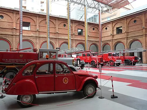 Museo del Fuego y de los Bomberos Museum, Zaragoza Municipality14 km S
-
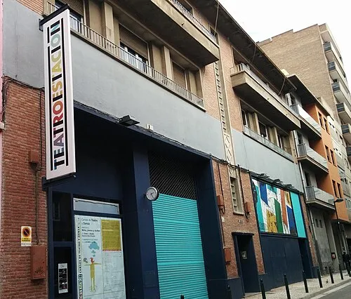 Teatro de la Estación Attraction, Zaragoza Municipality14 km S
-
San Gregorio Mediumwave Transmitter Landmark, Zaragoza Municipality10 km S
-
Castillo de Juslibol Historic site, Zaragoza Municipality10 km SW
-
Castillo De Miranda Historic site, Zaragoza Municipality10 km SW
-
Estadio de Atletismo Corona de Aragón Landmark, Zaragoza Municipality11 km S
Sources & licences
Data last updated: