Playa Calo De Ses Llisses
Located in Calvià, Balearic Islands Coordinates: 39°31′57″ N 2°26′17″ E
- Elevation
- 12 m
- above sea level
- Local time
- UTC+01:00
- Europe/Madrid · UTC+01:00
- Airports
- PMI Palma de Mallorca Airport26 km
- IBZ Ibiza Airport118 km
About Playa Calo De Ses Llisses
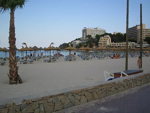
Playa Calo De Ses Llisses is a beach. Location: Calvià, Balearic Islands. The best months to visit are May–June, October. The nearest airport is Palma de Mallorca Airport (26 km). Nearby sights include Cala Don Monjo and Platges de Peguera.
Photos of Playa Calo De Ses Llisses
-
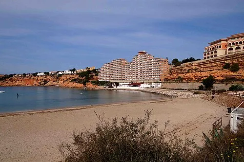
Platja Oarrer Foto Fitti · CC BY-SA 3.0 -
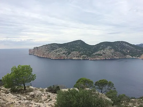
Cap del Llamp Sergei Gussev · CC BY 2.0


Climate of Playa Calo De Ses Llisses
Best months for sightseeingBest months for sightseeing: May–June, October.
This month · November
Outside the best season
Day 19° · Night 10° · Rain 60 mm
Better nearby cities in November
- Alicante · 285 km southwest20°
- Elche · 306 km southwest20°
- Orihuela · 334 km southwest20°
- Hottest month
- August (day 30°)
- Coldest month
- January (night 6°)
- Wettest month
- October (79 mm)
- Driest month
- July (7 mm)
Bars: average monthly low and high temperature. Below: precipitation. Monthly averages for 1970–2000 at about 18 km resolution, adjusted for elevation. Highlighted months are mild and relatively dry. Source: WorldClim 2.1 (CC BY 4.0).
Show values as a table
| Month | Jan | Feb | Mar | Apr | May | Jun | Jul | Aug | Sep | Oct | Nov | Dec |
|---|---|---|---|---|---|---|---|---|---|---|---|---|
| Average high (°C) | 15° | 15° | 17° | 19° | 23° | 27° | 30° | 30° | 27° | 23° | 19° | 16° |
| Average low (°C) | 6° | 6° | 7° | 9° | 13° | 17° | 19° | 20° | 18° | 14° | 10° | 8° |
| Precipitation (mm) | 49 | 39 | 39 | 43 | 33 | 18 | 7 | 21 | 54 | 79 | 60 | 59 |
How to get to Playa Calo De Ses Llisses
The nearest airport is Palma de Mallorca Airport (PMI), 26 km to the east as the crow flies. The nearest large city is Palma, 19 km to the east.
Airports
- Palma de Mallorca Airport (PMI) Palma de Mallorca 26 kmeast
- Ibiza Airport (IBZ) Ibiza (Eivissa) 118 kmsouthwest
- Menorca Airport (MAH) Mahón (Maó) 157 kmeast
Nearby large cities
- Palma Population: 438.2K 19 kmeast
- Tarragona Population: 141.5K 203 kmnorthwest
- L'Hospitalet de Llobregat Population: 257K 205 kmnorth
- Barcelona Population: 1.7M 207 kmnorth
- Sant Martí Population: 235.7K 210 kmnorth
Straight-line distances; road distances are longer. Airport data: OurAirports.
Day trips from Playa Calo De Ses Llisses
Within 100 km: 157 historic and cultural sites, 67 natural sites, 149 lakes, rivers and coasts.
0–25 km107 places
- Camp de Mar Beach 2 kmW
- Platja dde S'Oratori Beach 12 kmE
- Playa del Mago Beach 10 kmSE
- Platja de la Romana Beach 2 kmE
25–60 km122 places
- Majorca Island 50 kmE
- L'Arenal Beach 25 kmE
- Playa de Cala Pi Beach 39 kmSE
- Playa Es Trenc Covetes Beach 50 kmSE
60–100 km144 places
- Playa Llombards Beach 65 kmE
- Cala Romantica Beach 75 kmE
- Cala Murada Beach 73 kmE
- Cala Antena Beach 73 kmE
Straight-line distances.
Nearest towns and villages
-
 Peguera Village, Calvià1 km NE
-
Camp de Mar Village, Andratx1.4 km NW
-
Santa Ponsa Town, Calvià4.2 km SE
-
Andratx Municipality, Balearic Islands5 km N
-
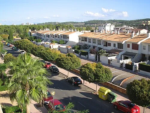 Son Ferrer Town, Calvià6.7 km SE
-
Andratx Town, Andratx5 km N
Nearby attractions & nature
Everything nearby-
Cala Don Monjo Beach, Calvià0.7 km SW
-
Platges de Peguera Beach, Calvià1 km E
-
Playa Palmira Beach, Calvià1.3 km E
-
Playa De Camp De Mar Beach, Andratx1.4 km W
-
Platja de la Romana Beach, Calvià1.7 km E
-
Camp de Mar Beach, Andratx1.8 km W
-
Platges de Santa Ponça Beach, Calvià2 km SE
-
Badia de Santa Ponça Natural site, Calvià2 km SE
More lakes, rivers and coasts in Spain
-
Platja Oarrer Beach, Calvià5.8 km SE
-
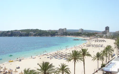 Magaluf Beach Beach, Calvià8.9 km E
-
Playa Santa Ponsa Beach, Calvià4 km SE
-
Es Malgrats Island, Calvià4 km S
-
 Platja de Son Maties Beach, Calvià8.9 km E
-
Isla de los Conejos Island, Calvià3.8 km S
Sources & licences
Data last updated: