- Elevation
- 259 m
- above sea level
- Local time
- UTC+01:00
- Europe/Madrid · UTC+01:00
- Airports
- BIO Bilbao Airport27 km
- VIT Vitoria Airport29 km
About Mariaca
Mariaca is a village. Location: Amurrio Municipality, Araba / Álava. Elevation: 259 m. The best months to visit are June–September. The nearest airport is Bilbao Airport (27 km). Nearby sights include Ungino and Iturrigorri.
Climate of Mariaca
Best months for sightseeingBest months for sightseeing: June–September.
This month · November
A wet month
Day 14° · Night 7° · Rain 113 mm
- Hottest month
- August (day 25°)
- Coldest month
- January (night 4°)
- Wettest month
- November (113 mm)
- Driest month
- July (51 mm)
Bars: average monthly low and high temperature. Below: precipitation. Monthly averages for 1970–2000 at about 18 km resolution, adjusted for elevation. Highlighted months are mild and relatively dry. Source: WorldClim 2.1 (CC BY 4.0).
Show values as a table
| Month | Jan | Feb | Mar | Apr | May | Jun | Jul | Aug | Sep | Oct | Nov | Dec |
|---|---|---|---|---|---|---|---|---|---|---|---|---|
| Average high (°C) | 11° | 12° | 14° | 15° | 19° | 22° | 25° | 25° | 23° | 19° | 14° | 12° |
| Average low (°C) | 4° | 4° | 5° | 6° | 9° | 12° | 14° | 14° | 13° | 10° | 7° | 5° |
| Precipitation (mm) | 102 | 84 | 81 | 112 | 90 | 64 | 51 | 66 | 61 | 96 | 113 | 99 |
Other places to visit in this season: June July August September
How to get to Mariaca
The nearest airport is Bilbao Airport (BIO), 27 km to the north as the crow flies. The nearest large city is Bilbao, 23 km to the north.
Airports
- Bilbao Airport (BIO) Bilbao 27 kmnorth
- Vitoria Airport (VIT) Alava 29 kmsoutheast
- Seve Ballesteros-Santander Airport (SDR) Santander 80 kmnorthwest
Nearby large cities
- Bilbao Population: 347.3K 23 kmnorth
- Barakaldo Population: 100.4K 26 kmnorth
- Vitoria-Gasteiz Population: 257.4K 34 kmsoutheast
- Logroño Population: 151.2K 79 kmsoutheast
- Santander Population: 173.6K 81 kmnorthwest
Straight-line distances; road distances are longer. Airport data: OurAirports.
Day trips from Mariaca
Within 100 km: 325 historic and cultural sites, 264 natural sites, 203 lakes, rivers and coasts.
0–25 km77 places
- Kortetako urtegia / Embalse de Korteta Lake 15 kmN
- Loiola Lake 24 kmN
- Oketa Mountain 22 kmE
- Peña de Igaña Mountain 18 kmW
25–60 km286 places
- Nerbioi / Nervión River 28 kmN
- Arrietara Beach 36 kmN
- Playa de San Julián Beach 50 kmNW
- Laga Beach 46 kmNE
60–100 km429 places
- Playa de la Concha Beach 79 kmNW
- Playa Los Biquinis Beach 79 kmNW
- Playa de la Magdalena Beach 79 kmNW
- Kontxa / La Concha Beach 85 kmE
Straight-line distances.
Nearby attractions & nature
Everything nearby-
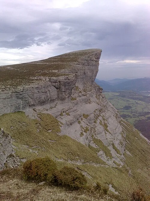 Ungino Mountain, Aiara / Ayala11 km W
-
Iturrigorri Mountain, Urduña / Orduña9.4 km SW
-
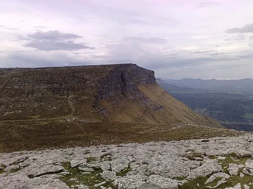 Eskutxi Mountain, Aiara / Ayala12 km W
-
Ponata Mountain, Aiara / Ayala11 km SW
-
Iglesia de San Pedro de Lamuza Attraction, Laudio / Llodio9.1 km N
-
Parroquia San Ignacio Attraction, Laudio / Llodio9.6 km N
Sources & licences
Data last updated: