Laguna de Lacorzana
Located in Armiñón Municipality, Araba / Álava Coordinates: 42°41′04″ N 2°54′01″ W
- Elevation
- 456 m
- above sea level
- Local time
- UTC+01:00
- Europe/Madrid · UTC+01:00
- Airports
- VIT Vitoria Airport26 km
- RJL Logroño-Agoncillo Airport54 km
About Laguna de Lacorzana
Laguna de Lacorzana is a lake. Location: Armiñón Municipality, Araba / Álava. Elevation: 456 m. The best months to visit are June–July, September. The nearest airport is Vitoria Airport (26 km). Nearby sights include Laguna de Bayas and Río Ayuda.
Photos of Laguna de Lacorzana
-
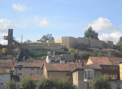
Castle of Miranda de Ebro DEb 109 · CC BY-SA 3.0

Climate of Laguna de Lacorzana
Best months for sightseeingBest months for sightseeing: June–July, September.
This month · November
Outside the best season
Day 13° · Night 5° · Rain 80 mm
- Hottest month
- August (day 27°)
- Coldest month
- January (night 2°)
- Wettest month
- November (80 mm)
- Driest month
- July (37 mm)
Bars: average monthly low and high temperature. Below: precipitation. Monthly averages for 1970–2000 at about 18 km resolution, adjusted for elevation. Highlighted months are mild and relatively dry. Source: WorldClim 2.1 (CC BY 4.0).
Show values as a table
| Month | Jan | Feb | Mar | Apr | May | Jun | Jul | Aug | Sep | Oct | Nov | Dec |
|---|---|---|---|---|---|---|---|---|---|---|---|---|
| Average high (°C) | 9° | 11° | 14° | 15° | 19° | 23° | 27° | 27° | 24° | 19° | 13° | 10° |
| Average low (°C) | 2° | 2° | 4° | 5° | 8° | 11° | 13° | 14° | 11° | 8° | 5° | 3° |
| Precipitation (mm) | 71 | 60 | 55 | 79 | 72 | 52 | 37 | 41 | 42 | 66 | 80 | 72 |
How to get to Laguna de Lacorzana
The nearest airport is Vitoria Airport (VIT), 26 km to the northeast as the crow flies. For international flights: Bilbao Airport (BIO) (69 km). The nearest large city is Vitoria-Gasteiz, 26 km to the northeast.
Airports
- Vitoria Airport (VIT) Alava 26 kmnortheast
- Logroño-Agoncillo Airport (RJL) Logroño 54 kmsoutheast
- Bilbao Airport (BIO) Bilbao 69 kmnorth
Nearby large cities
- Vitoria-Gasteiz Population: 257.4K 26 kmnortheast
- Logroño Population: 151.2K 44 kmsoutheast
- Bilbao Population: 347.3K 64 kmnorth
- Barakaldo Population: 100.4K 68 kmnorth
- Burgos Population: 176.4K 76 kmsouthwest
Straight-line distances; road distances are longer. Airport data: OurAirports.
Day trips from Laguna de Lacorzana
Within 100 km: 281 historic and cultural sites, 208 natural sites, 236 lakes, rivers and coasts.
0–25 km49 places
- El Lago Lake 22 kmS
- Laguna de Bayas Lake 1 kmW
- Pico de Toloño Mountain 13 kmSE
- Montes Obarenes Mountain 10 kmSW
25–60 km198 places
- Pantano de Valbornedo Lake 40 kmSE
- Pantano de la Grajera Lake 42 kmSE
- Pantano de González de Lacasa Lake 59 kmS
- Kortetako urtegia / Embalse de Korteta Lake 57 kmN
60–100 km478 places
- Nerbioi / Nervión River 71 kmN
- Arrietara Beach 79 kmN
- Playa de San Julián Beach 89 kmNW
- Laga Beach 83 kmN
Straight-line distances.
Nearest towns and villages
-
 Miranda de Ebro Municipality, Province of Burgos5.9 km W
-
Lacorzana Village, Armiñón Municipality0.6 km NE
-
Miranda de Ebro Town, Miranda de Ebro3.8 km W
-
Zambrana Village, Zambrana3.1 km SE
-
Berantevilla Village, Berantevilla Municipality3.5 km E
-
Erribera Beitia / Ribera Baja Municipality, Araba / Álava4.3 km N
Nearby attractions & nature
Everything nearby-
Laguna de Bayas Lake, Miranda de Ebro0.8 km W
-
Río Ayuda River, Spain1.1 km E
-
Baia River, Miranda de Ebro1.3 km W
-
Zadorra River, Zambrana1.9 km S
-
Río Oroncillo River, Miranda de Ebro5.6 km W
-
Castle of Miranda de Ebro Historic site, Miranda de Ebro4.4 km W
-
Estadio de Anduva Landmark, Miranda de Ebro2.9 km W
-
Jugalez (Inglares) River, Zambrana6.9 km SE
Sources & licences
Data last updated: