Carasta
Located in Erriberagoitia / Ribera Alta, Araba / Álava Coordinates: 42°46′40″ N 2°55′21″ W
- Elevation
- 727 m
- above sea level
- Local time
- UTC+01:00
- Europe/Madrid · UTC+01:00
- Airports
- VIT Vitoria Airport20 km
- BIO Bilbao Airport58 km
About Carasta
Carasta is a village. Location: Erriberagoitia / Ribera Alta, Araba / Álava. Elevation: 727 m. The best months to visit are June–September. The nearest airport is Vitoria Airport (20 km). Nearby sights include Castle of Miranda de Ebro and Santamancos.
Climate of Carasta
Best months for sightseeingBest months for sightseeing: June–September.
This month · November
A cold month
Day 11° · Night 3° · Rain 80 mm
- Hottest month
- August (day 25°)
- Coldest month
- January (night 0°)
- Wettest month
- November (80 mm)
- Driest month
- July (37 mm)
Bars: average monthly low and high temperature. Below: precipitation. Monthly averages for 1970–2000 at about 18 km resolution, adjusted for elevation. Highlighted months are mild and relatively dry. Source: WorldClim 2.1 (CC BY 4.0).
Show values as a table
| Month | Jan | Feb | Mar | Apr | May | Jun | Jul | Aug | Sep | Oct | Nov | Dec |
|---|---|---|---|---|---|---|---|---|---|---|---|---|
| Average high (°C) | 8° | 10° | 12° | 13° | 17° | 21° | 25° | 25° | 22° | 17° | 11° | 8° |
| Average low (°C) | 0° | 1° | 2° | 3° | 6° | 9° | 12° | 12° | 9° | 6° | 3° | 1° |
| Precipitation (mm) | 71 | 60 | 55 | 79 | 72 | 52 | 37 | 41 | 42 | 66 | 80 | 72 |
Other places to visit in this season: June July August September
How to get to Carasta
The nearest airport is Vitoria Airport (VIT), 20 km to the northeast as the crow flies. For international flights: Bilbao Airport (BIO) (58 km). The nearest large city is Vitoria-Gasteiz, 22 km to the east.
Airports
- Vitoria Airport (VIT) Alava 20 kmnortheast
- Bilbao Airport (BIO) Bilbao 58 kmnorth
- Logroño-Agoncillo Airport (RJL) Logroño 61 kmsoutheast
Nearby large cities
- Vitoria-Gasteiz Population: 257.4K 22 kmeast
- Logroño Population: 151.2K 52 kmsoutheast
- Bilbao Population: 347.3K 54 kmnorth
- Barakaldo Population: 100.4K 58 kmnorth
- Burgos Population: 176.4K 80 kmsouthwest
Straight-line distances; road distances are longer. Airport data: OurAirports.
Nearby attractions & nature
Everything nearby-
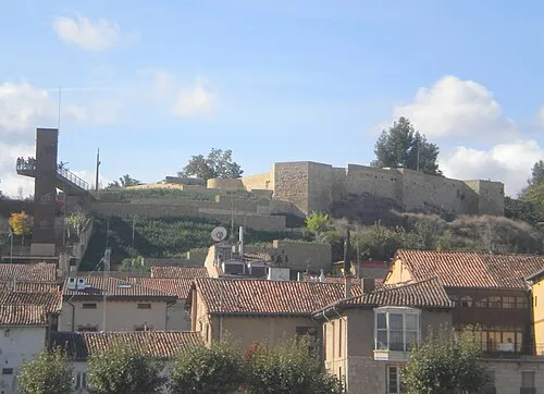 Castle of Miranda de Ebro Historic site, Miranda de Ebro11 km S
-
Santamancos Mountain, Lantarón8.3 km W
-
 Mendizorrotza Stadium Landmark, Gasteiz / Vitoria20 km E
-
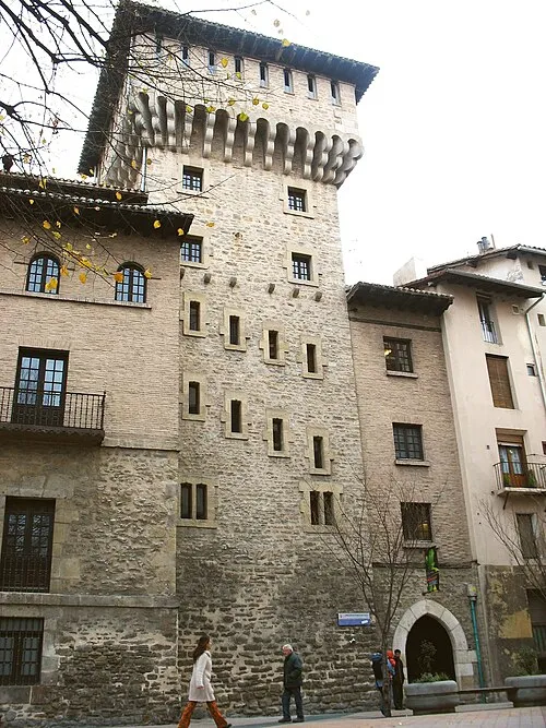 Torre de doña Ochanda Landmark, Gasteiz / Vitoria22 km E
-
Antonio Machado Attraction, Miranda de Ebro10 km S
-
Iglesia del Espíritu Santo Attraction, Miranda de Ebro11 km S
Sources & licences
Data last updated: