Otides
Located in Karrantza Harana / Valle de Carranza, Biscay Coordinates: 43°13′35″ N 3°22′52″ W
- Elevation
- 356 m
- above sea level
- Local time
- UTC+01:00
- Europe/Madrid · UTC+01:00
- Airports
- BIO Bilbao Airport39 km
- SDR Seve Ballesteros-Santander Airport42 km
About Otides
Otides is a village. Location: Karrantza Harana / Valle de Carranza, Biscay. Elevation: 356 m. The best months to visit are June–September. The nearest airport is Bilbao Airport (39 km). Nearby sights include Montes de Ordunte and Betaio.
Climate of Otides
Best months for sightseeingBest months for sightseeing: June–September.
This month · November
A wet month
Day 14° · Night 6° · Rain 123 mm
- Hottest month
- August (day 24°)
- Coldest month
- January (night 4°)
- Wettest month
- November (123 mm)
- Driest month
- July (54 mm)
Bars: average monthly low and high temperature. Below: precipitation. Monthly averages for 1970–2000 at about 18 km resolution, adjusted for elevation. Highlighted months are mild and relatively dry. Source: WorldClim 2.1 (CC BY 4.0).
Show values as a table
| Month | Jan | Feb | Mar | Apr | May | Jun | Jul | Aug | Sep | Oct | Nov | Dec |
|---|---|---|---|---|---|---|---|---|---|---|---|---|
| Average high (°C) | 11° | 12° | 14° | 15° | 18° | 21° | 24° | 24° | 23° | 19° | 14° | 12° |
| Average low (°C) | 4° | 4° | 5° | 6° | 9° | 11° | 13° | 14° | 12° | 9° | 6° | 5° |
| Precipitation (mm) | 108 | 88 | 86 | 118 | 94 | 65 | 54 | 70 | 71 | 108 | 123 | 108 |
Other places to visit in this season: June July August September
How to get to Otides
The nearest airport is Bilbao Airport (BIO), 39 km to the east as the crow flies. The nearest large city is Barakaldo, 33 km to the east.
Airports
- Bilbao Airport (BIO) Bilbao 39 kmeast
- Seve Ballesteros-Santander Airport (SDR) Santander 42 kmnorthwest
- Vitoria Airport (VIT) Alava 66 kmsoutheast
Nearby large cities
- Barakaldo Population: 100.4K 33 kmeast
- Bilbao Population: 347.3K 37 kmeast
- Santander Population: 173.6K 43 kmnorthwest
- Vitoria-Gasteiz Population: 257.4K 71 kmsoutheast
- Burgos Population: 176.4K 102 kmsouth
Straight-line distances; road distances are longer. Airport data: OurAirports.
Day trips from Otides
Within 100 km: 257 historic and cultural sites, 195 natural sites, 182 lakes, rivers and coasts.
0–25 km48 places
- Playa de San Julián Beach 21 kmN
- Pantano de Ordunte Lake 11 kmSE
- Alto de Zalama Mountain 10 kmS
- Peña Rocías Mountain 16 kmW
25–60 km325 places
- Nerbioi / Nervión River 33 kmE
- Arrietara Beach 36 kmNE
- Gorrondatxa Beach 34 kmNE
- Playa de la Concha Beach 42 kmNW
60–100 km261 places
- Playa de la Rabia Beach 79 kmW
- Playa de Pechón Beach 93 kmW
- Laga Beach 62 kmE
- Playa de Comillas Beach 76 kmW
Straight-line distances.
Nearby attractions & nature
Everything nearby-
Montes de Ordunte Mountain, Spain7.8 km SE
-
Betaio Mountain, Turtzioz / Trucios15 km NE
-
Alto de Zalama Mountain, Valle de Mena10 km S
-
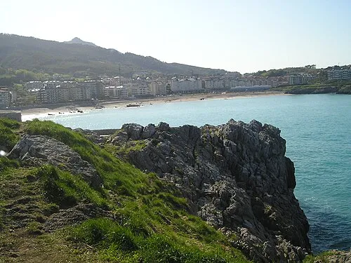 Playa de Ostende Beach, Castro-Urdiales22 km NE
-
Pantano de Ordunte Lake, Valle de Mena11 km SE
-
Alen Mountain, Sopuerta15 km E
Sources & licences
Data last updated: