Estadio Municipal De Maspalomas
Located in San Bartolomé de Tirajana, Las Palmas Coordinates: 27°45′57″ N 15°35′02″ W
- Local time
- UTC+00:00
- Atlantic/Canary · UTC+00:00
- Elevation
- 67 m
- above sea level
- Airports
- LPA Gran Canaria Airport27 km
- TFS Tenerife Sur Airport102 km
About Estadio Municipal De Maspalomas
Estadio Municipal De Maspalomas is a landmark. Location: San Bartolomé de Tirajana, Las Palmas. The best months to visit are November–June. The nearest airport is Gran Canaria Airport (27 km). Nearby sights include Parroquia De San Fernando De Maspalomas and San Fernando Park.
Climate of Estadio Municipal De Maspalomas
Best months for sightseeingBest months for sightseeing: November–June.
This month · November
A good month to visit
Day 24° · Night 17° · Rain 25 mm
- Hottest month
- August (day 30°)
- Coldest month
- January (night 14°)
- Wettest month
- December (34 mm)
- Driest month
- July (0 mm)
Bars: average monthly low and high temperature. Below: precipitation. Monthly averages for 1970–2000 at about 18 km resolution, adjusted for elevation. Highlighted months are mild and relatively dry. Source: WorldClim 2.1 (CC BY 4.0).
Show values as a table
| Month | Jan | Feb | Mar | Apr | May | Jun | Jul | Aug | Sep | Oct | Nov | Dec |
|---|---|---|---|---|---|---|---|---|---|---|---|---|
| Average high (°C) | 21° | 22° | 23° | 24° | 25° | 27° | 29° | 30° | 29° | 27° | 24° | 22° |
| Average low (°C) | 14° | 14° | 15° | 15° | 17° | 18° | 20° | 21° | 20° | 19° | 17° | 15° |
| Precipitation (mm) | 28 | 31 | 21 | 13 | 4 | 1 | 0 | 1 | 8 | 15 | 25 | 34 |
Other places to visit in this season: January February March April May June November December
How to get to Estadio Municipal De Maspalomas
The nearest airport is Gran Canaria Airport (LPA), 27 km to the northeast as the crow flies. The nearest large city is Telde, 30 km to the northeast.
Airports
- Gran Canaria Airport (LPA) Gran Canaria Island 27 kmnortheast
- Tenerife Sur Airport (TFS) Tenerife 102 kmwest
- Tenerife Norte-Ciudad de La Laguna Airport (TFN) Tenerife 109 kmnorthwest
Nearby large cities
- Telde Population: 123.3K 30 kmnortheast
- Las Palmas de Gran Canaria Population: 383.5K 41 kmnortheast
- Santa Cruz de Tenerife Population: 211.4K 102 kmnorthwest
- San Cristóbal de La Laguna Population: 150.7K 108 kmnorthwest
Straight-line distances; road distances are longer. Airport data: OurAirports.
Day trips from Estadio Municipal De Maspalomas
Within 100 km: 84 historic and cultural sites, 87 natural sites, 69 lakes, rivers and coasts.
0–25 km116 places
- Gran Canaria Island 23 kmN
- Playa de las Mujeres Beach 4 kmSW
- Playa de San Agustín Beach 4 kmE
- Playa del Inglés Beach 2 kmSE
25–60 km106 places
- Canary Islands Island 27 kmN
- Playa del Hombre Beach 33 kmNE
- Playa Hoya Del Pozo Beach 33 kmNE
- Playa de Melenara Beach 32 kmNE
60–100 km18 places
- Playa Leocadio Machado Beach 99 kmW
- Playa del Médano Beach 99 kmW
- Mount Roxa Mountain 99 kmW
- Playa del Confital Beach 99 kmW
Straight-line distances.
Nearby attractions & nature
Everything nearby-
Parroquia De San Fernando De Maspalomas Attraction, San Bartolomé de Tirajana0.3 km E
-
San Fernando Park Natural site, San Bartolomé de Tirajana0.4 km E
-
Parque V Centenario Natural site, San Bartolomé de Tirajana0.7 km W
-
Parque Botánico De Maspalomas Natural site, San Bartolomé de Tirajana0.8 km S
-
Templo Ecumenico el Salvador Attraction, San Bartolomé de Tirajana1.7 km SE
-
Parque Urbano Del Sur Natural site, San Bartolomé de Tirajana1.3 km W
-
Palacio de Congresos de Maspalomas Landmark, San Bartolomé de Tirajana3.1 km SW
-
Parque Tony Gallardo Natural site, San Bartolomé de Tirajana2.6 km SW
Nearest towns and villages
-
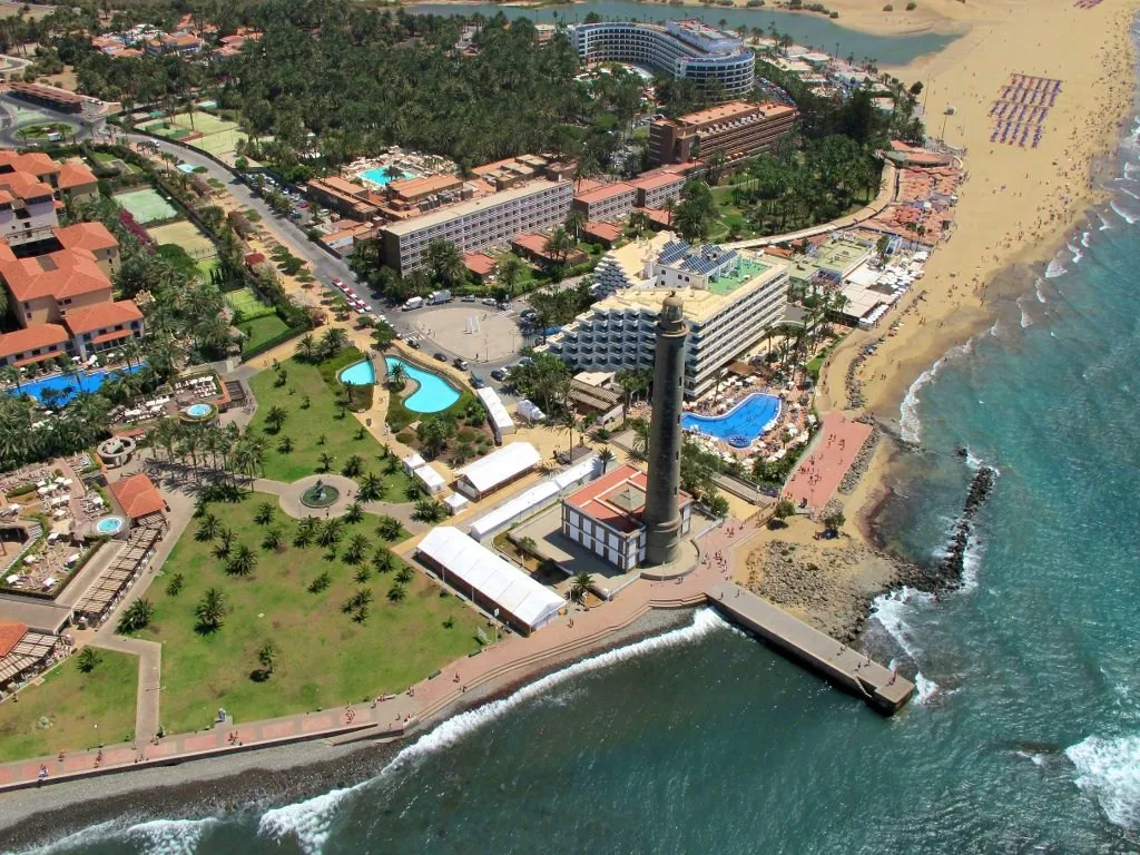 Maspalomas Town, San Bartolomé de Tirajana0.6 km S
-
Playa del Ingles Town, San Bartolomé de Tirajana1.1 km SE
-
Campo International Village, San Bartolomé de Tirajana1.7 km SW
-
Sonnenland Village, San Bartolomé de Tirajana1.8 km W
Sources & licences
Data last updated: