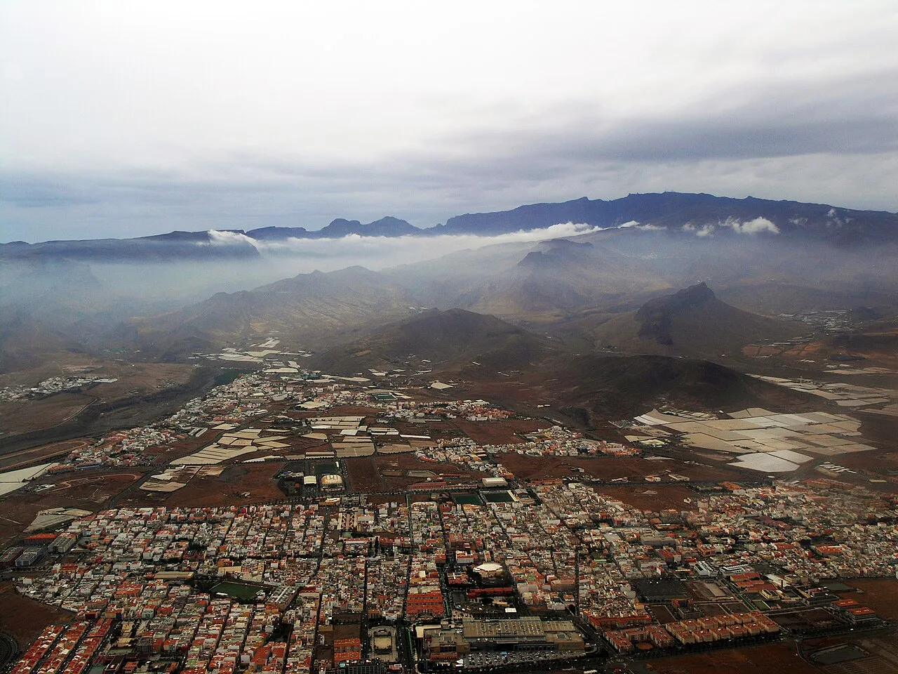
- Population
- 14,910
- 14.9K
- Elevation
- 97 m
- above sea level
- Local time
- UTC+00:00
- Atlantic/Canary · UTC+00:00
- Airports
- LPA Gran Canaria Airport11 km
- TFN Tenerife Norte-Ciudad de La Laguna Airport113 km
About Vecindario
Vecindario is a town. Location: Santa Lucía de Tirajana, Las Palmas. Population: 14,910. Elevation: 97 m.
Vecindario is a town in the municipality of Santa Lucía de Tirajana in the south-eastern part of the island of Gran Canaria, in the Province of Las Palmas, in the Canary Islands. The population of Vecindario was estimated at 80 235 inhabitants in the 2023 census. Its current president is D. Francisco José García López. Vecindario is located in the coastal area of the municipality of Santa Lucia de Tirajana being the 3rd in population of the island and the 5th of the archipelago.
Source: Wikipedia · CC BY-SA 4.0
At a glance
- Area
- 61.6 km²
Source: Wikidata
Photos of Vecindario
-

Olo72 · CC BY-SA 4.0 -

Olo72 · CC BY-SA 4.0 -

Fanny S Forsdik · CC BY-SA 3.0 -

Fanny S Forsdik · CC BY-SA 3.0 -
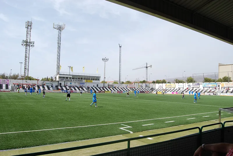
Estadio Municipal de Vecindario ErMolete · CC BY-SA 3.0


Climate of Vecindario
Best months for sightseeingBest months for sightseeing: November–June.
This month · November
A good month to visit
Day 24° · Night 17° · Rain 29 mm
- Hottest month
- August (day 30°)
- Coldest month
- January (night 14°)
- Wettest month
- December (38 mm)
- Driest month
- July (1 mm)
Bars: average monthly low and high temperature. Below: precipitation. Monthly averages for 1970–2000 at about 18 km resolution, adjusted for elevation. Highlighted months are mild and relatively dry. Source: WorldClim 2.1 (CC BY 4.0).
Show values as a table
| Month | Jan | Feb | Mar | Apr | May | Jun | Jul | Aug | Sep | Oct | Nov | Dec |
|---|---|---|---|---|---|---|---|---|---|---|---|---|
| Average high (°C) | 20° | 21° | 22° | 23° | 25° | 27° | 29° | 30° | 29° | 27° | 24° | 22° |
| Average low (°C) | 14° | 14° | 14° | 15° | 16° | 18° | 20° | 20° | 20° | 19° | 17° | 15° |
| Precipitation (mm) | 31 | 33 | 23 | 15 | 5 | 2 | 1 | 1 | 10 | 19 | 29 | 38 |
Other places to visit in this season: January February March April May June November December
How to get to Vecindario
The nearest airport is Gran Canaria Airport (LPA), 11 km to the northeast as the crow flies. The nearest large city is Telde, 16 km to the north.
Airports
- Gran Canaria Airport (LPA) Gran Canaria Island 11 kmnortheast
- Tenerife Norte-Ciudad de La Laguna Airport (TFN) Tenerife 113 kmnorthwest
- Tenerife Sur Airport (TFS) Tenerife 113 kmwest
Nearby large cities
- Telde Population: 123.3K 16 kmnorth
- Las Palmas de Gran Canaria Population: 383.5K 28 kmnorth
- Santa Cruz de Tenerife Population: 211.4K 105 kmnorthwest
- San Cristóbal de La Laguna Population: 150.7K 111 kmnorthwest
Straight-line distances; road distances are longer. Airport data: OurAirports.
Day trips from Vecindario
Within 100 km: 86 historic and cultural sites, 83 natural sites, 59 lakes, rivers and coasts.
0–25 km125 places
- Canary Islands Island 18 kmN
- Gran Canaria Island 20 kmNW
- Playa del Malpaso Beach 20 kmN
- Playa de Vargas Beach 7 kmNE
25–60 km98 places
- Playa del Risco Beach 37 kmNW
- Playa de los Nidillos Beach 34 kmN
- Playa de Guanarteme Beach 31 kmN
- Playa del Cebadal Beach 35 kmN
60–100 km5 places
- Punta de Jandía Natural site 95 kmE
- Península de Jandía Natural site 96 kmE
- Bahía de la Cruz Natural site 96 kmE
- Faro de Punta de Jandía Landmark 95 kmE
Straight-line distances.
Nearby attractions & nature
Everything nearby-
Estadio Municipal de Vecindario Landmark, Santa Lucía de Tirajana0.4 km NW
-
Parque de la Libertad Natural site, Santa Lucía de Tirajana0.3 km N
-
Teatro Víctor Jara Attraction, Santa Lucía de Tirajana0.2 km S
-
Parroquia de San Rafael Attraction, Santa Lucía de Tirajana0.2 km NE
-
Museo de la Zafra Museum, Santa Lucía de Tirajana0.6 km NE
-
Parque Cruce De Sardina Natural site, Santa Lucía de Tirajana1.1 km NE
-
El Local Natural site, Santa Lucía de Tirajana1.5 km SW
-
Parque de La Paz Natural site, Santa Lucía de Tirajana1.7 km N
Sources & licences
Data last updated: · 2 independent sources