Salinas de Pisuerga
Located in Palencia, Castille and León Coordinates: 42°51′28″ N 4°22′01″ W
- Population
- 375
- 375
- Elevation
- 958 m
- above sea level
- Local time
- UTC+01:00
- Europe/Madrid · UTC+01:00
- Places inside
- 3
- listed under Salinas de Pisuerga
- Airports
- SDR Seve Ballesteros-Santander Airport77 km
- LEN León Airport109 km
About Salinas de Pisuerga
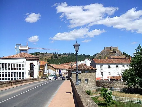
Salinas de Pisuerga is a municipality. Location: Palencia, Castille and León. Population: 375. Elevation: 958 m.
Salinas de Pisuerga is a municipality located in the province of Palencia, Castile and León, Spain. According to the 2004 census (INE), the municipality has a population of 337 inhabitants.
Source: Wikipedia · CC BY-SA 4.0
At a glance
- Area
- 21.2 km²
Source: Wikidata
Places bordering Salinas de Pisuerga
- Aguilar de Campoo
- Cervera de Pisuerga
Population of Salinas de Pisuerga over time
| 2014 | 356 | |
|---|---|---|
| 2015 | 358 | |
| 2016 | 335 | |
| 2017 | 334 | |
| 2018 | 317 | |
| 2019 | 319 | |
| 2020 | 318 | |
| 2021 | 311 | |
| 2022 | 313 | |
| 2023 | 312 | |
| 2024 | 329 | |
| 2025 | 348 |
Censuses and official estimates; source: Wikidata.
Climate of Salinas de Pisuerga
Best months for sightseeingBest months for sightseeing: June–September.
This month · November
A cold month
Day 11° · Night 3° · Rain 88 mm
- Hottest month
- July (day 25°)
- Coldest month
- January (night 0°)
- Wettest month
- December (98 mm)
- Driest month
- August (37 mm)
Bars: average monthly low and high temperature. Below: precipitation. Monthly averages for 1970–2000 at about 18 km resolution, adjusted for elevation. Highlighted months are mild and relatively dry. Source: WorldClim 2.1 (CC BY 4.0).
Show values as a table
| Month | Jan | Feb | Mar | Apr | May | Jun | Jul | Aug | Sep | Oct | Nov | Dec |
|---|---|---|---|---|---|---|---|---|---|---|---|---|
| Average high (°C) | 7° | 8° | 12° | 13° | 17° | 22° | 25° | 25° | 22° | 16° | 11° | 8° |
| Average low (°C) | 0° | 1° | 2° | 3° | 6° | 10° | 12° | 12° | 10° | 7° | 3° | 1° |
| Precipitation (mm) | 89 | 71 | 54 | 77 | 88 | 53 | 42 | 37 | 52 | 79 | 88 | 98 |
Other places to visit in this season: June July August September
How to get to Salinas de Pisuerga
The nearest airport is Seve Ballesteros-Santander Airport (SDR), 77 km to the northeast as the crow flies. For international flights: Bilbao Airport (BIO) (128 km). The nearest large city is Burgos, 79 km to the southeast.
Airports
- Seve Ballesteros-Santander Airport (SDR) Santander 77 kmnortheast
- León Airport (LEN) La Virgen del Camino 109 kmwest
- Bilbao Airport (BIO) Bilbao 128 kmnortheast
Nearby large cities
- Burgos Population: 176.4K 79 kmsoutheast
- Santander Population: 173.6K 82 kmnortheast
- León Population: 124.8K 103 kmwest
- Barakaldo Population: 100.4K 122 kmnortheast
- Bilbao Population: 347.3K 126 kmeast
Straight-line distances; road distances are longer. Airport data: OurAirports.
Day trips from Salinas de Pisuerga
Within 100 km: 129 historic and cultural sites, 182 natural sites, 271 lakes, rivers and coasts.
0–25 km23 places
- Pantano de Ruesga Lake 14 kmW
- Pantano Requejada Lake 13 kmNW
- Peña Labra Mountain 21 kmN
- Alto del Cotío Mountain 24 kmNE
25–60 km142 places
- Playa de la Rabia Beach 60 kmN
- Playa de Comillas Beach 59 kmN
- Playa de Merón Beach 59 kmN
- Playa De Fuentes Beach 60 kmN
60–100 km417 places
- Playa de San Antonio del Mar Beach 81 kmNW
- Playa de San Antolín Beach 77 kmNW
- Playa de Pechón Beach 61 kmN
- Playa de la Concha Beach 83 kmNE
Straight-line distances.
Places in Salinas de Pisuerga
3 placesBar: population relative to the most populous place in this list.
Cities & villages1
- Renedo de Zalima · Village
Nearby attractions & nature
Everything nearby-
Arroyo Reolista River, Aguilar de Campoo5 km S
-
Arroyo de Sosa River, Aguilar de Campoo8.4 km SE
-
Arroyo de Castillería River, Cervera de Pisuerga11 km NW
-
Río Perazancas River, Olmos de Ojeda13 km S
-
Río Camesa River, Pomar de Valdivia14 km SE
-
Río Lucio River, Pomar de Valdivia14 km SE
-
Cochillón o Peña del Pando Mountain, Pernía, La19 km N
-
Río Rubagón River, Pomar de Valdivia14 km E
Other cities and towns in Palencia
-
Aguilar de Campoo Municipality, Palencia11 km SE
-
Cervera de Pisuerga Municipality, Palencia13 km NW
-
Pomar de Valdivia Municipality, Palencia17 km SE
-
Olmos de Ojeda Municipality, Palencia16 km SW
-
Dehesa de Montejo Municipality, Palencia12 km W
-
 Aguilar de Campoo Town, Aguilar de Campoo11 km SE
Sources & licences
Data last updated: · 2 independent sources