Estépar
Located in Province of Burgos, Castille and León Coordinates: 42°16′38″ N 3°53′52″ W
- Population
- 705
- 705
- Elevation
- 813 m
- above sea level
- Local time
- UTC+01:00
- Europe/Madrid · UTC+01:00
- Places inside
- 14
- listed under Estépar
- Airports
- VLL Valladolid Airport101 km
- VIT Vitoria Airport117 km
About Estépar
Estépar is a municipality. Location: Province of Burgos, Castille and León. Population: 705. Elevation: 813 m. The best months to visit are May–June, September. The nearest airport is Valladolid Airport (101 km). Nearby sights include Río Hormazuela and Arroyo Penillas.
Climate of Estépar
Best months for sightseeingBest months for sightseeing: May–June, September.
This month · November
Outside the best season
Day 12° · Night 3° · Rain 48 mm
- Hottest month
- July (day 29°)
- Coldest month
- January (night 0°)
- Wettest month
- May (53 mm)
- Driest month
- August (19 mm)
Bars: average monthly low and high temperature. Below: precipitation. Monthly averages for 1970–2000 at about 18 km resolution, adjusted for elevation. Highlighted months are mild and relatively dry. Source: WorldClim 2.1 (CC BY 4.0).
Show values as a table
| Month | Jan | Feb | Mar | Apr | May | Jun | Jul | Aug | Sep | Oct | Nov | Dec |
|---|---|---|---|---|---|---|---|---|---|---|---|---|
| Average high (°C) | 8° | 10° | 14° | 15° | 19° | 24° | 29° | 29° | 25° | 18° | 12° | 8° |
| Average low (°C) | 0° | 1° | 2° | 4° | 7° | 10° | 13° | 13° | 10° | 7° | 3° | 1° |
| Precipitation (mm) | 45 | 37 | 28 | 46 | 53 | 40 | 22 | 19 | 30 | 45 | 48 | 50 |
How to get to Estépar
The nearest airport is Valladolid Airport (VLL), 101 km to the southwest as the crow flies. The nearest large city is Burgos, 18 km to the northeast.
Airports
- Valladolid Airport (VLL) Valladolid 101 kmsouthwest
- Vitoria Airport (VIT) Alava 117 kmnortheast
- Seve Ballesteros-Santander Airport (SDR) Santander 128 kmnorth
Nearby large cities
- Burgos Population: 176.4K 18 kmnortheast
- Valladolid Population: 300.6K 97 kmsouthwest
- Vitoria-Gasteiz Population: 257.4K 119 kmnortheast
- Logroño Population: 151.2K 121 kmeast
- Santander Population: 173.6K 132 kmnorth
Straight-line distances; road distances are longer. Airport data: OurAirports.
Day trips from Estépar
Within 100 km: 142 historic and cultural sites, 84 natural sites, 326 lakes, rivers and coasts.
0–25 km65 places
- Playa fluvial Fuente del Prior Beach 21 kmE
- Lagunas de Carcedo Lake 23 kmE
- Parque Lineal del Vena Natural site 21 kmNE
- Félix Rodríguez de la Fuente Park Natural site 20 kmNE
25–60 km124 places
- Pantano del Arlanzón Lake 46 kmE
- Medela Mountain 51 kmN
- Pico de San Millán Mountain 57 kmE
- Manantial de Torreros Natural site 51 kmNE
60–100 km363 places
- Playa de Arija Beach 80 kmN
- Pantano de Ruesga Lake 84 kmNW
- Pantano Requejada Lake 87 kmNW
- Pozo Obscuro Lake 99 kmNW
Straight-line distances.
Places in Estépar
14 placesBar: population relative to the most populous place in this list.
Cities & villages8
- Arenillas de Muñó · Village
- Arroyo de Muñó · Village
- Hormaza · Village
- Medinilla de la Dehesa · Village
- Pedrosa de Muñó · Village
- Quintanilla-Somuñó · Village
- Villagutiérrez · Village
- Vilviestre de Muñó · Village
Lakes, rivers & coasts3
- Arroyo de Mazuelo · River
- Río de los Ausines · River
- Río Urbel · River
Nearby attractions & nature
Everything nearby-
Río Hormazuela River, Pampliega3.6 km SW
-
Arroyo Penillas River, Pampliega7.2 km SW
-
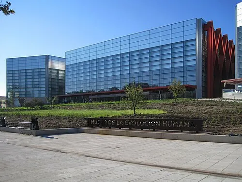 Museum of Human Evolution Museum, Burgos18 km NE
-
Arroyo de Rucabia River, Pampliega7.6 km SW
-
Arroyo de Páramo River, Rabé de las Calzadas8.2 km NE
-
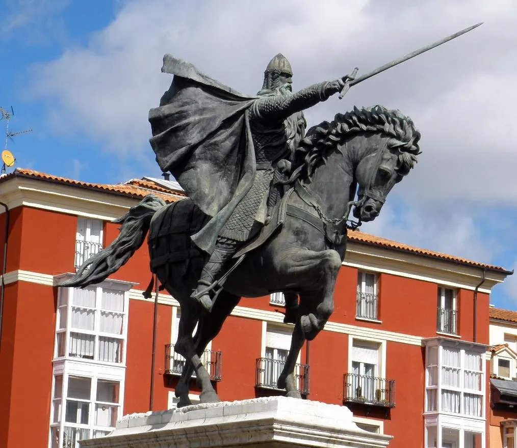 Estatua del Cid Landmark, Burgos18 km NE
-
Arroyo de Aguanal River, Presencio12 km SW
-
Villas Del Arlanzon Molino Ramon Natural site, Villalbilla de Burgos14 km NE
Other cities and towns in Province of Burgos
-
 Isar Municipality, Province of Burgos9.8 km N
-
 Villaldemiro Municipality, Province of Burgos7.5 km SW
-
 Iglesias Municipality, Province of Burgos8 km W
-
 Pampliega Municipality, Province of Burgos11 km SW
-
 Tardajos Municipality, Province of Burgos11 km NE
-
 Mazuela Municipality, Province of Burgos7.9 km S
Sources & licences
Data last updated: