Palazuelos de la Sierra
Located in Province of Burgos, Castille and León Coordinates: 42°12′58″ N 3°26′50″ W

- Population
- 66
- 66
- Elevation
- 1,208 m
- above sea level
- Local time
- UTC+01:00
- Europe/Madrid · UTC+01:00
- Places inside
- 2
- listed under Palazuelos de la Sierra
- Airports
- VIT Vitoria Airport95 km
- RJL Logroño-Agoncillo Airport97 km
About Palazuelos de la Sierra
Palazuelos de la Sierra is a municipality. Location: Province of Burgos, Castille and León. Population: 66. Elevation: 1,208 m.
Palazuelos de la Sierra is a municipality and town located in the province of Burgos, Castile and León, Spain. According to the 2022 census (INE), the municipality has a population of 92 inhabitants.
Source: Wikipedia · CC BY-SA 4.0
Photos of Palazuelos de la Sierra
-

Centro Nacional de Información Geográfica · CC BY 4.0 -

Centro Nacional de Información Geográfica · CC BY 4.0


Places bordering Palazuelos de la Sierra
- Ibeas de Juarros
- Villamiel de la Sierra
- Villoruebo
- Revilla del Campo
Population of Palazuelos de la Sierra over time
| 2014 | 76 | |
|---|---|---|
| 2015 | 79 | |
| 2016 | 81 | |
| 2017 | 81 | |
| 2018 | 82 | |
| 2019 | 80 | |
| 2020 | 85 | |
| 2021 | 87 | |
| 2022 | 92 | |
| 2023 | 95 | |
| 2024 | 93 | |
| 2025 | 95 |
Censuses and official estimates; source: Wikidata.
Climate of Palazuelos de la Sierra
Best months for sightseeingBest months for sightseeing: June–September.
This month · November
A cold month
Day 9° · Night 1° · Rain 60 mm
- Hottest month
- July (day 26°)
- Coldest month
- January (night -2°)
- Wettest month
- May (69 mm)
- Driest month
- August (24 mm)
Bars: average monthly low and high temperature. Below: precipitation. Monthly averages for 1970–2000 at about 18 km resolution, adjusted for elevation. Highlighted months are mild and relatively dry. Source: WorldClim 2.1 (CC BY 4.0).
Show values as a table
| Month | Jan | Feb | Mar | Apr | May | Jun | Jul | Aug | Sep | Oct | Nov | Dec |
|---|---|---|---|---|---|---|---|---|---|---|---|---|
| Average high (°C) | 5° | 7° | 11° | 12° | 17° | 22° | 26° | 26° | 22° | 15° | 9° | 6° |
| Average low (°C) | -2° | -2° | 0° | 1° | 5° | 8° | 11° | 11° | 8° | 5° | 1° | -1° |
| Precipitation (mm) | 58 | 49 | 35 | 61 | 69 | 48 | 29 | 24 | 39 | 54 | 60 | 61 |
Other places to visit in this season: June July August September
How to get to Palazuelos de la Sierra
The nearest airport is Vitoria Airport (VIT), 95 km to the northeast as the crow flies. For international flights: Bilbao Airport (BIO) (128 km). The nearest large city is Burgos, 25 km to the northwest.
Airports
- Vitoria Airport (VIT) Alava 95 kmnortheast
- Logroño-Agoncillo Airport (RJL) Logroño 97 kmeast
- Bilbao Airport (BIO) Bilbao 128 kmnorth
Nearby large cities
- Burgos Population: 176.4K 25 kmnorthwest
- Logroño Population: 151.2K 87 kmeast
- Vitoria-Gasteiz Population: 257.4K 95 kmnortheast
- Valladolid Population: 300.6K 123 kmsouthwest
- Bilbao Population: 347.3K 124 kmnorth
Straight-line distances; road distances are longer. Airport data: OurAirports.
Day trips from Palazuelos de la Sierra
Within 100 km: 176 historic and cultural sites, 106 natural sites, 327 lakes, rivers and coasts.
0–25 km48 places
- Playa fluvial Fuente del Prior Beach 23 kmNW
- Pantano del Arlanzón Lake 10 kmNE
- Lagunas de Carcedo Lake 17 kmNW
- Pico de San Millán Mountain 20 kmE
25–60 km154 places
- El Lago Lake 48 kmNE
- Sierra de Urbión Mountain 52 kmSE
- Montes Obarenes Mountain 59 kmNE
- Monte Marañón Mountain 60 kmSE
60–100 km407 places
- Playa de Arija Beach 96 kmNW
- Pantano de Valbornedo Lake 76 kmE
- Pantano de la Grajera Lake 82 kmE
- Pantano de González de Lacasa Lake 64 kmE
Straight-line distances.
Places in Palazuelos de la Sierra
2 placesBar: population relative to the most populous place in this list.
Lakes, rivers & coasts1
- Arroyo Matanza · River
Nearby attractions & nature
Everything nearby-
Arroyo de Repaul River, Ibeas de Juarros6.4 km NW
-
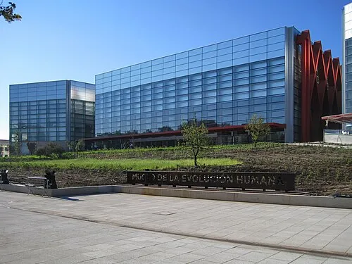 Museum of Human Evolution Museum, Burgos25 km NW
-
Santa María de Quintanilla de las Viñas Attraction, Mambrillas de Lara10 km S
-
Pantano del Arlanzón Lake, Villasur de Herreros10 km NE
-
Arroyo de Peguera River, Villasur de Herreros10 km NE
-
Arroyo de Santa María River, Ibeas de Juarros10 km NW
-
Río Seco River, Ibeas de Juarros10 km NW
-
Arroyo de Quintana River, Ibeas de Juarros11 km NE
Other cities and towns in Province of Burgos
-
 Ibeas de Juarros Municipality, Province of Burgos14 km NW
-
 Tinieblas de la Sierra Municipality, Province of Burgos7.9 km SE
-
 Villasur de Herreros Municipality, Province of Burgos11 km NE
-
 Mambrillas de Lara Municipality, Province of Burgos12 km S
-
 Campolara Municipality, Province of Burgos11 km S
-
 Castrillo del Val Municipality, Province of Burgos16 km NW
Sources & licences
Data last updated: · 2 independent sources