Valle de Mena
Located in Province of Burgos, Castille and León Coordinates: 43°06′40″ N 3°14′39″ W

- Population
- 3,931
- 3.9K
- Elevation
- 400 m
- above sea level
- Local time
- UTC+01:00
- Europe/Madrid · UTC+01:00
- Places inside
- 56
- listed under Valle de Mena
- Airports
- BIO Bilbao Airport34 km
- VIT Vitoria Airport49 km
About Valle de Mena
Valle de Mena is a municipality. Location: Province of Burgos, Castille and León. Population: 3,931. Elevation: 400 m.
The Mena Valley (Spanish: Valle de Mena) is a municipality in the province of Burgos in Spain. It is located in the autonomous community of Castile and León, bordering the provinces of Alava, Biscay and Cantabria. The Mena valley has 4,096 inhabitants distributed among 43 small villages. Its capital, Villasana de Mena, has 1,554 inhabitants.
Source: Wikipedia · CC BY-SA 4.0
Photos of Valle de Mena
-

Giorgio Galeotti · CC BY-SA 4.0 -

Giorgio Galeotti · CC BY-SA 4.0 -

Ander Ibarra · CC BY 2.0 -

Davileci · CC BY-SA 4.0 -

Pedrope87 · CC BY 4.0


Places bordering Valle de Mena
- Valle de Losa
- Junta de Traslaloma
- Merindad de Montija
Population of Valle de Mena over time
| 2014 | 3,856 | |
|---|---|---|
| 2015 | 3,826 | |
| 2016 | 3,806 | |
| 2017 | 3,742 | |
| 2018 | 3,739 | |
| 2019 | 3,726 | |
| 2020 | 3,805 | |
| 2021 | 3,987 | |
| 2022 | 4,030 | |
| 2023 | 4,096 | |
| 2024 | 4,147 | |
| 2025 | 4,155 |
Censuses and official estimates; source: Wikidata.
Climate of Valle de Mena
Best months for sightseeingBest months for sightseeing: June–September.
This month · November
A wet month
Day 14° · Night 6° · Rain 110 mm
- Hottest month
- August (day 26°)
- Coldest month
- January (night 3°)
- Wettest month
- November (110 mm)
- Driest month
- July (49 mm)
Bars: average monthly low and high temperature. Below: precipitation. Monthly averages for 1970–2000 at about 18 km resolution, adjusted for elevation. Highlighted months are mild and relatively dry. Source: WorldClim 2.1 (CC BY 4.0).
Show values as a table
| Month | Jan | Feb | Mar | Apr | May | Jun | Jul | Aug | Sep | Oct | Nov | Dec |
|---|---|---|---|---|---|---|---|---|---|---|---|---|
| Average high (°C) | 10° | 12° | 14° | 15° | 19° | 22° | 25° | 26° | 24° | 19° | 14° | 11° |
| Average low (°C) | 3° | 4° | 4° | 5° | 9° | 11° | 14° | 14° | 12° | 9° | 6° | 4° |
| Precipitation (mm) | 98 | 81 | 75 | 108 | 90 | 62 | 49 | 61 | 62 | 94 | 110 | 99 |
Other places to visit in this season: June July August September
How to get to Valle de Mena
The nearest airport is Bilbao Airport (BIO), 34 km to the northeast as the crow flies. The nearest large city is Barakaldo, 29 km to the northeast.
Airports
- Bilbao Airport (BIO) Bilbao 34 kmnortheast
- Vitoria Airport (VIT) Alava 49 kmsoutheast
- Seve Ballesteros-Santander Airport (SDR) Santander 58 kmnorthwest
Nearby large cities
- Barakaldo Population: 100.4K 29 kmnortheast
- Bilbao Population: 347.3K 31 kmnortheast
- Vitoria-Gasteiz Population: 257.4K 55 kmsoutheast
- Santander Population: 173.6K 60 kmnorthwest
- Burgos Population: 176.4K 93 kmsouthwest
Straight-line distances; road distances are longer. Airport data: OurAirports.
Day trips from Valle de Mena
Within 100 km: 294 historic and cultural sites, 217 natural sites, 207 lakes, rivers and coasts.
0–25 km29 places
- Pantano de Ordunte Lake 6 kmNW
- Loiola Lake 24 kmNE
- Alto de Zalama Mountain 14 kmW
- Montes de Ordunte Mountain 9 kmNW
25–60 km375 places
- Nerbioi / Nervión River 30 kmNE
- Arrietara Beach 37 kmNE
- Playa de San Julián Beach 35 kmN
- Laga Beach 58 kmNE
60–100 km314 places
- Playa de la Rabia Beach 94 kmW
- Playa de Comillas Beach 90 kmW
- Playa de Malkorbe Hondartza Beach 87 kmE
- Playa de Gaztetape Beach 87 kmE
Straight-line distances.
Places in Valle de Mena
56 placesVillasana de Mena
Population: 3.4K

Sopeñano
Population: 192

Santecilla
Population: 77

Covides
Population: 49

El Vigo
Population: 5
Cities & villages46
- Araduenga · Village
- Arceo · Village
- Artieta · Village
- Bárcenas · Village
- Barrasa · Village
- Berrandulez · Village
- Burceña · Village
- Cadagua · Village
- Campillo de Mena · Village
- Caniego · Village
- Carrasquedo · Village
- Cirión · Village
- Concejero · Village
- Entrambasaguas · Village
- Gijano · Village
- Haedo de Angulo · Village
- Hornes · Village
- Hoz de Mena · Village
- Irús · Village
- La Azuela · Village
- Las Bárcenas · Village
- Leciñana de Mena · Village
- Lezana de Mena · Village
- Maltrana · Village
- Medianas · Village
- Mediavilla · Village
- Menamayor · Village
- Nava de Ordunte · Village
- Opio · Village
- Oseguera · Village
- Ovilla · Village
- Partearroyo · Village
- Quintanilla de Siones · Village
- Ribota de Ordunte · Village
- Santa Cruz de Mena · Village
- Santa Olaja · Village
- Santiago de Tudela · Village
- Taranco · Village
- Ungo · Village
- Vallejo de Mena · Village
- Vallejuelo · Village
- Ventades · Village
- Viérgol · Village
- Villanueva de Mena · Village
- Villasuso de Mena · Village
- Vivanco de Mena · Village
Mountains & nature3
- Montes La Peña · Mountain
- Peña de Igaña · Mountain
- Sierra de la Magdalena · Mountain
Lakes, rivers & coasts1
- Pantano de Ordunte · Lake
Nearby attractions & nature
Everything nearby-
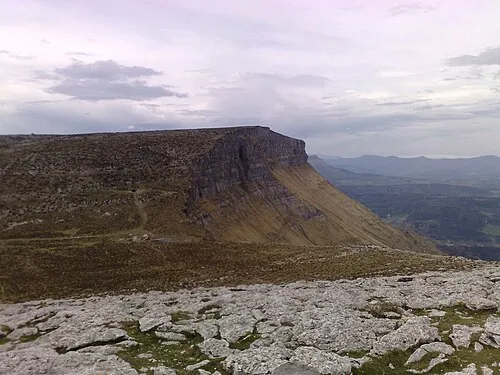 Eskutxi Mountain, Aiara / Ayala13 km SE
-
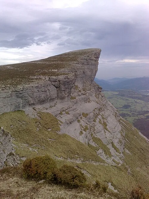 Ungino Mountain, Aiara / Ayala15 km SE
-
Artziniega River, Aiara / Ayala9.4 km E
-
Iglesia de San Vicente de Añes Attraction, Aiara / Ayala11 km SE
-
Montes de Ordunte Mountain, Spain9.3 km NW
-
Aro Mountain, Aiara / Ayala12 km SE
-
Ponata Mountain, Aiara / Ayala16 km SE
-
Iturrigorri Mountain, Urduña / Orduña17 km SE
Other cities and towns in Province of Burgos
-
 Valle de Losa Municipality, Province of Burgos14 km S
-
 Junta de Traslaloma Municipality, Province of Burgos16 km SW
-
 Villarcayo de Merindad de Castilla la Vieja Municipality, Province of Burgos32 km SW
-
 Valle de Tobalina Municipality, Province of Burgos33 km S
-
 Merindad de Montija Municipality, Province of Burgos20 km W
-
 Medina de Pomar Municipality, Province of Burgos22 km SW
Sources & licences
Data last updated: · 2 independent sources