- Population
- 122
- 122
- Elevation
- 724 m
- above sea level
- Local time
- UTC+01:00
- Europe/Madrid · UTC+01:00
- Places inside
- 5
- listed under Encina, La
- Airports
- SLM Salamanca Airport99 km
- VSE Aerodromo Goncalves Lobato (Viseu Airport)117 km
About Encina, La
Encina, La is a municipality. Location: Salamanca, Castille and León. Population: 122. Elevation: 724 m. The best months to visit are June–September. The nearest airport is Salamanca Airport (99 km). Nearby sights include Río Agadón and Pantano de Águeda.
Climate of Encina, La
Best months for sightseeingBest months for sightseeing: June–September.
This month · November
A wet month
Day 13° · Night 5° · Rain 113 mm
Better nearby cities in November
- Seville · 352 km south20°
- Dos Hermanas · 364 km south20°
- Seville · 351 km south20°
- Hottest month
- July (day 28°)
- Coldest month
- January (night 2°)
- Wettest month
- January (139 mm)
- Driest month
- August (14 mm)
Bars: average monthly low and high temperature. Below: precipitation. Monthly averages for 1970–2000 at about 18 km resolution, adjusted for elevation. Highlighted months are mild and relatively dry. Source: WorldClim 2.1 (CC BY 4.0).
Show values as a table
| Month | Jan | Feb | Mar | Apr | May | Jun | Jul | Aug | Sep | Oct | Nov | Dec |
|---|---|---|---|---|---|---|---|---|---|---|---|---|
| Average high (°C) | 9° | 11° | 14° | 15° | 18° | 24° | 28° | 28° | 24° | 18° | 13° | 10° |
| Average low (°C) | 2° | 3° | 4° | 5° | 8° | 12° | 15° | 14° | 12° | 9° | 5° | 3° |
| Precipitation (mm) | 139 | 111 | 62 | 76 | 80 | 45 | 15 | 14 | 42 | 96 | 113 | 139 |
Other places to visit in this season: June July August September
How to get to Encina, La
The nearest airport is Salamanca Airport (SLM), 99 km to the northeast as the crow flies. The nearest large city is Salamanca, 89 km to the northeast.
Airports
- Salamanca Airport (SLM) Salamanca 99 kmnortheast
- Aerodromo Goncalves Lobato (Viseu Airport) (VSE) Viseu 117 kmwest
- Vila Real Airport (VRL) Vila Real 131 kmnorthwest
Nearby large cities
- Salamanca Population: 144.8K 89 kmnortheast
- Badajoz Population: 150.5K 186 kmsouth
- Porto Population: 252.7K 189 kmwest
- Braga Population: 193.3K 196 kmnorthwest
- Valladolid Population: 300.6K 197 kmnortheast
Straight-line distances; road distances are longer. Airport data: OurAirports.
Day trips from Encina, La
Within 100 km: 77 historic and cultural sites, 85 natural sites, 208 lakes, rivers and coasts.
0–25 km36 places
- Pantano de Águeda Lake 4 kmE
- Río Horcajo River 23 kmSE
- Rivera de Gavilanes River 18 kmNE
- Rivera de Gallegos River 20 kmNW
25–60 km103 places
- Embalse de la Maside Lake 55 kmSE
- Sierra de Peña de Francia Mountain 37 kmE
- Las Hurdes Mountain 32 kmSE
- Sierra de Gata Mountain 42 kmSW
60–100 km231 places
- Pantano de Pasarón Lake 83 kmSE
- Pantano de Gargüera Lake 81 kmSE
- El Pantano Lake 60 kmSE
- Risco de la Umbrela Mountain 98 kmE
Straight-line distances.
Places in Encina, La
5 placesBar: population relative to the most populous place in this list.
Cities & villages2
Lakes, rivers & coasts2
- Río Agadones · River
- Río Burguillos de los Gatos · River
Nearby attractions & nature
Everything nearby-
Río Agadón River, Pastores4 km E
-
Pantano de Águeda Lake, Pastores4.5 km E
-
Arroyo del Pozo River, Herguijuela de Ciudad Rodrigo6 km S
-
Arroyo de la Atalaya River, Ciudad Rodrigo6.5 km NE
-
Arroyo de Navacervera River, Herguijuela de Ciudad Rodrigo6.9 km S
-
Arroyo del Valle de Peña River, Ciudad Rodrigo7 km NE
-
Castle of Henry II of Castile Historic site, Ciudad Rodrigo8.5 km N
-
Parroquia San Isidoro Attraction, Ciudad Rodrigo8.5 km N
Other cities and towns in Salamanca
-
Herguijuela de Ciudad Rodrigo Municipality, Salamanca8.2 km S
-
Martiago Municipality, Salamanca9.8 km SE
-
Carpio de Azaba Municipality, Salamanca10 km NW
-
Robleda Municipality, Salamanca16 km SW
-
Agallas Municipality, Salamanca14 km SE
-
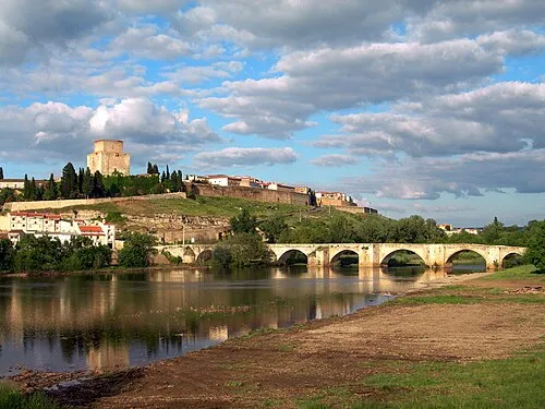 Ciudad Rodrigo Town, Ciudad Rodrigo8.9 km N
Sources & licences
Data last updated: