Ventosa de la Sierra
Located in Arévalo de la Sierra, Soria Coordinates: 41°55′56″ N 2°22′00″ W
- Population
- 15
- 15
- Elevation
- 1,246 m
- above sea level
- Local time
- UTC+01:00
- Europe/Madrid · UTC+01:00
- Airports
- RJL Logroño-Agoncillo Airport59 km
- VIT Vitoria Airport110 km
About Ventosa de la Sierra
Ventosa de la Sierra is a village. Location: Arévalo de la Sierra, Soria. Population: 15. Elevation: 1,246 m. The best months to visit are June–September. The nearest airport is Logroño-Agoncillo Airport (59 km). Nearby sights include Sierra de El Rodadero and Nuevo Estadio Los Pajaritos.
Climate of Ventosa de la Sierra
Best months for sightseeingBest months for sightseeing: June–September.
This month · November
A cold month
Day 10° · Night 0° · Rain 50 mm
- Hottest month
- August (day 27°)
- Coldest month
- January (night -3°)
- Wettest month
- May (67 mm)
- Driest month
- August (28 mm)
Bars: average monthly low and high temperature. Below: precipitation. Monthly averages for 1970–2000 at about 18 km resolution, adjusted for elevation. Highlighted months are mild and relatively dry. Source: WorldClim 2.1 (CC BY 4.0).
Show values as a table
| Month | Jan | Feb | Mar | Apr | May | Jun | Jul | Aug | Sep | Oct | Nov | Dec |
|---|---|---|---|---|---|---|---|---|---|---|---|---|
| Average high (°C) | 5° | 7° | 11° | 12° | 16° | 21° | 26° | 27° | 23° | 15° | 10° | 6° |
| Average low (°C) | -3° | -3° | -1° | 1° | 4° | 8° | 10° | 10° | 7° | 4° | 0° | -2° |
| Precipitation (mm) | 48 | 46 | 33 | 57 | 67 | 49 | 32 | 28 | 33 | 51 | 50 | 53 |
Other places to visit in this season: June July August September
How to get to Ventosa de la Sierra
The nearest airport is Logroño-Agoncillo Airport (RJL), 59 km to the north as the crow flies. The nearest large city is Logroño, 60 km to the north.
Airports
- Logroño-Agoncillo Airport (RJL) Logroño 59 kmnorth
- Vitoria Airport (VIT) Alava 110 kmnorth
- Pamplona Airport (PNA) Pamplona 110 kmnortheast
Nearby large cities
- Logroño Population: 151.2K 60 kmnorth
- Vitoria-Gasteiz Population: 257.4K 105 kmnorth
- Pamplona Population: 208.2K 115 kmnortheast
- Burgos Population: 176.4K 119 kmnorthwest
- Zaragoza Population: 687K 128 kmeast
Straight-line distances; road distances are longer. Airport data: OurAirports.
Day trips from Ventosa de la Sierra
Within 100 km: 160 historic and cultural sites, 81 natural sites, 212 lakes, rivers and coasts.
0–25 km41 places
- Sierra de Santa Ana Mountain 21 kmS
- Cerro Castillo Mountain 23 kmNW
- Sierra de la Ballenera Mountain 23 kmNE
- Sierra del Almuerzo Mountain 14 kmSE
25–60 km142 places
- Pantano de Valbornedo Lake 56 kmN
- Pantano de la Nava Lake 48 kmE
- Laguna de Lor Lake 60 kmE
- Pantano de la Grajera Lake 58 kmN
60–100 km270 places
- Laguna de Pitallas Lake 84 kmNE
- Pantano de Monteagudo Lake 62 kmS
- El Lagunazo Lake 92 kmE
- El Lago Lake 82 kmNW
Straight-line distances.
Nearby attractions & nature
Everything nearby-
Sierra de El Rodadero Mountain, Valtajeros10 km E
-
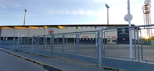 Nuevo Estadio Los Pajaritos Landmark, Soria21 km SW
-
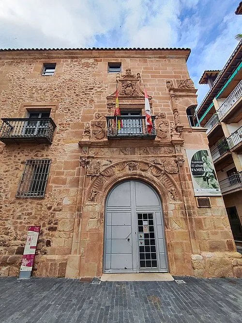 Palace of los Ríos y Salcedo Historic site, Soria20 km SW
-
Renieblas IV Historic site, Renieblas11 km S
-
Renieblas I Historic site, Renieblas11 km S
-
Renieblas II Historic site, Renieblas12 km S
Sources & licences
Data last updated: · 2 independent sources