- Elevation
- 755 m
- above sea level
- Local time
- UTC+01:00
- Europe/Madrid · UTC+01:00
- Airports
- SLM Salamanca Airport65 km
- BGC Bragança Airport78 km
About Fadón
Fadón is a village. Location: Bermillo de Sayago, Zamora. Elevation: 755 m. The best months to visit are May–June, August–September. The nearest airport is Salamanca Airport (65 km). Nearby sights include Arroyo de Fresnadillo and San Pedro de la Nave.
Climate of Fadón
Best months for sightseeingBest months for sightseeing: May–June, August–September.
This month · November
A wet month
Day 13° · Night 4° · Rain 102 mm
- Hottest month
- July (day 29°)
- Coldest month
- January (night 0°)
- Wettest month
- December (123 mm)
- Driest month
- July (18 mm)
Bars: average monthly low and high temperature. Below: precipitation. Monthly averages for 1970–2000 at about 18 km resolution, adjusted for elevation. Highlighted months are mild and relatively dry. Source: WorldClim 2.1 (CC BY 4.0).
Show values as a table
| Month | Jan | Feb | Mar | Apr | May | Jun | Jul | Aug | Sep | Oct | Nov | Dec |
|---|---|---|---|---|---|---|---|---|---|---|---|---|
| Average high (°C) | 8° | 11° | 14° | 15° | 19° | 25° | 29° | 29° | 25° | 18° | 13° | 9° |
| Average low (°C) | 0° | 1° | 3° | 4° | 8° | 11° | 14° | 13° | 11° | 7° | 4° | 2° |
| Precipitation (mm) | 117 | 112 | 66 | 69 | 68 | 48 | 18 | 18 | 45 | 92 | 102 | 123 |
Other places to visit in this season: May June August September
How to get to Fadón
The nearest airport is Salamanca Airport (SLM), 65 km to the southeast as the crow flies. The nearest large city is Salamanca, 55 km to the southeast.
Airports
- Salamanca Airport (SLM) Salamanca 65 kmsoutheast
- Bragança Airport (BGC) Bragança 78 kmnorthwest
- Valladolid Airport (VLL) Valladolid 103 kmeast
Nearby large cities
- Salamanca Population: 144.8K 55 kmsoutheast
- Valladolid Population: 300.6K 111 kmeast
- León Population: 124.8K 139 kmnorth
- Ourense Population: 105.2K 186 kmnorthwest
- Braga Population: 193.3K 202 kmwest
Straight-line distances; road distances are longer. Airport data: OurAirports.
Nearby attractions & nature
Everything nearby-
Arroyo de Fresnadillo River, Pereruela3.1 km N
-
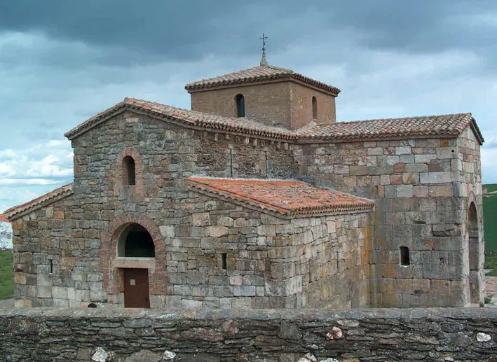 San Pedro de la Nave Attraction, San Pedro de la Nave-Almendra21 km N
-
Rivera de Fadoncino River, Pereruela7.4 km NE
-
Arroyo de la Rivera River, Pereruela9 km E
-
Rivera de Sobradillo River, Pereruela9 km NE
-
Valle del Duero Natural site, Torregamones23 km NW
Sources & licences
Data last updated: