- Elevation
- 805 m
- above sea level
- Local time
- UTC+01:00
- Europe/Madrid · UTC+01:00
- Airports
- SLM Salamanca Airport57 km
- BGC Bragança Airport86 km
About Mogátar
Mogátar is a village. Location: Fresno de Sayago, Zamora. Elevation: 805 m. The best months to visit are May–June, August–September. The nearest airport is Salamanca Airport (57 km). Nearby sights include Arroyo de la Rivera and Arroyo de Saceda.
Climate of Mogátar
Best months for sightseeingBest months for sightseeing: May–June, August–September.
This month · November
Outside the best season
Day 12° · Night 3° · Rain 89 mm
- Hottest month
- July (day 29°)
- Coldest month
- January (night 0°)
- Wettest month
- December (105 mm)
- Driest month
- July (17 mm)
Bars: average monthly low and high temperature. Below: precipitation. Monthly averages for 1970–2000 at about 18 km resolution, adjusted for elevation. Highlighted months are mild and relatively dry. Source: WorldClim 2.1 (CC BY 4.0).
Show values as a table
| Month | Jan | Feb | Mar | Apr | May | Jun | Jul | Aug | Sep | Oct | Nov | Dec |
|---|---|---|---|---|---|---|---|---|---|---|---|---|
| Average high (°C) | 8° | 10° | 13° | 15° | 19° | 24° | 29° | 28° | 24° | 18° | 12° | 9° |
| Average low (°C) | 0° | 1° | 2° | 4° | 7° | 11° | 13° | 13° | 11° | 7° | 3° | 2° |
| Precipitation (mm) | 99 | 93 | 57 | 63 | 63 | 45 | 17 | 17 | 42 | 81 | 89 | 105 |
Other places to visit in this season: May June August September
How to get to Mogátar
The nearest airport is Salamanca Airport (SLM), 57 km to the southeast as the crow flies. The nearest large city is Salamanca, 48 km to the southeast.
Airports
- Salamanca Airport (SLM) Salamanca 57 kmsoutheast
- Bragança Airport (BGC) Bragança 86 kmnorthwest
- Valladolid Airport (VLL) Valladolid 98 kmnortheast
Nearby large cities
- Salamanca Population: 144.8K 48 kmsoutheast
- Valladolid Population: 300.6K 106 kmeast
- León Population: 124.8K 142 kmnorth
- Ourense Population: 105.2K 195 kmnorthwest
- Móstoles Population: 207.1K 208 kmsoutheast
Straight-line distances; road distances are longer. Airport data: OurAirports.
Day trips from Mogátar
Within 100 km: 89 historic and cultural sites, 55 natural sites, 196 lakes, rivers and coasts.
0–25 km49 places
- Teso Santo Mountain 14 kmS
- Tres Arboles Park Natural site 23 kmNE
- Parque Ignacio Sarda Natural site 23 kmNE
- Parque de La Marina Española Natural site 23 kmNE
25–60 km117 places
- Embalse de Ricobayo Lake 38 kmN
- Embalse del Esla Lake 30 kmN
- Sierra de Casica Mountain 56 kmNW
- Campanario Mountain 52 kmN
60–100 km174 places
- Sierra de Peña de Francia Mountain 90 kmS
- Peña Mira Mountain 77 kmNW
- Sierra de la Culebra Mountain 65 kmNW
- Sierra de Carpurias Mountain 85 kmN
Straight-line distances.
Nearby attractions & nature
Everything nearby-
Arroyo de la Rivera River, Pereruela3.9 km NE
-
Arroyo de Saceda River, Peñausende5.8 km SE
-
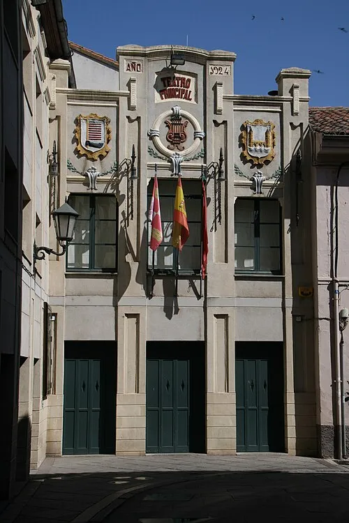 Teatro Principal Attraction, Zamora22 km NE
-
Rivera de Sobradillo River, Pereruela8.9 km N
-
Teso Santo Mountain, Santiz14 km S
-
Puerta del Obispo Landmark, Zamora21 km NE
Sources & licences
Data last updated: