Las Navillas
Located in Retuerta del Bullaque, Ciudad Real Coordinates: 39°33′32″ N 4°21′25″ W
- Elevation
- 839 m
- above sea level
- Local time
- UTC+01:00
- Europe/Madrid · UTC+01:00
- Airports
- MAD Adolfo Suárez Madrid–Barajas Airport124 km
- SLM Salamanca Airport183 km
About Las Navillas
Las Navillas is a village. Location: Retuerta del Bullaque, Ciudad Real. Elevation: 839 m. The best months to visit are May–June, September–October. The nearest airport is Adolfo Suárez Madrid–Barajas Airport (124 km). Nearby sights include Montes de Toledo and Pantano del Torcón.
Climate of Las Navillas
Best months for sightseeingBest months for sightseeing: May–June, September–October.
This month · November
Outside the best season
Day 13° · Night 5° · Rain 54 mm
Better nearby cities in November
- Seville · 280 km southwest20°
- Dos Hermanas · 287 km southwest20°
- Málaga · 316 km south20°
- Hottest month
- July (day 31°)
- Coldest month
- January (night 1°)
- Wettest month
- December (60 mm)
- Driest month
- August (10 mm)
Bars: average monthly low and high temperature. Below: precipitation. Monthly averages for 1970–2000 at about 18 km resolution, adjusted for elevation. Highlighted months are mild and relatively dry. Source: WorldClim 2.1 (CC BY 4.0).
Show values as a table
| Month | Jan | Feb | Mar | Apr | May | Jun | Jul | Aug | Sep | Oct | Nov | Dec |
|---|---|---|---|---|---|---|---|---|---|---|---|---|
| Average high (°C) | 9° | 11° | 15° | 16° | 21° | 26° | 31° | 31° | 26° | 19° | 13° | 10° |
| Average low (°C) | 1° | 2° | 4° | 6° | 9° | 14° | 17° | 17° | 13° | 9° | 5° | 2° |
| Precipitation (mm) | 47 | 41 | 35 | 51 | 52 | 34 | 12 | 10 | 26 | 51 | 54 | 60 |
Other places to visit in this season: May June September October
How to get to Las Navillas
The nearest airport is Adolfo Suárez Madrid–Barajas Airport (MAD), 124 km to the northeast as the crow flies. The nearest large city is Parla, 91 km to the northeast.
Airports
- Adolfo Suárez Madrid–Barajas Airport (MAD) Madrid 124 kmnortheast
- Salamanca Airport (SLM) Salamanca 183 kmnorthwest
- Córdoba Airport (ODB) Córdoba 195 kmsouth
Nearby large cities
- Parla Population: 115.6K 91 kmnortheast
- Fuenlabrada Population: 190.5K 94 kmnortheast
- Móstoles Population: 207.1K 95 kmnortheast
- Alcorcón Population: 172.4K 99 kmnortheast
- Getafe Population: 187.5K 99 kmnortheast
Straight-line distances; road distances are longer. Airport data: OurAirports.
Day trips from Las Navillas
Within 100 km: 217 historic and cultural sites, 109 natural sites, 214 lakes, rivers and coasts.
0–25 km23 places
- Pantano del Torcón Lake 6 kmN
- Montes de Toledo Mountain 2 kmSE
- Sierra del Chorito Mountain 20 kmS
- Noez Mountain 25 kmNE
25–60 km113 places
- Embalse de Cijara Lake 52 kmSW
- Sierra del Trincheto Mountain 43 kmSE
- Sierra de Peralosilla Mountain 52 kmSE
- Sierra de Palancosillo Mountain 54 kmSW
60–100 km404 places
- Laguna de Valparaíso Lake 63 kmS
- Embalse de Valdecañas Lake 96 kmW
- Laguna del Taray Lake 89 kmE
- Laguna de San Pedro Lake 97 kmSW
Straight-line distances.
Nearby attractions & nature
Everything nearby-
Montes de Toledo Mountain, Spain2.2 km SE
-
Pantano del Torcón Lake, Menasalbas6.5 km N
-
Arroyo de la Yedra River, San Pablo de los Montes5 km NW
-
Arroyo de los Molinos River, Menasalbas5.7 km NE
-
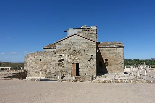 Santa María de Melque Attraction, San Martín de Montalbán21 km N
-
Arroyo de Villapalos River, Menasalbas6.2 km N
Sources & licences
Data last updated: