Casas de Fernando Alonso
Located in Province of Cuenca, Castille-La Mancha Coordinates: 39°20′32″ N 2°20′10″ W

- Population
- 1,446
- 1.4K
- Elevation
- 727 m
- above sea level
- Local time
- UTC+01:00
- Europe/Madrid · UTC+01:00
- Places inside
- 1
- listed under Casas de Fernando Alonso
- Airports
- VLC Valencia Airport161 km
- MAD Adolfo Suárez Madrid–Barajas Airport166 km
About Casas de Fernando Alonso
Casas de Fernando Alonso is a municipality. Location: Province of Cuenca, Castille-La Mancha. Population: 1,446. Elevation: 727 m.
Casas de Fernando Alonso is a municipality in Cuenca, Castile-La Mancha, Spain. It has a population of 1,405.
Source: Wikipedia · CC BY-SA 4.0
At a glance
- Area
- 30.3 km²
Source: Wikidata
Photos of Casas de Fernando Alonso
-

Jesus 14314 · CC BY-SA 3.0 -

Jesus 393 · CC BY-SA 4.0 -

Jesus 450 · CC BY-SA 4.0 -

19Tarrestnom65 · CC BY-SA 4.0 -

La Mancha 567 · CC BY-SA 4.0


Places bordering Casas de Fernando Alonso
- Casas de los Pinos
- Vara de Rey
- Casas de Haro
Population of Casas de Fernando Alonso over time
| 2014 | 1,358 | |
|---|---|---|
| 2015 | 1,311 | |
| 2016 | 1,258 | |
| 2017 | 1,208 | |
| 2018 | 1,210 | |
| 2019 | 1,169 | |
| 2020 | 1,140 | |
| 2021 | 1,147 | |
| 2022 | 1,144 | |
| 2023 | 1,132 | |
| 2024 | 1,088 | |
| 2025 | 1,041 |
Censuses and official estimates; source: Wikidata.
Climate of Casas de Fernando Alonso
Best months for sightseeingBest months for sightseeing: May, October.
This month · November
Outside the best season
Day 15° · Night 4° · Rain 46 mm
Better nearby cities in November
- Murcia · 184 km southeast20°
- Orihuela · 185 km southeast20°
- Elche · 186 km southeast20°
- Hottest month
- July (day 34°)
- Coldest month
- January (night 0°)
- Wettest month
- December (55 mm)
- Driest month
- August (9 mm)
Bars: average monthly low and high temperature. Below: precipitation. Monthly averages for 1970–2000 at about 18 km resolution, adjusted for elevation. Highlighted months are mild and relatively dry. Source: WorldClim 2.1 (CC BY 4.0).
Show values as a table
| Month | Jan | Feb | Mar | Apr | May | Jun | Jul | Aug | Sep | Oct | Nov | Dec |
|---|---|---|---|---|---|---|---|---|---|---|---|---|
| Average high (°C) | 11° | 13° | 17° | 18° | 23° | 29° | 34° | 34° | 28° | 21° | 15° | 11° |
| Average low (°C) | 0° | 1° | 3° | 5° | 9° | 14° | 17° | 17° | 13° | 8° | 4° | 2° |
| Precipitation (mm) | 43 | 37 | 29 | 47 | 47 | 31 | 11 | 9 | 25 | 47 | 46 | 55 |
How to get to Casas de Fernando Alonso
The nearest airport is Valencia Airport (VLC), 161 km to the east as the crow flies. The nearest large city is Albacete, 57 km to the southeast.
Airports
- Valencia Airport (VLC) Valencia 161 kmeast
- Adolfo Suárez Madrid–Barajas Airport (MAD) Madrid 166 kmnorthwest
- Alicante-Elche Miguel Hernández Airport (ALC) Alicante 194 kmsoutheast
Nearby large cities
- Albacete Population: 173K 57 kmsoutheast
- Alcalá de Henares Population: 193.8K 154 kmnorthwest
- Torrejón de Ardoz Population: 118.2K 157 kmnorthwest
- Parla Population: 115.6K 158 kmnorthwest
- Getafe Population: 187.5K 160 kmnorthwest
Straight-line distances; road distances are longer. Airport data: OurAirports.
Day trips from Casas de Fernando Alonso
Within 100 km: 99 historic and cultural sites, 164 natural sites, 153 lakes, rivers and coasts.
0–25 km34 places
- Cerro Agudo Mountain 14 kmN
- Cerro de Pedro García Mountain 18 kmN
- Cerro de Marujo Mountain 21 kmNW
- El Monte Mountain 16 kmN
25–60 km102 places
- Laguna Ojos de Villaverde Lake 59 kmS
- Laguna de Manjavacas Lake 46 kmW
- Embalse de Alarcón Lake 33 kmNE
- Cerro de la Zorra Mountain 42 kmNW
60–100 km280 places
- Laguna Tinajas Lake 63 kmSW
- Laguna del Taray Lake 87 kmW
- Laguna San Pedro Lake 63 kmSW
- Laguna del Rey Lake 63 kmSW
Straight-line distances.
Places in Casas de Fernando Alonso
1 placeBar: population relative to the most populous place in this list.
Nearby attractions & nature
Everything nearby-
Iglesia de Casas de los Pinos Attraction, Casas de los Pinos3.1 km W
-
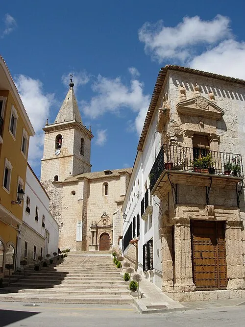 Church of El Salvador o de la Transfiguración Attraction, La Roda21 km SE
-
Palacio del Marqués de Valdeguerrero Historic site, San Clemente10 km NW
-
Cerro Agudo Mountain, Vara de Rey14 km N
-
El Monte Mountain, San Clemente16 km N
-
Cerro de Pedro García Mountain, Atalaya del Cañavate18 km N
-
Pico del Águila Mountain, Alberca de Záncara, La19 km NW
-
Río de Santa María del Campo River, San Clemente15 km N
Other cities and towns in Province of Cuenca
-
 Pozoamargo Municipality, Province of Cuenca12 km E
-
San Clemente Municipality, Province of Cuenca13 km NW
-
 Honrubia Municipality, Province of Cuenca31 km N
-
 Sisante Municipality, Province of Cuenca19 km E
-
 Quintanar del Rey Municipality, Province of Cuenca34 km E
-
Casas de Benítez Municipality, Province of Cuenca20 km E
Sources & licences
Data last updated: · 2 independent sources