Montesclaros
Located in Province of Toledo, Castille-La Mancha Coordinates: 40°05′23″ N 4°55′37″ W

- Population
- 455
- 455
- Elevation
- 482 m
- above sea level
- Local time
- UTC+01:00
- Europe/Madrid · UTC+01:00
- Places inside
- 2
- listed under Montesclaros
- Airports
- SLM Salamanca Airport107 km
- MAD Adolfo Suárez Madrid–Barajas Airport124 km
About Montesclaros
Montesclaros is a municipality. Location: Province of Toledo, Castille-La Mancha. Population: 455. Elevation: 482 m.
Montesclaros is a municipality located in the province of Toledo, Castile-La Mancha, Spain. According to the 2006 census (INE), the municipality had a population of 406 inhabitants. The town borders Hontanares to the north; Navamorcuende to the east; Cervera de los Montes, Segurilla, and Mejorada to the south; and Velada to the west. It is known for its marble quarries.
Source: Wikipedia · CC BY-SA 4.0
At a glance
- Area
- 21 km²
Source: Wikidata
Photos of Montesclaros
-

Centro Nacional de Información Geográfica · CC BY 4.0 -

Asqueladd · CC BY-SA 3.0 -

Asqueladd · CC BY-SA 3.0 -

Javier Cano Blázquez · CC BY-SA 4.0


Places bordering Montesclaros
- Navamorcuende
- Velada
- Mejorada
- Segurilla
- Cervera de los Montes
Population of Montesclaros over time
| 2014 | 445 | |
|---|---|---|
| 2015 | 440 | |
| 2016 | 426 | |
| 2017 | 417 | |
| 2018 | 408 | |
| 2019 | 406 | |
| 2020 | 393 | |
| 2021 | 389 | |
| 2022 | 384 | |
| 2023 | 381 | |
| 2024 | 365 | |
| 2025 | 377 |
Censuses and official estimates; source: Wikidata.
Climate of Montesclaros
Best months for sightseeingBest months for sightseeing: May–June, September–October.
This month · November
Outside the best season
Day 15° · Night 6° · Rain 42 mm
Better nearby cities in November
- Seville · 314 km south20°
- Dos Hermanas · 324 km south20°
- Málaga · 377 km south20°
- Hottest month
- July (day 32°)
- Coldest month
- January (night 2°)
- Wettest month
- December (43 mm)
- Driest month
- July (9 mm)
Bars: average monthly low and high temperature. Below: precipitation. Monthly averages for 1970–2000 at about 18 km resolution, adjusted for elevation. Highlighted months are mild and relatively dry. Source: WorldClim 2.1 (CC BY 4.0).
Show values as a table
| Month | Jan | Feb | Mar | Apr | May | Jun | Jul | Aug | Sep | Oct | Nov | Dec |
|---|---|---|---|---|---|---|---|---|---|---|---|---|
| Average high (°C) | 11° | 13° | 16° | 18° | 22° | 27° | 32° | 31° | 27° | 21° | 15° | 12° |
| Average low (°C) | 2° | 4° | 5° | 7° | 10° | 14° | 17° | 17° | 14° | 10° | 6° | 3° |
| Precipitation (mm) | 35 | 33 | 25 | 35 | 37 | 28 | 9 | 9 | 23 | 39 | 42 | 43 |
Other places to visit in this season: May June September October
How to get to Montesclaros
The nearest airport is Salamanca Airport (SLM), 107 km to the northwest as the crow flies. For international flights: Adolfo Suárez Madrid–Barajas Airport (MAD) (124 km). The nearest large city is Móstoles, 94 km to the east.
Airports
- Salamanca Airport (SLM) Salamanca 107 kmnorthwest
- Adolfo Suárez Madrid–Barajas Airport (MAD) Madrid 124 kmeast
- Valladolid Airport (VLL) Valladolid 180 kmnorth
Nearby large cities
- Móstoles Population: 207.1K 94 kmeast
- Alcorcón Population: 172.4K 98 kmeast
- Fuenlabrada Population: 190.5K 99 kmeast
- Parla Population: 115.6K 100 kmeast
- Leganés Population: 188.4K 102 kmeast
Straight-line distances; road distances are longer. Airport data: OurAirports.
Day trips from Montesclaros
Within 100 km: 207 historic and cultural sites, 130 natural sites, 269 lakes, rivers and coasts.
0–25 km45 places
- Pelados Mountain 19 kmE
- Navalasierra Mountain 14 kmNE
- Cabeza Gorda Mountain 4 kmSW
- Empedrado Mountain 5 kmNW
25–60 km151 places
- Embalse de Valdecañas Lake 54 kmSW
- Laguna Grande de Gredos Lake 35 kmNW
- Embalse del Burguillo Lake 48 kmNE
- Pantano de San Juan Lake 60 kmNE
60–100 km410 places
- Pantano del Torcón Lake 71 kmSE
- Pantano de Pasarón Lake 78 kmW
- Pantano de Gargüera Lake 84 kmW
- Embalse de Cijara Lake 84 kmS
Straight-line distances.
Places in Montesclaros
2 placesBar: population relative to the most populous place in this list.
Lakes, rivers & coasts1
- Arroyo Marrupalejo · River
Nearby attractions & nature
Everything nearby-
Cabeza Gorda Mountain, Velada4.3 km SW
-
Empedrado Mountain, Velada4.5 km NW
-
Garganta de Lanzahita River, Arenas de San Pedro7.9 km N
-
Arroyo de Valdeoliva River, Arenas de San Pedro9.4 km NW
-
Arroyo de Nadinos River, Velada9.6 km SW
-
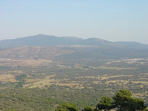 Cruces Mountain, Navamorcuende17 km NE
-
Sierras del Águila Mountain, Navalcán14 km W
-
Navalasierra Mountain, Navamorcuende14 km NE
Other cities and towns in Province of Toledo
-
 Talavera de la Reina Municipality, Province of Toledo16 km SE
-
 Buenaventura Municipality, Province of Toledo10 km NE
-
 Parrillas Municipality, Province of Toledo10 km W
-
 Velada Municipality, Province of Toledo11 km SW
-
 Cervera de los Montes Municipality, Province of Toledo9 km SE
-
 Marrupe Municipality, Province of Toledo10 km E
Sources & licences
Data last updated: · 2 independent sources