Real de San Vicente, El
Located in Province of Toledo, Castille-La Mancha Coordinates: 40°10′02″ N 4°40′36″ W
- Population
- 1,097
- 1.1K
- Elevation
- 732 m
- above sea level
- Local time
- UTC+01:00
- Europe/Madrid · UTC+01:00
- Places inside
- 2
- listed under Real de San Vicente, El
- Airports
- MAD Adolfo Suárez Madrid–Barajas Airport101 km
- SLM Salamanca Airport112 km
About Real de San Vicente, El
Real de San Vicente, El is a municipality. Location: Province of Toledo, Castille-La Mancha. Population: 1,097. Elevation: 732 m. The best months to visit are May–June, September–October. The nearest airport is Adolfo Suárez Madrid–Barajas Airport (101 km). Nearby sights include Cruces and Navalasierra.
Photos of Real de San Vicente, El
-
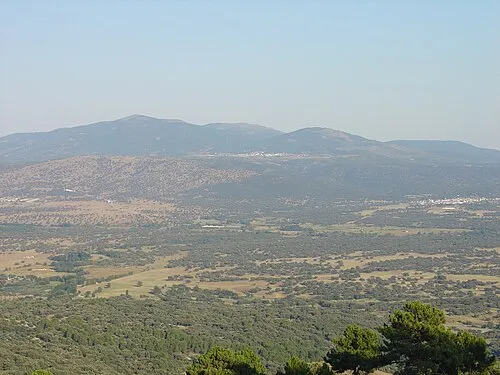
Cruces Felixario · Public domain

Climate of Real de San Vicente, El
Best months for sightseeingBest months for sightseeing: May–June, September–October.
This month · November
Outside the best season
Day 13° · Night 4° · Rain 42 mm
Better nearby cities in November
- Seville · 329 km south20°
- Dos Hermanas · 338 km south20°
- Málaga · 384 km south20°
- Hottest month
- July (day 30°)
- Coldest month
- January (night 1°)
- Wettest month
- December (44 mm)
- Driest month
- August (10 mm)
Bars: average monthly low and high temperature. Below: precipitation. Monthly averages for 1970–2000 at about 18 km resolution, adjusted for elevation. Highlighted months are mild and relatively dry. Source: WorldClim 2.1 (CC BY 4.0).
Show values as a table
| Month | Jan | Feb | Mar | Apr | May | Jun | Jul | Aug | Sep | Oct | Nov | Dec |
|---|---|---|---|---|---|---|---|---|---|---|---|---|
| Average high (°C) | 9° | 11° | 14° | 16° | 20° | 25° | 30° | 29° | 25° | 19° | 13° | 10° |
| Average low (°C) | 1° | 2° | 4° | 6° | 9° | 13° | 16° | 16° | 13° | 9° | 4° | 2° |
| Precipitation (mm) | 35 | 31 | 26 | 39 | 42 | 30 | 11 | 10 | 25 | 41 | 42 | 44 |
Other places to visit in this season: May June September October
How to get to Real de San Vicente, El
The nearest airport is Adolfo Suárez Madrid–Barajas Airport (MAD), 101 km to the east as the crow flies. The nearest large city is Móstoles, 71 km to the east.
Airports
- Adolfo Suárez Madrid–Barajas Airport (MAD) Madrid 101 kmeast
- Salamanca Airport (SLM) Salamanca 112 kmnorthwest
- Valladolid Airport (VLL) Valladolid 172 kmnorth
Nearby large cities
- Móstoles Population: 207.1K 71 kmeast
- Alcorcón Population: 172.4K 75 kmeast
- Fuenlabrada Population: 190.5K 76 kmeast
- Parla Population: 115.6K 78 kmeast
- Leganés Population: 188.4K 80 kmeast
Straight-line distances; road distances are longer. Airport data: OurAirports.
Day trips from Real de San Vicente, El
Within 100 km: 454 historic and cultural sites, 250 natural sites, 261 lakes, rivers and coasts.
0–25 km33 places
- Pelados Mountain 4 kmSW
- Navalasierra Mountain 9 kmW
- Alto del Mirlo Mountain 22 kmNE
- Cabeza del Madroñal Mountain 11 kmN
25–60 km199 places
- Laguna Grande de Gredos Lake 52 kmW
- Embalse del Burguillo Lake 30 kmN
- Pantano de San Juan Lake 37 kmNE
- Pantano de San Juan Lake 38 kmNE
60–100 km733 places
- San Millán Attraction 98 kmNE
- Embalse de Valdecañas Lake 76 kmSW
- Pantano del Torcón Lake 67 kmSE
- Pantano de Pasarón Lake 100 kmW
Straight-line distances.
Places in Real de San Vicente, El
2 placesBar: population relative to the most populous place in this list.
Mountains & nature1
- Pelados · Mountain
Nearby attractions & nature
Everything nearby-
Cruces Mountain, Navamorcuende5.9 km W
-
Navalasierra Mountain, Navamorcuende8.7 km W
-
Cabeza del Madroñal Mountain, Adrada, La11 km N
-
Arroyo de la Cerecala River, Iglesuela, La11 km NW
-
Arroyo Castaña River, Adrada, La12 km N
-
Valle del Tiétar Natural site, Spain14 km W
-
Iberian Peninsula Natural site, Avila14 km NW
-
Cerro de la Encinilla Mountain, Barraco, El24 km NE
Other cities and towns in Province of Toledo
-
 Navamorcuende Municipality, Province of Toledo14 km W
-
 Nombela Municipality, Province of Toledo13 km E
-
 Sartajada Municipality, Province of Toledo12 km NW
-
 Cardiel de los Montes Municipality, Province of Toledo11 km S
-
 Talavera de la Reina Municipality, Province of Toledo27 km SW
-
 Cazalegas Municipality, Province of Toledo18 km S
Sources & licences
Data last updated: