- Elevation
- 402 m
- above sea level
- Local time
- UTC+01:00
- Europe/Madrid · UTC+01:00
- Airports
- LEU Pirineus - la Seu d'Urgel Airport49 km
- ILD Lleida-Alguaire Airport56 km
About Río Bellfort
Río Bellfort is a river. Location: la Baronia de Rialb, Lleida. The best months to visit are May–June, September–October. The nearest airport is Pirineus - la Seu d'Urgel Airport (49 km). Nearby sights include el Segre and el Rialb.
Climate of Río Bellfort
Best months for sightseeingBest months for sightseeing: May–June, September–October.
This month · November
Outside the best season
Day 14° · Night 5° · Rain 55 mm
- Hottest month
- July (day 30°)
- Coldest month
- January (night 1°)
- Wettest month
- May (68 mm)
- Driest month
- July (29 mm)
Bars: average monthly low and high temperature. Below: precipitation. Monthly averages for 1970–2000 at about 18 km resolution, adjusted for elevation. Highlighted months are mild and relatively dry. Source: WorldClim 2.1 (CC BY 4.0).
Show values as a table
| Month | Jan | Feb | Mar | Apr | May | Jun | Jul | Aug | Sep | Oct | Nov | Dec |
|---|---|---|---|---|---|---|---|---|---|---|---|---|
| Average high (°C) | 9° | 12° | 15° | 17° | 21° | 25° | 30° | 30° | 26° | 20° | 14° | 10° |
| Average low (°C) | 1° | 2° | 4° | 6° | 9° | 13° | 16° | 17° | 13° | 9° | 5° | 2° |
| Precipitation (mm) | 36 | 32 | 42 | 51 | 68 | 57 | 29 | 49 | 62 | 60 | 55 | 42 |
Other places to visit in this season: May June September October
How to get to Río Bellfort
The nearest airport is Pirineus - la Seu d'Urgel Airport (LEU), 49 km to the northeast as the crow flies. For international flights: Reus Airport (REU) (88 km). The nearest large city is Lleida, 57 km to the southwest.
Airports
- Pirineus - la Seu d'Urgel Airport (LEU) La Seu d'Urgell Pyrenees and Andorra 49 kmnortheast
- Lleida-Alguaire Airport (ILD) Lleida 56 kmsouthwest
- Reus Airport (REU) Reus 88 kmsouth
Nearby large cities
- Lleida Population: 140.8K 57 kmsouthwest
- Terrassa Population: 218.5K 83 kmsoutheast
- Reus Population: 103.5K 87 kmsouth
- Sabadell Population: 211.7K 91 kmsoutheast
- Tarragona Population: 141.5K 91 kmsouth
Straight-line distances; road distances are longer. Airport data: OurAirports.
Day trips from Río Bellfort
Within 100 km: 360 historic and cultural sites, 1,142 natural sites, 266 lakes, rivers and coasts.
0–25 km30 places
- Pantà d'Oliana Lake 23 kmNE
- Serra de Sant Mamet Mountain 15 kmW
- Serra d'Oliana Mountain 22 kmNE
- el Montsec de Rubies Mountain 18 kmNW
25–60 km323 places
- Estany d'Ivars i Vila-san Lake 33 kmSW
- Pantà de Sant Antoni Lake 33 kmNW
- Pantà de Terradets Lake 26 kmNW
- Pantà de Sant Llorenç de Montgai Lake 27 kmW
60–100 km1,415 places
- Esglesia de Sant Esteve de Ginast Attraction 71 kmNW
- Artigue River 94 kmN
- Playa del Rincón Beach 97 kmS
- Playa Barà Beach 90 kmS
Straight-line distances.
Nearest towns and villages
-
Torreblanca Village, Ponts0.8 km S
-
Ponts Village, Ponts4 km SE
-
Ponts Municipality, Lleida4.3 km SE
-
la Baronia de Rialb Village, Isona i Conca Dellà3.9 km E
-
Gualter Village, la Baronia de Rialb2.5 km NE
-
Anya Village, Artesa de Segre3.9 km SW
Nearby attractions & nature
Everything nearby-
el Segre River, Tiurana3.4 km SE
-
el Rialb River, Tiurana7.5 km NE
-
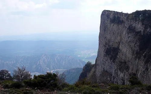 lo Coscollet Mountain, Peramola22 km NE
-
el Llobregós River, Oliola9.5 km SE
-
el Boix River, Artesa de Segre11 km W
-
el Boix River, Artesa de Segre12 km NW
-
Roca Alta Mountain, Vilanova de Meià15 km NW
-
Serra de Sant Mamet Mountain, Artesa de Segre15 km W
Sources & licences
Data last updated: