Castelo de Lemos
Located in Monforte de Lemos, Lugo Coordinates: 42°31′27″ N 7°30′40″ W
- Local time
- UTC+01:00
- Europe/Madrid · UTC+01:00
- Elevation
- 347 m
- above sea level
- Airports
- SCQ Santiago-Rosalía de Castro Airport85 km
- VGO Vigo Airport97 km
About Castelo de Lemos
Castelo de Lemos is a historic site. Location: Monforte de Lemos, Lugo.
In comparison
- 15 sights and natural places within 10 km Monasterio de San Vicente del Pino, Centro del Vino de la Ribeira Sacra
Climate of Castelo de Lemos
Best months for sightseeingBest months for sightseeing: June–September.
Bars: average monthly low and high temperature. Below: precipitation. Monthly averages for 1970–2000 at about 18 km resolution, adjusted for elevation. Highlighted months are mild and relatively dry. Source: WorldClim 2.1 (CC BY 4.0).
Show values as a table
| Month | Jan | Feb | Mar | Apr | May | Jun | Jul | Aug | Sep | Oct | Nov | Dec |
|---|---|---|---|---|---|---|---|---|---|---|---|---|
| Average high (°C) | 11° | 13° | 16° | 17° | 19° | 24° | 27° | 28° | 25° | 20° | 15° | 12° |
| Average low (°C) | 3° | 4° | 5° | 6° | 9° | 12° | 14° | 14° | 13° | 10° | 7° | 5° |
| Precipitation (mm) | 212 | 181 | 144 | 128 | 121 | 66 | 38 | 43 | 99 | 183 | 200 | 228 |
Other places to visit in this season: June July August September
Airports nearest to Castelo de Lemos
- Santiago-Rosalía de Castro Airport (SCQ) Santiago de Compostela 85 km
- Vigo Airport (VGO) Vigo 97 km
- Bragança Airport (BGC) Bragança 99 km
Straight-line distance; airports with scheduled flights only. Source: OurAirports (public domain).
Nearby attractions & nature
Everything nearby-
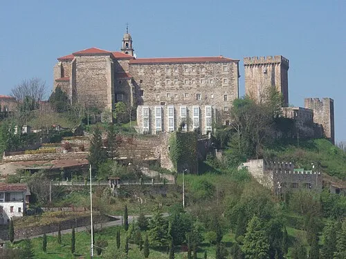 Monasterio de San Vicente del Pino Attraction, Monforte de Lemos0.1 km SE
-
Centro del Vino de la Ribeira Sacra Museum, Monforte de Lemos0.3 km SW
-
Puente Romano Historic site, Monforte de Lemos0.3 km SW
-
Convento das Clarisas de Monforte Museum, Monforte de Lemos0.4 km W
-
Parroquia de Santo Antonio de Pádua Attraction, Monforte de Lemos0.4 km W
-
Colegio de Nuestra Señora de la Antigua Attraction, Monforte de Lemos0.8 km SW
-
Museo de Casas de Muñecas Museum, Monforte de Lemos0.9 km NE
-
Parque dos Condes Natural site, Monforte de Lemos0.6 km SW
Nearest towns and villages
-
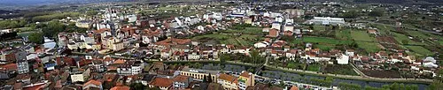 Monforte de Lemos Town, Monforte de Lemos0.4 km SW
-
Distriz Village, Monforte de Lemos4.2 km SW
-
Santa Mariña do Monte Village, Monforte de Lemos2.2 km W
-
Piñeira Village, Monforte de Lemos2.6 km SW
Sources & licences
Data last updated: