Vilamartín de Valdeorras
Located in Ourense, Galicia Coordinates: 42°26′47″ N 7°03′29″ W
- Population
- 1,988
- 2K
- Elevation
- 619 m
- above sea level
- Local time
- UTC+01:00
- Europe/Madrid · UTC+01:00
- Places inside
- 15
- listed under Vilamartín de Valdeorras
About Vilamartín de Valdeorras
Vilamartín de Valdeorras is a municipality. Location: Ourense, Galicia. Population: 1,988. Elevation: 619 m.
In comparison
- No. 33 of 92 places in Ourense by population
- Nearest larger town: A Rúa, 6 km SW
- 5 sights and natural places within 10 km Río Leira, Regato da Fervenza
- Listed here: Village: 14, River: 1
Airports nearest to Vilamartín de Valdeorras
- Bragança Airport (BGC) Bragança 72 km
- León Airport (LEN) La Virgen del Camino 117 km
- Santiago-Rosalía de Castro Airport (SCQ) Santiago de Compostela 122 km
Straight-line distance; airports with scheduled flights only. Source: OurAirports (public domain).
Places in Vilamartín de Valdeorras
15 places-
Vilamartín de Valdeorras Village974
-
Córgomo Village221
-
Arcos Village169
-
A Portela Village135
-
Valencia do Sil Village73
-
San Vicente de Leira Village72
-
Correxais Village61
-
San Miguel do Outeiro Village47
-
Arnado Village37
-
Cernego Village26
-
Penouta Village23
-
O Mazo Village22
-
Bajeles Village
-
Río Leira River
-
Valencia do Sil Village
Nearby attractions & nature
Everything nearby-
Regato da Fervenza River, Barco de Valdeorras, O6.2 km SE
-
Arroyo Balado River, Barco de Valdeorras, O7.3 km SE
-
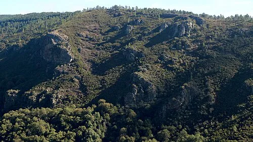 Serra do Courel Mountain, Folgoso do Courel18 km NW
-
Arroyo de Pincheira River, Quiroga9.3 km SW
-
Río Fuloma River, Barco de Valdeorras, O9.9 km E
-
Arroyo de Candis River, Barco de Valdeorras, O11 km E
-
Río Casoio River, Barco de Valdeorras, O12 km E
-
Paxaro Mountain, Folgoso do Courel16 km NW
Sources & licences
Data last updated: