- Local time
- UTC+01:00
- Europe/Madrid · UTC+01:00
- Elevation
- 295 m
- above sea level
- Airports
- SCQ Santiago-Rosalía de Castro Airport24 km
- VGO Vigo Airport52 km
About Igrexa de San Paio
Igrexa de San Paio is a tourist attraction. Location: Estrada, A, Pontevedra. The best months to visit are June–September. The nearest airport is Santiago-Rosalía de Castro Airport (24 km). Nearby sights include Dispara Xestión Cultural and Iglesia de Santa María de Aguiones.
Climate of Igrexa de San Paio
Best months for sightseeingBest months for sightseeing: June–September.
This month · November
A wet month
Day 14° · Night 7° · Rain 192 mm
- Hottest month
- August (day 24°)
- Coldest month
- January (night 5°)
- Wettest month
- December (243 mm)
- Driest month
- July (36 mm)
Bars: average monthly low and high temperature. Below: precipitation. Monthly averages for 1970–2000 at about 18 km resolution, adjusted for elevation. Highlighted months are mild and relatively dry. Source: WorldClim 2.1 (CC BY 4.0).
Show values as a table
| Month | Jan | Feb | Mar | Apr | May | Jun | Jul | Aug | Sep | Oct | Nov | Dec |
|---|---|---|---|---|---|---|---|---|---|---|---|---|
| Average high (°C) | 11° | 12° | 14° | 16° | 18° | 22° | 24° | 24° | 22° | 18° | 14° | 12° |
| Average low (°C) | 5° | 5° | 6° | 7° | 9° | 12° | 14° | 14° | 13° | 10° | 7° | 5° |
| Precipitation (mm) | 225 | 197 | 138 | 128 | 131 | 73 | 36 | 49 | 107 | 174 | 192 | 243 |
Other places to visit in this season: June July August September
How to get to Igrexa de San Paio
The nearest airport is Santiago-Rosalía de Castro Airport (SCQ), 24 km to the north as the crow flies. The nearest large city is Vigo, 54 km to the south.
Airports
- Santiago-Rosalía de Castro Airport (SCQ) Santiago de Compostela 24 kmnorth
- Vigo Airport (VGO) Vigo 52 kmsouth
- A Coruña Airport (LCG) Culleredo 68 kmnorth
Nearby large cities
- Vigo Population: 293.6K 54 kmsouth
- Ourense Population: 105.2K 65 kmsoutheast
- A Coruña Population: 250.4K 76 kmnorth
- Braga Population: 193.3K 127 kmsouth
- Porto Population: 252.7K 172 kmsouth
Straight-line distances; road distances are longer. Airport data: OurAirports.
Nearby attractions & nature
Everything nearby-
Dispara Xestión Cultural Museum, Estrada, A0.5 km SE
-
Iglesia de Santa María de Aguiones Attraction, Estrada, A1.8 km NE
-
Iglesia de Santa Cristina de Vea Attraction, Estrada, A5.2 km NW
-
Igrexa de San Xoán de Santeles Attraction, Estrada, A5.6 km N
-
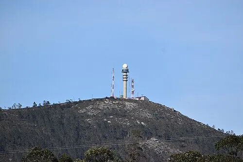 Monte Gesteiras Mountain, Estrada, A8.1 km W
-
Pazo de Maindo Historic site, Estrada, A8.2 km NW
-
Río Liñares River, Vedra6.3 km N
-
Puente de Gundián Landmark, Vedra13 km NE
Nearest towns and villages
Sources & licences
Data last updated: