- Elevation
- 56 m
- above sea level
- Local time
- UTC+01:00
- Europe/Madrid · UTC+01:00
- Airports
- RMU Region of Murcia International Airport15 km
- ALC Alicante-Elche Miguel Hernández Airport67 km
About La Vela
La Vela is a village. Location: Torre-Pacheco, Murcia. Elevation: 56 m. The best months to visit are March–May, October–November. The nearest airport is Region of Murcia International Airport (15 km). Nearby sights include Iglesia Nuestra Señora del Rosario and Centro De Artes Escénicas.
Climate of La Vela
Best months for sightseeingBest months for sightseeing: March–May, October–November.
This month · November
A good month to visit
Day 21° · Night 9° · Rain 36 mm
- Hottest month
- August (day 33°)
- Coldest month
- January (night 5°)
- Wettest month
- October (45 mm)
- Driest month
- July (4 mm)
Bars: average monthly low and high temperature. Below: precipitation. Monthly averages for 1970–2000 at about 18 km resolution, adjusted for elevation. Highlighted months are mild and relatively dry. Source: WorldClim 2.1 (CC BY 4.0).
Show values as a table
| Month | Jan | Feb | Mar | Apr | May | Jun | Jul | Aug | Sep | Oct | Nov | Dec |
|---|---|---|---|---|---|---|---|---|---|---|---|---|
| Average high (°C) | 17° | 18° | 20° | 22° | 26° | 30° | 33° | 33° | 30° | 25° | 21° | 17° |
| Average low (°C) | 5° | 6° | 8° | 10° | 13° | 17° | 20° | 21° | 18° | 13° | 9° | 6° |
| Precipitation (mm) | 25 | 26 | 28 | 27 | 29 | 15 | 4 | 7 | 25 | 45 | 36 | 25 |
Other places to visit in this season: March April May October November
How to get to La Vela
The nearest airport is Region of Murcia International Airport (RMU), 15 km to the west as the crow flies. The nearest large city is Cartagena, 19 km to the south.
Airports
- Region of Murcia International Airport (RMU) Corvera 15 kmwest
- Alicante-Elche Miguel Hernández Airport (ALC) Alicante 67 kmnortheast
- Almería Airport (LEI) Almería 162 kmsouthwest
Nearby large cities
- Cartagena Population: 213.9K 19 kmsouth
- Murcia Population: 472K 28 kmnorthwest
- Orihuela Population: 101.3K 35 kmnorth
- Elche Population: 234.8K 59 kmnorth
- Alicante Population: 348.9K 76 kmnortheast
Straight-line distances; road distances are longer. Airport data: OurAirports.
Day trips from La Vela
Within 100 km: 360 historic and cultural sites, 186 natural sites, 164 lakes, rivers and coasts.
0–25 km135 places
- Playa de las Mulas Beach 25 kmSE
- Playa de la Hita Beach 13 kmE
- Playa de Fatares Beach 22 kmS
- Playa de las Salinas Beach 12 kmE
25–60 km281 places
- Isla Plana Island 31 kmSW
- Playa Larga Beach 26 kmSE
- Playa del Cura Beach 34 kmNE
- Playa de La Chapineta Beach 30 kmSW
60–100 km294 places
- Museo de La Asegurada Museum 77 kmNE
- MUBAG Museum 77 kmNE
- MARQ - Museo Arqueológico Museum 78 kmNE
- Playa del Postiguet Beach 77 kmNE
Straight-line distances.
Nearby attractions & nature
Everything nearby-
Iglesia Nuestra Señora del Rosario Attraction, Torre-Pacheco3 km S
-
Centro De Artes Escénicas Attraction, Torre-Pacheco3.4 km S
-
Iglesia Evangélica de las Asambleas de Dios Attraction, Alcázares, Los9 km E
-
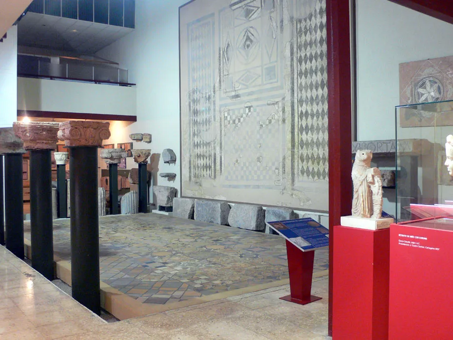 Museo Arqueológico Municipal de Cartagena Museum, Cartagena17 km S
-
Playa de Manzanares Beach, Alcázares, Los10 km E
-
Beach Carrion Beach, Alcázares, Los10 km E
Sources & licences
Data last updated: