- Population
- 2,663
- 2.7K
- Elevation
- 335 m
- above sea level
- Local time
- UTC+01:00
- Europe/Madrid · UTC+01:00
- Places inside
- 3
- listed under Ablitas
- Airports
- ZAZ Zaragoza Airport57 km
- RJL Logroño-Agoncillo Airport81 km
About Ablitas
Ablitas is a municipality. Location: Navarre, Navarre. Population: 2,663. Elevation: 335 m.
Ablitas is a town and municipality located in the province and autonomous community of Navarra, northern Spain.
Source: Wikipedia · CC BY-SA 4.0
Places bordering Ablitas
- Barillas
- Fontellas
- Ribaforada
Population of Ablitas over time
| 2014 | 2,549 | |
|---|---|---|
| 2015 | 2,520 | |
| 2016 | 2,494 | |
| 2017 | 2,514 | |
| 2018 | 2,483 | |
| 2019 | 2,481 | |
| 2020 | 2,484 | |
| 2021 | 2,480 | |
| 2022 | 2,557 | |
| 2023 | 2,610 | |
| 2024 | 2,669 | |
| 2025 | 2,657 |
Censuses and official estimates; source: Wikidata.
Climate of Ablitas
Best months for sightseeingBest months for sightseeing: May–June, September–October.
This month · November
Outside the best season
Day 15° · Night 5° · Rain 36 mm
- Hottest month
- July (day 31°)
- Coldest month
- January (night 2°)
- Wettest month
- May (53 mm)
- Driest month
- July (23 mm)
Bars: average monthly low and high temperature. Below: precipitation. Monthly averages for 1970–2000 at about 18 km resolution, adjusted for elevation. Highlighted months are mild and relatively dry. Source: WorldClim 2.1 (CC BY 4.0).
Show values as a table
| Month | Jan | Feb | Mar | Apr | May | Jun | Jul | Aug | Sep | Oct | Nov | Dec |
|---|---|---|---|---|---|---|---|---|---|---|---|---|
| Average high (°C) | 11° | 13° | 16° | 18° | 22° | 27° | 31° | 31° | 27° | 21° | 15° | 11° |
| Average low (°C) | 2° | 3° | 5° | 7° | 10° | 14° | 16° | 16° | 13° | 10° | 5° | 3° |
| Precipitation (mm) | 30 | 27 | 26 | 45 | 53 | 41 | 23 | 23 | 28 | 38 | 36 | 35 |
Other places to visit in this season: May June September October
How to get to Ablitas
The nearest airport is Zaragoza Airport (ZAZ), 57 km to the southeast as the crow flies. The nearest large city is Zaragoza, 69 km to the southeast.
Airports
- Zaragoza Airport (ZAZ) Zaragoza 57 kmsoutheast
- Logroño-Agoncillo Airport (RJL) Logroño 81 kmnorthwest
- Pamplona Airport (PNA) Pamplona 89 kmnorth
Nearby large cities
- Zaragoza Population: 687K 69 kmsoutheast
- Logroño Population: 151.2K 90 kmnorthwest
- Pamplona Population: 208.2K 94 kmnorth
- Vitoria-Gasteiz Population: 257.4K 132 kmnorthwest
- Donostia / San Sebastian Population: 185.4K 152 kmnorth
Straight-line distances; road distances are longer. Airport data: OurAirports.
Day trips from Ablitas
Within 100 km: 244 historic and cultural sites, 148 natural sites, 135 lakes, rivers and coasts.
0–25 km30 places
- Pantano de la Nava Lake 20 kmNW
- Laguna de Lor Lake 5 kmW
- Castildetierra Natural site 24 kmN
- Río Huecha River 17 kmE
25–60 km111 places
- Laguna de Pitallas Lake 49 kmN
- Estanca del Gancho Lake 41 kmNE
- El Lagunazo Lake 36 kmNE
- Pantano de Egea Lake 46 kmNE
60–100 km386 places
- Yamaguchi Natural site 93 kmN
- Pantano de Yesa Lake 79 kmNE
- Pantano de Valbornedo Lake 95 kmNW
- Embalse de la Sotonera Lake 77 kmE
Straight-line distances.
Places in Ablitas
3 placesCities & villages1
- Ablitas · Village
Heritage & sights2
- Casa de Cultura de Ablitas · Attraction
- Parroquia Santa María Magdalena · Attraction
Nearby attractions & nature
Everything nearby-
Laguna de Lor Lake, Cascante5.2 km W
-
Santa María De La Caridad Attraction, Tulebras6.9 km W
-
Basílica Virgen del Romero Attraction, Cascante8 km NW
-
Plaza de Toros Tudela Attraction, Tudela9.5 km N
-
Battle of Tudela Historic site, Tudela9.7 km N
-
Kalon Museum, Tudela10 km N
-
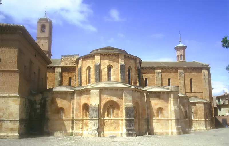 Monastery of Fitero Attraction, Fitero24 km NW
-
Teatro Gaztambide Attraction, Tudela10 km N
Sources & licences
Data last updated: · 2 independent sources