- Elevation
- 327 m
- above sea level
- Local time
- UTC+01:00
- Europe/Madrid · UTC+01:00
- Airports
- OVD Asturias Airport70 km
- LCG A Coruña Airport122 km
About Vega de Ouría
Vega de Ouría is a village. Location: Boal, Asturias. Elevation: 327 m. The best months to visit are June–September. The nearest airport is Asturias Airport (70 km). Nearby sights include Pico Penouta transmitter and Iglesia de Santiago.
Climate of Vega de Ouría
Best months for sightseeingBest months for sightseeing: June–September.
This month · November
A wet month
Day 14° · Night 7° · Rain 147 mm
- Hottest month
- August (day 24°)
- Coldest month
- January (night 4°)
- Wettest month
- December (151 mm)
- Driest month
- July (44 mm)
Bars: average monthly low and high temperature. Below: precipitation. Monthly averages for 1970–2000 at about 18 km resolution, adjusted for elevation. Highlighted months are mild and relatively dry. Source: WorldClim 2.1 (CC BY 4.0).
Show values as a table
| Month | Jan | Feb | Mar | Apr | May | Jun | Jul | Aug | Sep | Oct | Nov | Dec |
|---|---|---|---|---|---|---|---|---|---|---|---|---|
| Average high (°C) | 12° | 13° | 15° | 15° | 18° | 22° | 24° | 24° | 23° | 18° | 14° | 12° |
| Average low (°C) | 4° | 4° | 5° | 6° | 9° | 12° | 14° | 14° | 12° | 10° | 7° | 5° |
| Precipitation (mm) | 136 | 112 | 97 | 116 | 100 | 60 | 44 | 49 | 81 | 137 | 147 | 151 |
Other places to visit in this season: June July August September
How to get to Vega de Ouría
The nearest airport is Asturias Airport (OVD), 70 km to the east as the crow flies. The nearest large city is Oviedo, 85 km to the east.
Airports
- Asturias Airport (OVD) Ranón 70 kmeast
- A Coruña Airport (LCG) Culleredo 122 kmwest
- León Airport (LEN) La Virgen del Camino 138 kmsoutheast
Nearby large cities
- Oviedo Population: 220K 85 kmeast
- Gijón Population: 271.8K 99 kmeast
- A Coruña Population: 250.4K 123 kmwest
- León Population: 124.8K 142 kmsoutheast
- Ourense Population: 105.2K 147 kmsouthwest
Straight-line distances; road distances are longer. Airport data: OurAirports.
Day trips from Vega de Ouría
Within 100 km: 133 historic and cultural sites, 106 natural sites, 191 lakes, rivers and coasts.
0–25 km30 places
- Playa de Represas Beach 15 kmN
- Playa Permenande Beach 14 kmN
- Playa De Frexulfe Beach 21 kmNE
- Las Pantorgas Island 16 kmNW
25–60 km94 places
- Playa de Santa Ana Beach 40 kmE
- Praia de Paixás Beach 34 kmNW
- Praia de Lobás Beach 32 kmNW
- Playa de San Pedro Beach 56 kmE
60–100 km306 places
- Praia de Cariño Beach 86 kmNW
- Playón de Bayas Beach 69 kmE
- Playa de Poniente Beach 99 kmE
- Playa de Aguilar Beach 63 kmE
Straight-line distances.
Nearby attractions & nature
Everything nearby-
Pico Penouta transmitter Landmark, Boal5 km E
-
Iglesia de Santiago Attraction, Boal8.8 km SE
-
Ermita Virgen de la Soledad Attraction, Boal10 km SE
-
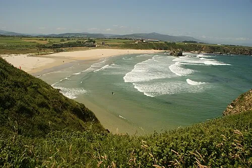 Playa Penarronda Beach, Castropol Municipality16 km NW
-
Cabo Blanco Natural site, Franco, El12 km N
-
Castro de Coaña Historic site, Coaña Municipality13 km NE
Sources & licences
Data last updated: