Colunga Municipality
Located in Asturias, Principality of Asturias Coordinates: 43°29′49″ N 5°16′31″ W

- Population
- 3,614
- 3.6K
- Elevation
- 166 m
- above sea level
- Local time
- UTC+01:00
- Europe/Madrid · UTC+01:00
- Places inside
- 35
- listed under Colunga Municipality
- Airports
- OVD Asturias Airport62 km
- LEN León Airport105 km
About Colunga Municipality
Colunga Municipality is a municipality. Location: Asturias, Principality of Asturias. Population: 3,614. Elevation: 166 m.
Colunga (Spanish pronunciation: [koˈluŋɡa]) is a municipality in the Autonomous community of the Principality of Asturias, Spain. It lies on the Cantabrian Sea, and is bordered to the west by Villaviciosa, to the south by Parres and Piloña, and to the east by Caravia.
Source: Wikipedia · CC BY-SA 4.0
Photos of Colunga Municipality
-

Giorgio Galeotti · CC BY-SA 4.0 -

David Álvarez López · CC BY 2.0 -

McBodes · CC BY 3.0 -

Vanbasten 23 · CC BY-SA 3.0 -

Vanbasten 23 · CC BY-SA 3.0


Places bordering Colunga Municipality
- Villaviciosa
- Parres Municipality
- Caravia
Population of Colunga Municipality over time
| 2014 | 3,569 | |
|---|---|---|
| 2015 | 3,518 | |
| 2016 | 3,487 | |
| 2017 | 3,440 | |
| 2018 | 3,332 | |
| 2019 | 3,257 | |
| 2020 | 3,205 | |
| 2021 | 3,236 | |
| 2022 | 3,220 | |
| 2023 | 3,187 | |
| 2024 | 3,148 | |
| 2025 | 3,143 |
Censuses and official estimates; source: Wikidata.
Climate of Colunga Municipality
Best months for sightseeingBest months for sightseeing: June–September.
This month · November
Outside the best season
Day 15° · Night 7° · Rain 97 mm
- Hottest month
- August (day 24°)
- Coldest month
- January (night 4°)
- Wettest month
- November (97 mm)
- Driest month
- July (48 mm)
Bars: average monthly low and high temperature. Below: precipitation. Monthly averages for 1970–2000 at about 18 km resolution, adjusted for elevation. Highlighted months are mild and relatively dry. Source: WorldClim 2.1 (CC BY 4.0).
Show values as a table
| Month | Jan | Feb | Mar | Apr | May | Jun | Jul | Aug | Sep | Oct | Nov | Dec |
|---|---|---|---|---|---|---|---|---|---|---|---|---|
| Average high (°C) | 12° | 13° | 15° | 16° | 18° | 21° | 24° | 24° | 22° | 19° | 15° | 12° |
| Average low (°C) | 4° | 5° | 6° | 7° | 10° | 13° | 15° | 15° | 14° | 10° | 7° | 5° |
| Precipitation (mm) | 88 | 80 | 70 | 92 | 84 | 51 | 48 | 49 | 58 | 94 | 97 | 93 |
Other places to visit in this season: June July August September
How to get to Colunga Municipality
The nearest airport is Asturias Airport (OVD), 62 km to the west as the crow flies. The nearest large city is Gijón, 32 km to the west.
Airports
- Asturias Airport (OVD) Ranón 62 kmwest
- León Airport (LEN) La Virgen del Camino 105 kmsouth
- Seve Ballesteros-Santander Airport (SDR) Santander 118 kmeast
Nearby large cities
- Gijón Population: 271.8K 32 kmwest
- Oviedo Population: 220K 49 kmwest
- León Population: 124.8K 103 kmsouth
- Santander Population: 173.6K 119 kmeast
- Burgos Population: 176.4K 182 kmsoutheast
Straight-line distances; road distances are longer. Airport data: OurAirports.
Day trips from Colunga Municipality
Within 100 km: 123 historic and cultural sites, 144 natural sites, 128 lakes, rivers and coasts.
0–25 km20 places
- Monte de la Guía Mountain 19 kmE
- Pico Pienzu Mountain 8 kmS
- Cabo Lastres Natural site 5 kmNW
- Ensenada de la Conejera Natural site 8 kmNW
25–60 km241 places
- Playa de San Antonio del Mar Beach 28 kmE
- Playa de San Antolín Beach 34 kmE
- Playa de la Ñora Beach 26 kmW
- Playa Cervigón Beach 30 kmW
60–100 km134 places
- Playa de Santa Ana Beach 93 kmW
- Playa de la Rabia Beach 77 kmE
- Playa de Pechón Beach 64 kmE
- Playón de Bayas Beach 63 kmW
Straight-line distances.
Places in Colunga Municipality
35 placesBar: population relative to the most populous place in this list.
Cities & villages28
- Agüera · Village
- Beldredo · Village
- Bucial · Village
- Buerres · Village
- Carrandi · Village
- Castiello de Abajo · Village
- Coceña · Village
- El Monte · Village
- Eslabayo · Village
- Fano · Village
- Gobiendes · Village
- La Isla · Village
- La Llera · Village
- La Riera · Village
- Lastres · Village
- Libardón · Village
- Loroñe · Village
- Los Toyos · Village
- Luces · Village
- Lué · Village
- Pernús · Village
- Pis · Village
- Pivierda · Village
- Poladura · Village
- Pumerín · Village
- Sales · Village
- San Juan · Village
- Villaescusa · Village
Mountains & nature2
- Cabo Lastres · Natural site
- Pico Pienzu · Mountain
Lakes, rivers & coasts2
- Río de Colunga · River
- Río Espasa · River
Heritage & sights2
- Lastres · Attraction
- Museo del Jurasico de Asturias · Museum
Nearby attractions & nature
Everything nearby-
Ensenada de la Conejera Natural site, Villaviciosa8 km NW
-
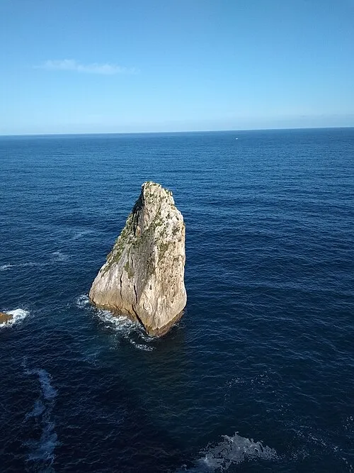 Islote Palo Verde Island, Ribadesella Municipality22 km E
-
Centro de Arte Rupestre de Tito Bustillo Museum, Ribadesella Municipality17 km E
-
Río Piloña River, Parres Municipality14 km SE
-
Iglesia de Santa Cruz Attraction, Cangas de Onís20 km SE
-
Río Sella River, Ribadesella Municipality18 km E
-
Río Zardón River, Parres Municipality20 km SE
-
Río España River, Villaviciosa20 km W
Other cities and towns in Asturias
-
 Villaviciosa Municipality, Asturias12 km W
-
 Parres Municipality Municipality, Asturias16 km SE
-
 Ribadesella Municipality Municipality, Asturias17 km E
-
 Cabranes Municipality, Asturias16 km SW
-
 Nava Municipality, Asturias25 km SW
-
 Siero Municipality, Asturias34 km W
Sources & licences
Data last updated: · 2 independent sources